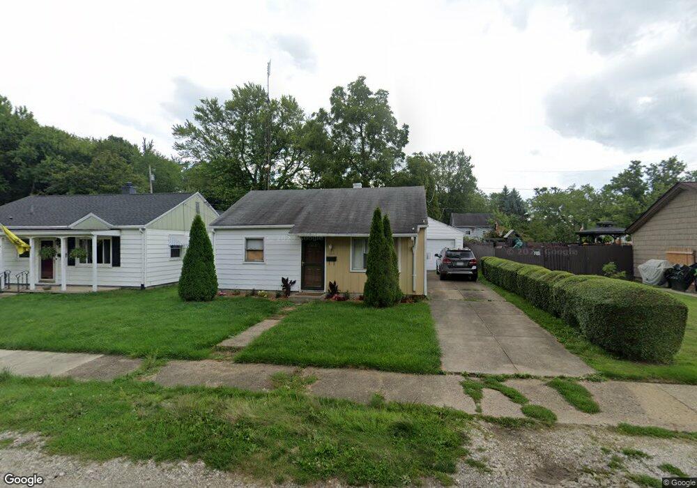
1023 Devine St Alliance, OH 44601
Estimated Value: $32,000 - $112,000
3
Beds
1
Bath
792
Sq Ft
$97/Sq Ft
Est. Value
About This Home
This home is located at 1023 Devine St, Alliance, OH 44601 and is currently estimated at $77,127, approximately $97 per square foot. 1023 Devine St is a home located in Stark County with nearby schools including Alliance Elementary School at Rockhill, Alliance Intermediate School at Northside, and Alliance Middle School.
Ownership History
Date
Name
Owned For
Owner Type
Purchase Details
Closed on
Nov 7, 2025
Sold by
Hillier Patricia L and Fast Patricia Edling
Bought by
Ash Hunter Williams
Current Estimated Value
Purchase Details
Closed on
May 23, 2006
Sold by
Hillier Paul L and Hillier Patricia L
Bought by
Hillier Patricia L
Purchase Details
Closed on
Oct 4, 2001
Sold by
Smith Sally A and Smith Walter W
Bought by
Hillier Paul L and Hillier Patricia L
Purchase Details
Closed on
May 15, 2001
Sold by
Estate Of Kathryn R Thomas
Bought by
Smith Sally A and Murphy Charles
Create a Home Valuation Report for This Property
The Home Valuation Report is an in-depth analysis detailing your home's value as well as a comparison with similar homes in the area
Home Values in the Area
Average Home Value in this Area
Purchase History
| Date | Buyer | Sale Price | Title Company |
|---|---|---|---|
| Ash Hunter Williams | $5,845 | None Listed On Document | |
| Hillier Patricia L | -- | None Available | |
| Hillier Paul L | $47,000 | -- | |
| Smith Sally A | -- | -- |
Source: Public Records
Tax History
| Year | Tax Paid | Tax Assessment Tax Assessment Total Assessment is a certain percentage of the fair market value that is determined by local assessors to be the total taxable value of land and additions on the property. | Land | Improvement |
|---|---|---|---|---|
| 2025 | $6,345 | $14,390 | $4,940 | $9,450 |
| 2024 | $5,455 | $14,390 | $4,940 | $9,450 |
| 2023 | $5,313 | $12,890 | $4,730 | $8,160 |
| 2022 | $521 | $12,890 | $4,730 | $8,160 |
| 2021 | $522 | $12,890 | $4,730 | $8,160 |
| 2020 | $484 | $11,170 | $4,100 | $7,070 |
| 2019 | $477 | $11,170 | $4,100 | $7,070 |
| 2018 | $480 | $11,170 | $4,100 | $7,070 |
| 2017 | $1,219 | $9,980 | $3,430 | $6,550 |
| 2016 | $698 | $9,980 | $3,430 | $6,550 |
| 2015 | $444 | $9,980 | $3,430 | $6,550 |
| 2014 | $444 | $9,520 | $3,150 | $6,370 |
| 2013 | $221 | $9,520 | $3,150 | $6,370 |
Source: Public Records
Map
Nearby Homes
- 1522 Wade Ave
- 834 Devine St
- 1608 S Liberty Ave
- 1823 S Seneca Ave
- 1350 S Freedom Ave
- 935 S Morgan Ave
- 233 Shadyside Ct
- 2351 S Freedom Ave
- 2041 Watson Ave
- 22862 Norman Ave
- 955 E Summit St
- 2408 S Linden Ave
- 853 Fairway Dr
- 167 11th St
- 226 Milner St
- 152 E Mill St
- 231 Rosenberry St
- 134 11th St
- 234 Rosenberry St
- 452 E Summit St
Your Personal Tour Guide
Ask me questions while you tour the home.