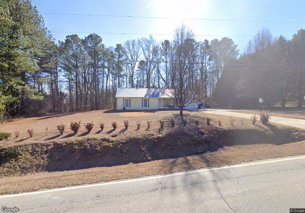
1023 Mcdaniel St Monroe, GA 30655
Estimated Value: $235,115 - $303,000
Studio
--
Bath
1,216
Sq Ft
$216/Sq Ft
Est. Value
About This Home
This home is located at 1023 Mcdaniel St, Monroe, GA 30655 and is currently estimated at $262,529, approximately $215 per square foot. 1023 Mcdaniel St is a home located in Walton County with nearby schools including Atha Road Elementary School, Youth Middle School, and Walnut Grove High School.
Ownership History
Date
Name
Owned For
Owner Type
Purchase Details
Closed on
Jun 30, 2004
Sold by
Pulcinik George
Bought by
Hooper Ralph B
Current Estimated Value
Home Financials for this Owner
Home Financials are based on the most recent Mortgage that was taken out on this home.
Original Mortgage
$85,260
Outstanding Balance
$41,765
Interest Rate
6.25%
Mortgage Type
VA
Estimated Equity
$220,764
Purchase Details
Closed on
Aug 19, 1999
Sold by
Hooper Ralph B
Bought by
Plucinik George
Home Financials for this Owner
Home Financials are based on the most recent Mortgage that was taken out on this home.
Original Mortgage
$82,620
Interest Rate
7.65%
Mortgage Type
VA
Purchase Details
Closed on
Apr 7, 1993
Sold by
Peoples Bank Trust
Bought by
Hooper Ralph B
Home Financials for this Owner
Home Financials are based on the most recent Mortgage that was taken out on this home.
Original Mortgage
$35,000
Interest Rate
7.47%
Create a Home Valuation Report for This Property
The Home Valuation Report is an in-depth analysis detailing your home's value as well as a comparison with similar homes in the area
Home Values in the Area
Average Home Value in this Area
Purchase History
| Date | Buyer | Sale Price | Title Company |
|---|---|---|---|
| Hooper Ralph B | $93,500 | -- | |
| Plucinik George | $81,000 | -- | |
| Hooper Ralph B | $54,000 | -- |
Source: Public Records
Mortgage History
| Date | Status | Borrower | Loan Amount |
|---|---|---|---|
| Open | Hooper Ralph B | $85,260 | |
| Previous Owner | Plucinik George | $82,620 | |
| Previous Owner | Hooper Ralph B | $35,000 |
Source: Public Records
Tax History
| Year | Tax Paid | Tax Assessment Tax Assessment Total Assessment is a certain percentage of the fair market value that is determined by local assessors to be the total taxable value of land and additions on the property. | Land | Improvement |
|---|---|---|---|---|
| 2025 | $406 | $84,080 | $19,600 | $64,480 |
| 2024 | $347 | $78,680 | $16,000 | $62,680 |
| 2023 | $339 | $73,040 | $14,000 | $59,040 |
| 2022 | $325 | $59,040 | $14,000 | $45,040 |
| 2021 | $325 | $44,120 | $10,000 | $34,120 |
| 2020 | $333 | $43,280 | $10,000 | $33,280 |
| 2019 | $339 | $34,720 | $6,000 | $28,720 |
| 2018 | $339 | $34,720 | $6,000 | $28,720 |
| 2017 | $1,017 | $29,520 | $6,000 | $23,520 |
| 2016 | $818 | $26,600 | $6,000 | $20,600 |
| 2015 | $795 | $25,520 | $6,000 | $19,520 |
| 2014 | $823 | $25,760 | $6,000 | $19,760 |
Source: Public Records
Map
Nearby Homes
- 509 Mill Farm Ln
- 720 Overlook Crest
- 679 Michael Cir
- 675 Michael Cir
- 631 St Ives Walk
- 661 Michael Cir
- 921 Horizon Ct
- 911 Woodchase Dr
- 943 Masters Dr Unit 2
- 810 Hampton
- 925 Tigers Way
- 0 Pine View Dr Unit CL350808
- 0 Pine View Dr Unit 10706074
- 0 Pine View Dr Unit 7731449
- 250 Martin Luther King Junior Blvd
- 505 Breedlove Dr
- 150 Mountain View Dr
- 506 Breedlove Dr
- 114 Henson Dr
- 118 Henson Dr
Your Personal Tour Guide
Ask me questions while you tour the home.