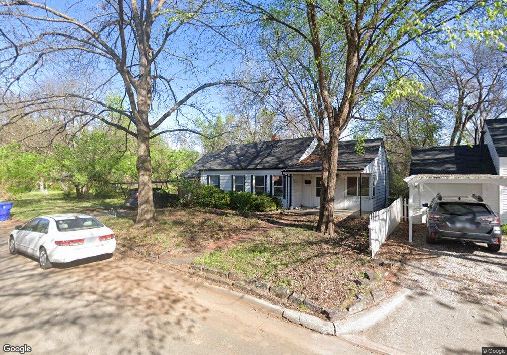
1023 Mcfarland St Norman, OK 73069
Southwest Norman NeighborhoodEstimated Value: $265,188 - $343,000
3
Beds
2
Baths
1,198
Sq Ft
$249/Sq Ft
Est. Value
About This Home
This home is located at 1023 Mcfarland St, Norman, OK 73069 and is currently estimated at $298,297, approximately $248 per square foot. 1023 Mcfarland St is a home located in Cleveland County with nearby schools including McKinley Elementary School, Alcott Middle School, and Norman High School.
Ownership History
Date
Name
Owned For
Owner Type
Purchase Details
Closed on
Jul 19, 2010
Sold by
Worster Amber S and Lawson Stephen E
Bought by
Worster Amber S and Lawson Stephen E
Current Estimated Value
Purchase Details
Closed on
Jun 13, 2005
Sold by
Rollins Sue C
Bought by
Lawson Stephen E and Worster Amber S
Home Financials for this Owner
Home Financials are based on the most recent Mortgage that was taken out on this home.
Original Mortgage
$15,000
Outstanding Balance
$7,831
Interest Rate
5.76%
Mortgage Type
Credit Line Revolving
Estimated Equity
$290,466
Purchase Details
Closed on
Jun 10, 2005
Sold by
Innes Pamela J
Bought by
Lawson Stephen E and Lawson Amber S
Home Financials for this Owner
Home Financials are based on the most recent Mortgage that was taken out on this home.
Original Mortgage
$15,000
Outstanding Balance
$7,831
Interest Rate
5.76%
Mortgage Type
Credit Line Revolving
Estimated Equity
$290,466
Create a Home Valuation Report for This Property
The Home Valuation Report is an in-depth analysis detailing your home's value as well as a comparison with similar homes in the area
Home Values in the Area
Average Home Value in this Area
Purchase History
| Date | Buyer | Sale Price | Title Company |
|---|---|---|---|
| Worster Amber S | -- | None Available | |
| Lawson Stephen E | $50,000 | None Available | |
| Lawson Stephen E | $50,000 | None Available |
Source: Public Records
Mortgage History
| Date | Status | Borrower | Loan Amount |
|---|---|---|---|
| Open | Lawson Stephen E | $15,000 | |
| Open | Lawson Stephen E | $80,000 |
Source: Public Records
Tax History Compared to Growth
Tax History
| Year | Tax Paid | Tax Assessment Tax Assessment Total Assessment is a certain percentage of the fair market value that is determined by local assessors to be the total taxable value of land and additions on the property. | Land | Improvement |
|---|---|---|---|---|
| 2024 | $1,547 | $12,910 | $3,140 | $9,770 |
| 2023 | $1,476 | $12,295 | $3,732 | $8,563 |
| 2022 | $1,348 | $11,709 | $3,554 | $8,155 |
| 2021 | $1,354 | $11,152 | $3,385 | $7,767 |
| 2020 | $1,262 | $10,621 | $3,223 | $7,398 |
| 2019 | $1,221 | $10,115 | $3,070 | $7,045 |
| 2018 | $1,129 | $9,634 | $2,924 | $6,710 |
| 2017 | $1,087 | $15,814 | $0 | $0 |
| 2016 | $1,052 | $8,738 | $2,652 | $6,086 |
| 2015 | -- | $8,322 | $2,526 | $5,796 |
| 2014 | -- | $7,926 | $2,406 | $5,520 |
Source: Public Records
Map
Nearby Homes
- 1017 Mcfarland St
- 1032 W Lindsey St
- 810 S Lahoma Ave
- 1424 Avondale Dr
- 818 W Boyd St
- 1221 Cruce St
- 1202 Windsor Way
- 444 S Pickard Ave
- 1222 Windsor Way
- 1125 W Apache St
- 531 S Berry Rd
- 1614 Cruce St
- 415 S Pickard Ave
- 1524 Wilshire Ave
- 1613 Franklin Dr
- 1109 Westbrooke Terrace
- 1626 Lenox Dr
- 1124 Westbrooke Terrace
- 915 W Comanche St
- 318 College Ave
- 1021 Mcfarland St
- 1106 Mcfarland St
- 1116 Mcfarland St
- 1102 Mcfarland St
- 1100 W Brooks St
- 1030 W Brooks St
- 1110 W Brooks St
- 1106 W Brooks St
- 1015 Mcfarland St
- 1032 Mcfarland St
- 807 Carey Dr
- 1025 Parsons St
- 1011 Mcfarland St
- 1017 Parsons St
- 811 Carey Dr
- 803 Carey Dr
- 1028 W Brooks St
- 1013 Parsons St
- 1005 Mcfarland St
- 801 Carey Dr