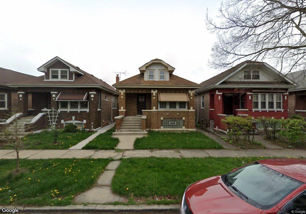
1023 S Monitor Ave Chicago, IL 60644
Austin NeighborhoodEstimated Value: $237,531 - $328,000
2
Beds
1
Bath
1,077
Sq Ft
$273/Sq Ft
Est. Value
About This Home
This home is located at 1023 S Monitor Ave, Chicago, IL 60644 and is currently estimated at $293,883, approximately $272 per square foot. 1023 S Monitor Ave is a home located in Cook County with nearby schools including Clark G R Elementary School and St. Frances of Rome School.
Ownership History
Date
Name
Owned For
Owner Type
Purchase Details
Closed on
Mar 15, 2018
Sold by
Tatoiu Cristina
Bought by
Ct Real Estate Llc 1023 S Monitor Series
Current Estimated Value
Purchase Details
Closed on
Sep 21, 2015
Sold by
Tatoiu Stefan
Bought by
Tatoiu Cristina
Purchase Details
Closed on
Jun 19, 2008
Sold by
Deutsche Bank National Trust Co
Bought by
Tatoiu Stefan
Purchase Details
Closed on
Mar 20, 2002
Sold by
Logan David W
Bought by
Va
Purchase Details
Closed on
Feb 12, 1996
Sold by
Olson Michael J and Olson Mary L
Bought by
Logan David W
Home Financials for this Owner
Home Financials are based on the most recent Mortgage that was taken out on this home.
Original Mortgage
$107,100
Interest Rate
7.07%
Mortgage Type
VA
Create a Home Valuation Report for This Property
The Home Valuation Report is an in-depth analysis detailing your home's value as well as a comparison with similar homes in the area
Home Values in the Area
Average Home Value in this Area
Purchase History
| Date | Buyer | Sale Price | Title Company |
|---|---|---|---|
| Ct Real Estate Llc 1023 S Monitor Series | -- | None Available | |
| Tatoiu Cristina | -- | None Available | |
| Tatoiu Stefan | -- | None Available | |
| Va | -- | -- | |
| Logan David W | $105,000 | Chicago Title Insurance Co |
Source: Public Records
Mortgage History
| Date | Status | Borrower | Loan Amount |
|---|---|---|---|
| Previous Owner | Logan David W | $107,100 |
Source: Public Records
Tax History Compared to Growth
Tax History
| Year | Tax Paid | Tax Assessment Tax Assessment Total Assessment is a certain percentage of the fair market value that is determined by local assessors to be the total taxable value of land and additions on the property. | Land | Improvement |
|---|---|---|---|---|
| 2024 | $4,220 | $19,600 | $4,914 | $14,686 |
| 2023 | $4,114 | $20,000 | $3,969 | $16,031 |
| 2022 | $4,114 | $20,000 | $3,969 | $16,031 |
| 2021 | $4,022 | $20,000 | $3,969 | $16,031 |
| 2020 | $2,634 | $11,826 | $3,969 | $7,857 |
| 2019 | $2,640 | $13,141 | $3,969 | $9,172 |
| 2018 | $2,596 | $13,141 | $3,969 | $9,172 |
| 2017 | $3,595 | $16,698 | $3,591 | $13,107 |
| 2016 | $3,344 | $16,698 | $3,591 | $13,107 |
| 2015 | $3,060 | $16,698 | $3,591 | $13,107 |
| 2014 | $2,624 | $14,140 | $3,402 | $10,738 |
| 2013 | $2,572 | $14,140 | $3,402 | $10,738 |
Source: Public Records
Map
Nearby Homes
- 1007 S Austin Blvd
- 1215 S 58th Ct
- 5701 W Roosevelt Rd
- 5 Fillmore St Unit 3
- 1228 S 56th Ct
- 1014 S Humphrey Ave
- 1165 S Humphrey Ave
- 1314 S 58th Ct
- 1310 S 59th Ave
- 928 Lyman Ave
- 1333 S 57th Ave
- 1345 S 58th Ave
- 1182 S Taylor Ave
- 1173 S Taylor Ave
- 1336 S Austin Blvd
- 410 S Austin Blvd Unit 3S
- 1169 S Taylor Ave
- 5540 W Congress Pkwy
- 5551 W Van Buren St
- 1140 S Harvey Ave
- 1019 S Monitor Ave
- 1025 S Monitor Ave
- 1029 S Monitor Ave
- 1031 S Monitor Ave
- 1011 S Monitor Ave
- 1024 S Menard Ave
- 1018 S Menard Ave Unit 1
- 1022 S Menard Ave
- 1007 S Monitor Ave
- 1016 S Menard Ave
- 1028 S Menard Ave
- 1028 S Menard Ave
- 1012 S Menard Ave Unit 1
- 1030 S Menard Ave Unit 1
- 1005 S Monitor Ave
- 1010 S Menard Ave
- 1024 S Monitor Ave
- 1028 S Monitor Ave
- 1028 S Monitor Ave Unit 1