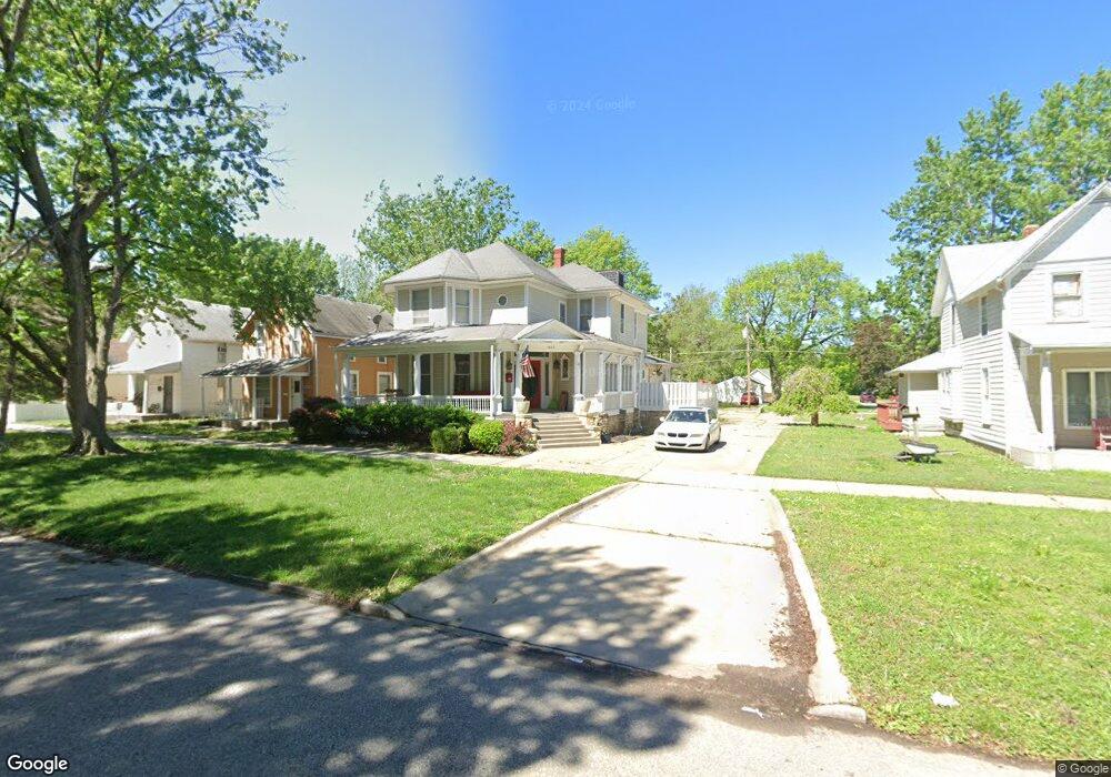
1023 SW Clay St Topeka, KS 66604
Tennessee Town NeighborhoodEstimated Value: $175,000 - $191,000
3
Beds
2
Baths
2,940
Sq Ft
$63/Sq Ft
Est. Value
About This Home
This home is located at 1023 SW Clay St, Topeka, KS 66604 and is currently estimated at $184,730, approximately $62 per square foot. 1023 SW Clay St is a home located in Shawnee County with nearby schools including Lowman Hill Elementary School, Robinson Middle School, and Topeka High School.
Ownership History
Date
Name
Owned For
Owner Type
Purchase Details
Closed on
Jul 21, 2021
Sold by
Moseley Nancy L
Bought by
Daniels Anita M
Current Estimated Value
Purchase Details
Closed on
May 2, 2007
Sold by
Zimmerman Ronald K and Zimmerman Anita W
Bought by
Moseley Nancy L and Daniels Anita M
Purchase Details
Closed on
Jun 2, 2006
Sold by
Droge Raymond A and Estate Of Diane K Laub
Bought by
Zimmerman Ronald K and Zimmerman Anita W
Home Financials for this Owner
Home Financials are based on the most recent Mortgage that was taken out on this home.
Original Mortgage
$75,200
Interest Rate
9%
Mortgage Type
Adjustable Rate Mortgage/ARM
Create a Home Valuation Report for This Property
The Home Valuation Report is an in-depth analysis detailing your home's value as well as a comparison with similar homes in the area
Home Values in the Area
Average Home Value in this Area
Purchase History
| Date | Buyer | Sale Price | Title Company |
|---|---|---|---|
| Daniels Anita M | -- | None Available | |
| Moseley Nancy L | -- | Capital Title Ins Co Lc | |
| Zimmerman Ronald K | $94,000 | Heartland Title Servics |
Source: Public Records
Mortgage History
| Date | Status | Borrower | Loan Amount |
|---|---|---|---|
| Previous Owner | Zimmerman Ronald K | $75,200 |
Source: Public Records
Tax History Compared to Growth
Tax History
| Year | Tax Paid | Tax Assessment Tax Assessment Total Assessment is a certain percentage of the fair market value that is determined by local assessors to be the total taxable value of land and additions on the property. | Land | Improvement |
|---|---|---|---|---|
| 2025 | $2,676 | $20,081 | -- | -- |
| 2023 | $2,676 | $18,042 | $0 | $0 |
| 2022 | $2,515 | $16,862 | $0 | $0 |
| 2021 | $2,408 | $15,329 | $0 | $0 |
| 2020 | $1,846 | $11,950 | $0 | $0 |
| 2019 | $1,820 | $11,715 | $0 | $0 |
| 2018 | $1,767 | $11,373 | $0 | $0 |
| 2017 | $1,771 | $11,373 | $0 | $0 |
| 2014 | $1,688 | $10,750 | $0 | $0 |
Source: Public Records
Map
Nearby Homes
- 1031 SW Clay St
- 1020 SW 11th St
- 1200 SW Taylor St
- 1021 SW Polk St
- 731 SW Lincoln St
- 711 SW Buchanan St
- 1225 SW Throop St
- 1301 SW Fillmore St Unit Main Floor Apt. 12
- 1281 SW Buchanan St
- 1300 SW Fillmore St
- 634 SW Lincoln St
- 1224 SW Garfield Ave
- 710 SW 13th St
- 817 SW Tyler St
- 1255 SW Tyler St
- 603 SW 8th St
- 1216 SW College Ave
- 705 SW 6th Ave
- 511 SW Buchanan St
- 0 SW Buchanan St
- 1025 SW Clay St
- 1015 SW Clay St
- 1027 SW Clay St
- 1029 SW Clay St
- 1033 SW Clay St
- 1018 SW Buchanan St
- 1108 SW 11th St
- 1110 SW 11th St
- 1012 SW Buchanan St
- 1035 SW Clay St
- 1107 SW 10th Ave
- 1105 SW 10th Ave
- 1111 SW 10th Ave
- 1101 SW 10th Ave
- 1030 SW Buchanan St
- 1115 SW 10th Ave
- 1032 SW Buchanan St
- 1022 SW Clay St
- 1020 SW Clay St
- 1026 SW Clay St