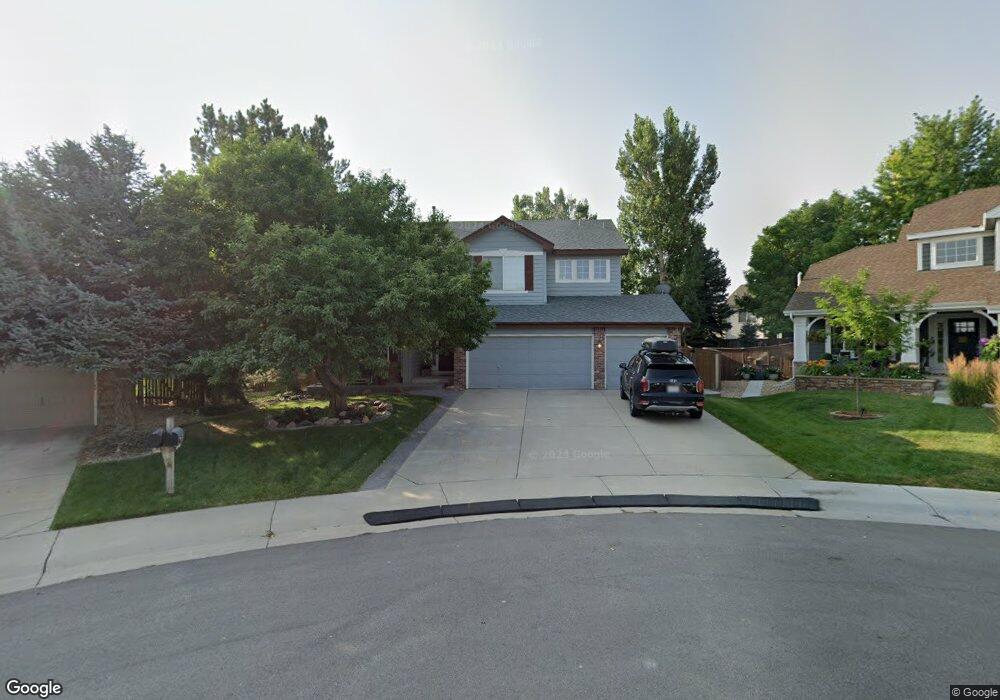
10232 Gemstone Ct Parker, CO 80134
Clarke Farms NeighborhoodEstimated Value: $715,758 - $818,000
3
Beds
3
Baths
2,582
Sq Ft
$291/Sq Ft
Est. Value
About This Home
This home is located at 10232 Gemstone Ct, Parker, CO 80134 and is currently estimated at $752,440, approximately $291 per square foot. 10232 Gemstone Ct is a home located in Douglas County with nearby schools including Cherokee Trail Elementary School, Sierra Middle School, and Chaparral High School.
Ownership History
Date
Name
Owned For
Owner Type
Purchase Details
Closed on
Apr 16, 2003
Sold by
Adams Douglas R and Uchmanowicz Karen K
Bought by
Adams Douglas R and Adams Karen K
Current Estimated Value
Home Financials for this Owner
Home Financials are based on the most recent Mortgage that was taken out on this home.
Original Mortgage
$255,000
Interest Rate
5.57%
Purchase Details
Closed on
May 18, 1998
Sold by
The Ryland Group Inc
Bought by
Adams Douglas R and Uchmanowicz Karen K
Home Financials for this Owner
Home Financials are based on the most recent Mortgage that was taken out on this home.
Original Mortgage
$178,550
Interest Rate
7.11%
Purchase Details
Closed on
Oct 15, 1997
Sold by
Stonegate Westerra
Bought by
Ryland Group Inc
Create a Home Valuation Report for This Property
The Home Valuation Report is an in-depth analysis detailing your home's value as well as a comparison with similar homes in the area
Home Values in the Area
Average Home Value in this Area
Purchase History
We collect this data history from publicly available records. To have your information removed, we recommend requesting removal directly through your county’s website.
| Date | Buyer | Sale Price | Title Company |
|---|---|---|---|
| Adams Douglas R | -- | -- | |
| Adams Douglas R | $246,597 | -- | |
| Ryland Group Inc | $310,800 | -- |
Source: Public Records
Mortgage History
We collect this data history from publicly available records. To have your information removed, we recommend requesting removal directly through your county’s website.
| Date | Status | Borrower | Loan Amount |
|---|---|---|---|
| Closed | Adams Douglas R | $255,000 | |
| Closed | Adams Douglas R | $178,550 |
Source: Public Records
Tax History
| Year | Tax Paid | Tax Assessment Tax Assessment Total Assessment is a certain percentage of the fair market value that is determined by local assessors to be the total taxable value of land and additions on the property. | Land | Improvement |
|---|---|---|---|---|
| 2025 | $5,261 | $47,000 | $12,900 | $34,100 |
| 2024 | $5,261 | $52,820 | $10,770 | $42,050 |
| 2023 | $5,306 | $52,820 | $10,770 | $42,050 |
| 2022 | $3,945 | $35,740 | $7,130 | $28,610 |
| 2021 | $4,057 | $35,740 | $7,130 | $28,610 |
| 2020 | $3,815 | $34,460 | $7,700 | $26,760 |
| 2019 | $3,723 | $34,460 | $7,700 | $26,760 |
| 2018 | $3,430 | $31,320 | $6,990 | $24,330 |
| 2017 | $3,235 | $31,320 | $6,990 | $24,330 |
| 2016 | $3,163 | $30,140 | $5,570 | $24,570 |
| 2015 | $1,612 | $30,140 | $5,570 | $24,570 |
| 2014 | $1,536 | $25,890 | $5,410 | $20,480 |
Source: Public Records
Map
Nearby Homes
- 17130 Opal Hill Dr
- 17351 Cornerstone Dr
- 10318 Severance Dr
- 10420 White Pine Dr
- 11634 Masonville Dr
- 10221 Amethyst Way
- 10515 Holyoke Dr
- 11517 Wray Ct
- 10270 Amethyst Way
- 16642 Autumn Rock Cove
- 9923 Boca Cir
- 16907 Molina Place
- 10072 Boca Cir
- 10006 Boca Cir
- 9646 Deerhorn Ct Unit 99
- 10617 Clarke Farms Dr
- 17302 Witten Ct
- 10035 Boca Cir
- 16648 Oakmoor Place
- 9608 Deerhorn Ct Unit 81
- 10242 Gemstone Ct
- 10265 Turquoise Ct
- 10255 Turquoise Ct
- 17087 Cornerstone Dr
- 17073 Cornerstone Dr
- 10275 Turquoise Ct
- 10212 Gemstone Ct
- 17059 Cornerstone Dr
- 10241 Gemstone Ct
- 10285 Turquoise Ct
- 17045 Cornerstone Dr
- 10245 Turquoise Ct
- 10231 Gemstone Ct
- 17140 Opal Hill Dr
- 10221 Gemstone Ct
- 17154 Opal Hill Dr
- 17031 Cornerstone Dr
- 10211 Gemstone Ct
- 10270 Topaz Cir
- 17072 Cornerstone Dr
Your Personal Tour Guide
Ask me questions while you tour the home.