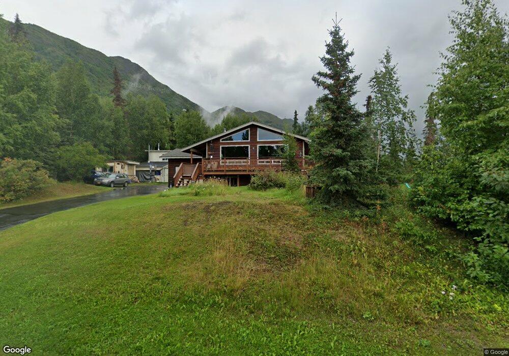
10233 Preuss Ln Eagle River, AK 99577
Eagle River Valley NeighborhoodEstimated Value: $476,000 - $554,000
3
Beds
2
Baths
1,404
Sq Ft
$373/Sq Ft
Est. Value
About This Home
This home is located at 10233 Preuss Ln, Eagle River, AK 99577 and is currently estimated at $523,086, approximately $372 per square foot. 10233 Preuss Ln is a home located in Anchorage Municipality with nearby schools including Ravenwood Elementary School, Gruening Middle School, and Chugiak High School.
Ownership History
Date
Name
Owned For
Owner Type
Purchase Details
Closed on
Oct 3, 1990
Sold by
Houston Kent R and Houston Leora S
Bought by
Radcliffe Richard K and Radcliffe Melodie C
Current Estimated Value
Home Financials for this Owner
Home Financials are based on the most recent Mortgage that was taken out on this home.
Original Mortgage
$113,661
Interest Rate
10.41%
Mortgage Type
FHA
Create a Home Valuation Report for This Property
The Home Valuation Report is an in-depth analysis detailing your home's value as well as a comparison with similar homes in the area
Home Values in the Area
Average Home Value in this Area
Purchase History
| Date | Buyer | Sale Price | Title Company |
|---|---|---|---|
| Radcliffe Richard K | -- | -- |
Source: Public Records
Mortgage History
| Date | Status | Borrower | Loan Amount |
|---|---|---|---|
| Closed | Radcliffe Richard K | $113,661 |
Source: Public Records
Tax History
| Year | Tax Paid | Tax Assessment Tax Assessment Total Assessment is a certain percentage of the fair market value that is determined by local assessors to be the total taxable value of land and additions on the property. | Land | Improvement |
|---|---|---|---|---|
| 2025 | $3,580 | $467,300 | $128,800 | $338,500 |
| 2024 | $3,580 | $455,300 | $113,900 | $341,400 |
| 2023 | $6,889 | $418,800 | $109,900 | $308,900 |
| 2022 | $3,459 | $408,500 | $105,400 | $303,100 |
| 2021 | $6,763 | $382,300 | $105,400 | $276,900 |
| 2020 | $2,728 | $381,000 | $105,400 | $275,600 |
| 2019 | $2,894 | $380,200 | $105,400 | $274,800 |
| 2018 | $2,666 | $365,900 | $94,600 | $271,300 |
| 2017 | $2,865 | $351,100 | $89,600 | $261,500 |
| 2016 | $4,542 | $349,500 | $84,700 | $264,800 |
| 2015 | $4,542 | $351,100 | $85,700 | $265,400 |
| 2014 | $4,542 | $349,100 | $87,000 | $262,100 |
Source: Public Records
Map
Nearby Homes
- 20786 Melody Ln
- 19823 Eagle River Rd
- 9545 Grey Owl Way
- L7 Grey Owl Way
- 9621 Nizki Cir
- 20514 Birch Crest Ln
- 20779 Mountain Vista Dr
- 19817 Belknap Cir
- L4 Sheppard Dr
- 20610 Mountainside Dr
- 20850 Mountainside Dr
- 19413 First St
- 20638 Driftwood Bay Dr
- 19861 Highland Ridge Dr
- 19855 Highland Ridge Dr
- 8935 Birch Park Cir
- 19950 Driftwood Bay Dr Unit 7
- 19862 Driftwood Bay Dr
- 19351 Verdant Cir
- 19110 War Admiral Rd
- 10213 Preuss Ln
- 10213 Preuss Ln Unit B
- 10228 Preuss Ln
- 20714 Lucas Ave
- 10145 Preuss Ln
- 20745 Lucas Ave
- 20727 Lucas Ave
- 10144 Preuss Ln
- 10129 Preuss Ln
- 10225 Donald Place
- 20630 Lucas Ave
- 20707 Lucas Ave
- 10207 Donald Place
- LT 4 Uplands Ph 3
- 20740 Philadelphia Way
- 10126 Preuss Ln
- L3 Uplands Ph 3
- 10454 Stewart Dr
- 10133 Donald Place
- 20629 Lucas Ave
Your Personal Tour Guide
Ask me questions while you tour the home.