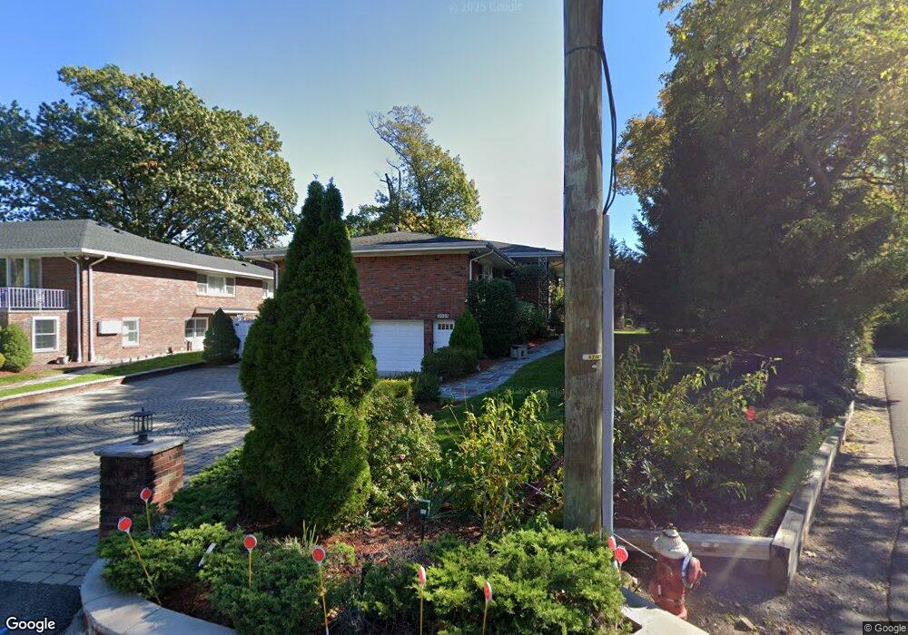
1024 Briar Way Fort Lee, NJ 07024
Estimated Value: $1,167,743 - $1,634,000
--
Bed
--
Bath
2,817
Sq Ft
$502/Sq Ft
Est. Value
About This Home
This home is located at 1024 Briar Way, Fort Lee, NJ 07024 and is currently estimated at $1,413,186, approximately $501 per square foot. 1024 Briar Way is a home located in Bergen County with nearby schools including Fort Lee High School.
Ownership History
Date
Name
Owned For
Owner Type
Purchase Details
Closed on
Apr 7, 2005
Sold by
Tundidor Lorenzo
Bought by
Zimbron Juan and Thornton Cynthia
Current Estimated Value
Home Financials for this Owner
Home Financials are based on the most recent Mortgage that was taken out on this home.
Original Mortgage
$575,000
Outstanding Balance
$295,181
Interest Rate
5.7%
Estimated Equity
$1,118,005
Create a Home Valuation Report for This Property
The Home Valuation Report is an in-depth analysis detailing your home's value as well as a comparison with similar homes in the area
Home Values in the Area
Average Home Value in this Area
Purchase History
| Date | Buyer | Sale Price | Title Company |
|---|---|---|---|
| Zimbron Juan | $925,000 | -- |
Source: Public Records
Mortgage History
| Date | Status | Borrower | Loan Amount |
|---|---|---|---|
| Open | Zimbron Juan | $575,000 |
Source: Public Records
Tax History Compared to Growth
Tax History
| Year | Tax Paid | Tax Assessment Tax Assessment Total Assessment is a certain percentage of the fair market value that is determined by local assessors to be the total taxable value of land and additions on the property. | Land | Improvement |
|---|---|---|---|---|
| 2025 | $17,105 | $656,100 | $397,500 | $258,600 |
| 2024 | $16,232 | $656,100 | $397,500 | $258,600 |
| 2023 | $16,291 | $656,100 | $397,500 | $258,600 |
| 2022 | $16,291 | $656,100 | $397,500 | $258,600 |
| 2021 | $15,956 | $656,100 | $397,500 | $258,600 |
| 2020 | $15,805 | $656,100 | $397,500 | $258,600 |
| 2019 | $15,438 | $656,100 | $397,500 | $258,600 |
| 2018 | $15,077 | $656,100 | $397,500 | $258,600 |
| 2017 | $14,907 | $656,100 | $397,500 | $258,600 |
| 2016 | $14,788 | $656,100 | $397,500 | $258,600 |
| 2015 | $14,447 | $656,100 | $397,500 | $258,600 |
| 2014 | $14,178 | $656,100 | $397,500 | $258,600 |
Source: Public Records
Map
Nearby Homes
- 96 Bluff Rd
- 1018 Palisade Ave Unit 15
- 185 Kensington Dr
- 110 Kensington Dr
- 900 Palisade Ave Unit 4J
- 900 Palisade Ave Unit 2104
- 900 Palisade Ave Unit 11L
- 17 Cumbermeade Rd Unit 102
- 800 Palisade Ave Unit 1804
- 800 Palisade Ave Unit 1404
- 800 Palisade Ave Unit 2007
- 800 Palisade Ave Unit 23B
- 800 Palisade Ave Unit 109
- 800 Palisade Ave Unit PH21A
- 800 Palisade Ave Unit 401
- 55 Victoria Place E
- 1096 Briar Way
- 1003 Cumbermeade Rd
- 5 Kings Ct
- 1082 Palisade Ave
- 1036 Briar Way
- 1025 Arcadian Way
- 50 State Rt 5
- 1015 Arcadian Way
- 40 State Rt 5
- 64 State Rt 5
- 86 Bluff Rd
- 75 State Rt 5
- 1018 Palisade Ave Unit 5
- 1018 Palisade Ave Unit 4
- 1018 Palisade Ave Unit 8
- 1018 Palisade Ave Unit 13
- 1018 Palisade Ave Unit 9
- 1018 Palisade Ave Unit 18
- 1018 Palisade Ave Unit 17
- 1018 Palisade Ave Unit 16
- 1018 Palisade Ave Unit 14
- 1018 Palisade Ave Unit 12
- 1018 Palisade Ave Unit 11
- 1018 Palisade Ave Unit 10