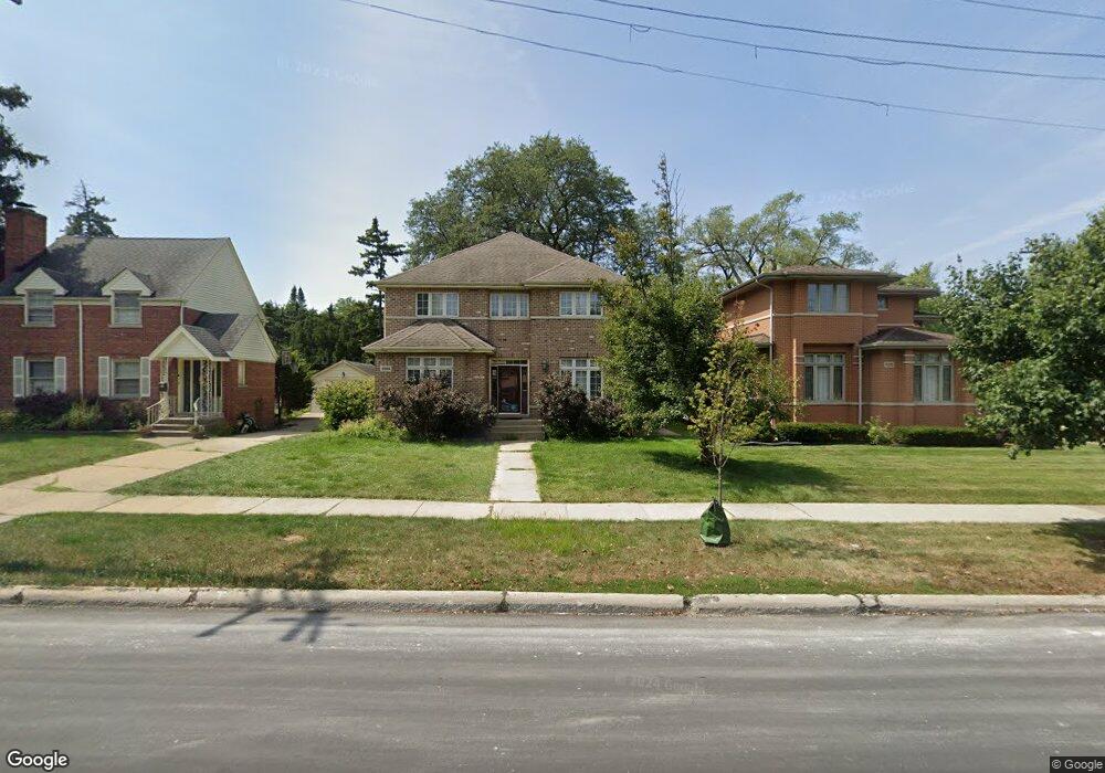
1024 Canfield Rd Park Ridge, IL 60068
Estimated Value: $719,000 - $951,000
4
Beds
4
Baths
2,743
Sq Ft
$297/Sq Ft
Est. Value
About This Home
This home is located at 1024 Canfield Rd, Park Ridge, IL 60068 and is currently estimated at $814,242, approximately $296 per square foot. 1024 Canfield Rd is a home located in Cook County with nearby schools including Theodore Roosevelt Elementary School, Lincoln Middle School, and Maine South High School.
Ownership History
Date
Name
Owned For
Owner Type
Purchase Details
Closed on
Jul 20, 2004
Sold by
Midwest Bank & Trust Co
Bought by
Beltran Leopold and Beltran Yao
Current Estimated Value
Home Financials for this Owner
Home Financials are based on the most recent Mortgage that was taken out on this home.
Original Mortgage
$538,400
Outstanding Balance
$246,097
Interest Rate
5.25%
Mortgage Type
Purchase Money Mortgage
Estimated Equity
$568,145
Create a Home Valuation Report for This Property
The Home Valuation Report is an in-depth analysis detailing your home's value as well as a comparison with similar homes in the area
Home Values in the Area
Average Home Value in this Area
Purchase History
| Date | Buyer | Sale Price | Title Company |
|---|---|---|---|
| Beltran Leopold | $673,000 | Git |
Source: Public Records
Mortgage History
| Date | Status | Borrower | Loan Amount |
|---|---|---|---|
| Open | Beltran Leopold | $538,400 |
Source: Public Records
Tax History
| Year | Tax Paid | Tax Assessment Tax Assessment Total Assessment is a certain percentage of the fair market value that is determined by local assessors to be the total taxable value of land and additions on the property. | Land | Improvement |
|---|---|---|---|---|
| 2025 | $10,354 | $50,650 | $6,300 | $44,350 |
| 2024 | $10,354 | $39,807 | $5,355 | $34,452 |
| 2023 | $9,908 | $39,807 | $5,355 | $34,452 |
| 2022 | $9,908 | $39,807 | $5,355 | $34,452 |
| 2021 | $8,923 | $31,004 | $3,307 | $27,697 |
| 2020 | $8,602 | $31,004 | $3,307 | $27,697 |
| 2019 | $8,433 | $34,071 | $3,307 | $30,764 |
| 2018 | $9,644 | $35,419 | $2,835 | $32,584 |
| 2017 | $9,612 | $35,419 | $2,835 | $32,584 |
| 2016 | $9,376 | $35,419 | $2,835 | $32,584 |
| 2015 | $9,421 | $31,856 | $2,362 | $29,494 |
| 2014 | $9,243 | $31,856 | $2,362 | $29,494 |
| 2013 | $8,747 | $31,856 | $2,362 | $29,494 |
Source: Public Records
Map
Nearby Homes
- 6429 N Oliphant Ave
- 100 Arthur St
- 6520 N Oshkosh Ave
- 6530 N Oliphant Ave
- 916 Cleveland Ave
- 1201 Grove Ave
- 6553 N Oliphant Ave
- 803 S Vine Ave
- 7725 W Myrtle Ave
- 710 S Washington Ave
- 7508 W Devon Ave
- 6681 N Northwest Hwy
- 6610 N Northwest Hwy
- 1309 S Crescent Ave
- 6850 N Northwest Hwy Unit 2B
- 6870 N Northwest Hwy Unit 2F
- 6845 N Northwest Hwy Unit 1E
- 6135 N Ozark Ave
- 518 S Vine Ave
- 400 S Northwest Hwy Unit 301B
- 1024 Canfield Rd
- 1020 Canfield Rd
- 1030 Canfield Rd
- 1100 Canfield Rd
- 1100 Canfield Rd
- 1025 Cleveland Ave
- 1021 Cleveland Ave
- 1029 Cleveland Ave
- 1029 Cleveland Ave
- 2 Arthur St
- 6448 N Oliphant Ave
- 6444 N Oliphant Ave
- 6467 N Ozanam Ave
- 1102 Canfield Rd
- 1101 Cleveland Ave
- 6452 N Oliphant Ave
- 6456 N Oliphant Ave
- 1015 Cleveland Ave
- 1008 Canfield Rd
- 6477 N Ozanam Ave
Your Personal Tour Guide
Ask me questions while you tour the home.