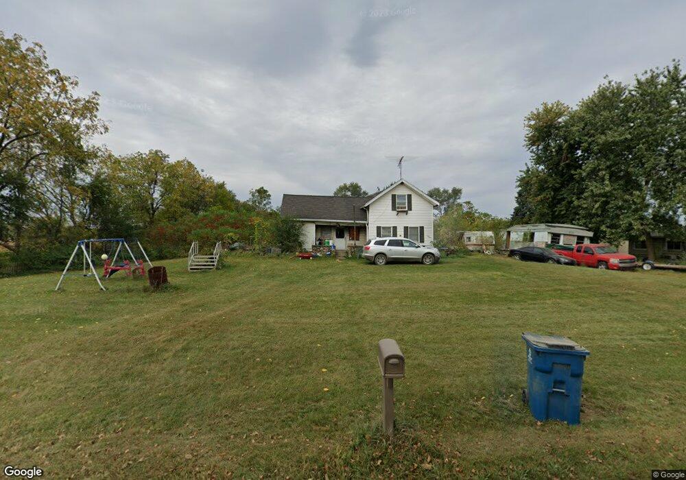
1024 Gunthorpe Rd Burr Oak, MI 49030
Estimated Value: $92,000 - $139,390
3
Beds
1
Bath
1,700
Sq Ft
$69/Sq Ft
Est. Value
About This Home
This home is located at 1024 Gunthorpe Rd, Burr Oak, MI 49030 and is currently estimated at $117,848, approximately $69 per square foot. 1024 Gunthorpe Rd is a home located in Branch County with nearby schools including Ryan Elementary School, Anderson Elementary School, and Bronson Junior/Senior High School.
Ownership History
Date
Name
Owned For
Owner Type
Purchase Details
Closed on
Sep 16, 2024
Sold by
Belleau Frederick J
Bought by
Belleau Frederick J and Knoll Linda
Current Estimated Value
Purchase Details
Closed on
May 18, 2011
Sold by
Mccormick Nick R and Mccormock Nick R
Bought by
Belleau Fredrick J
Purchase Details
Closed on
Aug 11, 2006
Sold by
Kirkpatrick Rudolph M and Kirkpatrick Linda S
Bought by
Mccormock Nick R
Home Financials for this Owner
Home Financials are based on the most recent Mortgage that was taken out on this home.
Original Mortgage
$67,500
Interest Rate
9.85%
Mortgage Type
Purchase Money Mortgage
Create a Home Valuation Report for This Property
The Home Valuation Report is an in-depth analysis detailing your home's value as well as a comparison with similar homes in the area
Home Values in the Area
Average Home Value in this Area
Purchase History
| Date | Buyer | Sale Price | Title Company |
|---|---|---|---|
| Belleau Frederick J | -- | None Listed On Document | |
| Belleau Fredrick J | $17,000 | Branch County Abstract & Tit | |
| Mccormock Nick R | $75,000 | None Available |
Source: Public Records
Mortgage History
| Date | Status | Borrower | Loan Amount |
|---|---|---|---|
| Previous Owner | Mccormock Nick R | $67,500 |
Source: Public Records
Tax History Compared to Growth
Tax History
| Year | Tax Paid | Tax Assessment Tax Assessment Total Assessment is a certain percentage of the fair market value that is determined by local assessors to be the total taxable value of land and additions on the property. | Land | Improvement |
|---|---|---|---|---|
| 2025 | $901 | $51,609 | $0 | $0 |
| 2024 | $364 | $45,554 | $0 | $0 |
| 2023 | $331 | $38,375 | $0 | $0 |
| 2022 | $331 | $35,495 | $0 | $0 |
| 2021 | -- | $33,178 | $0 | $0 |
| 2020 | -- | $33,836 | $0 | $0 |
| 2019 | -- | $30,670 | $0 | $0 |
| 2018 | -- | $27,964 | $0 | $0 |
| 2017 | -- | $29,989 | $0 | $0 |
| 2016 | -- | $33,906 | $0 | $0 |
| 2015 | -- | $30,226 | $0 | $0 |
| 2014 | -- | $27,701 | $0 | $0 |
| 2013 | -- | $30,950 | $0 | $0 |
Source: Public Records
Map
Nearby Homes
- 812 George Rd
- 8415 Indiana 120
- V Lot Fawn River Rd
- 9955 Indiana 120
- 4635 N 800 E
- 11599 E 605 N
- 11580 E 565 N
- 00 W 650 N
- 31301 E Lafayette Rd
- 6950 N 315 E
- 3145 E 695 N
- 1001 Rierson Rd
- VL County Farm Rd
- 406 Taggart Rd
- 1232 Smoker Rd
- 1052 Carpenter Rd
- 68433 Sweet Lake Rd
- 0 Rierson Rd
- 783 Rierson Rd
- 9545 Indiana 120
- 1020 Gunthorpe Rd
- 1022 Gunthorpe Rd
- 1038 Gunthorpe Rd
- 1038 Gunthorpe Rd
- 1045 Gunthorpe Rd
- 1003 Gunthorpe Rd
- 1001 Gunthorpe Rd
- 1019 Gunthorpe Rd
- 0 Gunthorp Unit 68020050682
- 0 Gunthorp Unit 20050682
- 7970 N 800 E
- 1231 Binkley Rd
- 0 Gunthorpe Rd
- 800 Eighth St
- 1175 Trayer Rd
- 1184 Trayer Rd
- 8045 N 725 E
- 7770 N 800 E
- 1166 Trayer Rd
- 1159 Trayer Rd