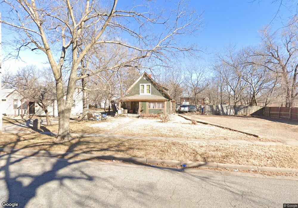
1024 N Piatt Ave Wichita, KS 67214
North Central NeighborhoodEstimated Value: $102,714 - $170,000
4
Beds
2
Baths
1,382
Sq Ft
$99/Sq Ft
Est. Value
About This Home
This home is located at 1024 N Piatt Ave, Wichita, KS 67214 and is currently estimated at $136,357, approximately $98 per square foot. 1024 N Piatt Ave is a home located in Sedgwick County with nearby schools including Spaght Science and Communications Magnet, Gordon Parks Academy, and Wichita Alternative High School.
Ownership History
Date
Name
Owned For
Owner Type
Purchase Details
Closed on
May 25, 2018
Sold by
Pittman Saundra June and Pittman Steven Craig
Bought by
Cooper Kendra Y
Current Estimated Value
Purchase Details
Closed on
Feb 26, 2018
Sold by
Thomson Vaden L and Thomson Patsy O
Bought by
Cooper Kendra Y
Purchase Details
Closed on
Jan 17, 2006
Sold by
Cooper Kenneth
Bought by
Cooper Linda
Purchase Details
Closed on
Oct 19, 2001
Sold by
Williams Dasie M
Bought by
Cooper Kenneth and Cooper Linda F
Create a Home Valuation Report for This Property
The Home Valuation Report is an in-depth analysis detailing your home's value as well as a comparison with similar homes in the area
Home Values in the Area
Average Home Value in this Area
Purchase History
| Date | Buyer | Sale Price | Title Company |
|---|---|---|---|
| Cooper Kendra Y | -- | Security 1St Title | |
| Cooper Kendra Y | -- | Security 1St Title | |
| Cooper Linda | -- | None Available | |
| Cooper Kenneth | -- | -- |
Source: Public Records
Tax History Compared to Growth
Tax History
| Year | Tax Paid | Tax Assessment Tax Assessment Total Assessment is a certain percentage of the fair market value that is determined by local assessors to be the total taxable value of land and additions on the property. | Land | Improvement |
|---|---|---|---|---|
| 2025 | $520 | $5,451 | $667 | $4,784 |
| 2023 | $520 | $4,867 | $552 | $4,315 |
| 2022 | $374 | $3,842 | $518 | $3,324 |
| 2021 | $378 | $3,585 | $518 | $3,067 |
| 2020 | $380 | $3,585 | $518 | $3,067 |
| 2019 | $380 | $3,585 | $518 | $3,067 |
| 2018 | $406 | $3,807 | $552 | $3,255 |
| 2017 | $406 | $0 | $0 | $0 |
| 2016 | $405 | $0 | $0 | $0 |
| 2015 | $401 | $0 | $0 | $0 |
| 2014 | $394 | $0 | $0 | $0 |
Source: Public Records
Map
Nearby Homes
- 2120 E Random Rd
- 2232 E Random Rd
- 2301 E Random Rd
- 830 N Spruce St
- 1207 N Hydraulic St
- 832 N Grove St
- 721 N Madison Ave
- 1329 N Piatt Ave
- 706 N Piatt Ave
- LOTS 26-28 N Ash St
- 616 N Madison Ave
- 1344 N Kansas Ave
- 1258 N Green St
- 1231 N Mathewson Ave
- 1452 N Minnesota Ave
- Lot 16 Buck's Add
- 1157 N Erie Ave
- 1527 N Minnesota Ave
- 1556 N Minnesota Ave
- 1234 N Chautauqua Ave
- 1028 N Piatt Ave
- 1030 N Piatt Ave
- 1031 N Ash Ave
- 1021 N Ash Ave
- 1035 N Ash Ave
- 1025 N Piatt Ave
- 1031 N Piatt Ave
- 2030 E 9th St N
- 2038 E 9th St N
- 1035 N Piatt Ave
- 1037 N Ash Ave
- 2042 E 9th St N
- 1046 N Piatt Ave
- 1049 N Ash Ave
- 1041 N Piatt Ave
- 1047 N Piatt Ave
- 1050 N Piatt Ave
- 1014 N Ash Ave
- 1012 N Ash Ave
- 1049 N Piatt Ave