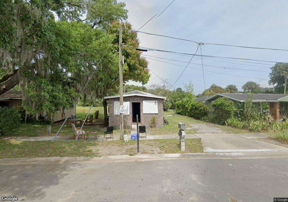
1024 West St Titusville, FL 32780
Estimated Value: $136,865 - $194,000
2
Beds
2
Baths
960
Sq Ft
$173/Sq Ft
Est. Value
About This Home
This home is located at 1024 West St, Titusville, FL 32780 and is currently estimated at $165,966, approximately $172 per square foot. 1024 West St is a home located in Brevard County with nearby schools including Titusville High School, Apollo Elementary School, and Andrew Jackson Middle School.
Ownership History
Date
Name
Owned For
Owner Type
Purchase Details
Closed on
Feb 11, 2019
Sold by
James W Latricia
Bought by
Strachan Roderick L
Current Estimated Value
Purchase Details
Closed on
Mar 8, 2017
Sold by
Strachan Roby Virginia
Bought by
Strachan Rodrick L and Strachan Ruby V
Purchase Details
Closed on
Apr 3, 2015
Sold by
Strachan Ruby Virginia Portlock
Bought by
Strachan Ruby Virginia Portlock and Strachan Joe Bathsheba
Create a Home Valuation Report for This Property
The Home Valuation Report is an in-depth analysis detailing your home's value as well as a comparison with similar homes in the area
Home Values in the Area
Average Home Value in this Area
Purchase History
| Date | Buyer | Sale Price | Title Company |
|---|---|---|---|
| Strachan Roderick L | -- | None Available | |
| Strachan Rodrick L | -- | Attorney | |
| Strachan Ruby Virginia Portlock | -- | None Available |
Source: Public Records
Mortgage History
| Date | Status | Borrower | Loan Amount |
|---|---|---|---|
| Closed | Strachan Rodrick L | $0 |
Source: Public Records
Tax History Compared to Growth
Tax History
| Year | Tax Paid | Tax Assessment Tax Assessment Total Assessment is a certain percentage of the fair market value that is determined by local assessors to be the total taxable value of land and additions on the property. | Land | Improvement |
|---|---|---|---|---|
| 2025 | $707 | $53,170 | -- | -- |
| 2024 | $735 | $53,620 | -- | -- |
| 2023 | $735 | $63,490 | $0 | $0 |
| 2022 | $566 | $44,850 | $0 | $0 |
| 2021 | $535 | $40,510 | $3,150 | $37,360 |
| 2020 | $575 | $42,760 | $0 | $0 |
| 2019 | $563 | $40,660 | $3,150 | $37,510 |
| 2018 | $583 | $41,430 | $3,150 | $38,280 |
| 2017 | $145 | $20,490 | $0 | $0 |
| 2016 | $577 | $23,580 | $3,150 | $20,430 |
| 2015 | $57 | $22,160 | $3,150 | $19,010 |
| 2014 | $57 | $21,990 | $3,150 | $18,840 |
Source: Public Records
Map
Nearby Homes
- 918 Wager Ave
- 900 S Park Ave
- 1006 1st Ave
- 810 Booker St
- 903 Pine St
- 1219 Pine St
- 505 Roderick A Harris Sr Ave
- 908 Gilbert St
- 470 S Robbins Ave
- 1041 Rosella Ln
- 910 Tropic St
- 414 Dummitt Ave
- 728 S Washington Ave
- 1010 Lane Ave
- 1019 Main St
- 553 Rockpit Rd
- 1003 S Washington Ave
- 1007 S Washington Ave
- 1700 Bluebird Ct
- 537 Rockpit Rd
- 1022 West St
- 1026 West St
- 1018 West St
- 22-35-04-7 Unknown St
- 0000 Ronald St
- 0 Ronald St
- 1004 West St
- 830 S Deleon Ave
- 914 S Deleon Ave
- 912 S Deleon Ave
- 916 S Deleon Ave
- 922 S Deleon Ave
- 924 S Deleon Ave
- 826 S Deleon Ave
- 726 S Deleon Ave
- 728 S Deleon Ave
- 932 S Deleon Ave
- 907 S Deleon Ave
- 917 S Deleon Ave
- 1213 Ronald St