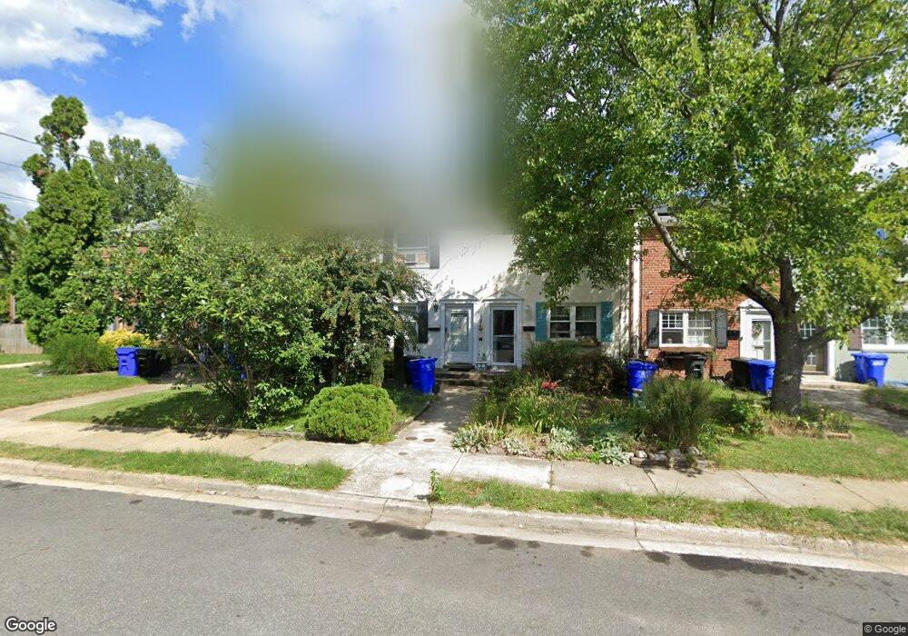
1025 Philip Powers Dr Laurel, MD 20707
Estimated Value: $257,000 - $324,000
Studio
2
Baths
800
Sq Ft
$367/Sq Ft
Est. Value
About This Home
This home is located at 1025 Philip Powers Dr, Laurel, MD 20707 and is currently estimated at $293,736, approximately $367 per square foot. 1025 Philip Powers Dr is a home located in Prince George's County with nearby schools including Laurel Elementary School, Dwight D. Eisenhower Middle School, and Laurel High School.
Ownership History
Date
Name
Owned For
Owner Type
Purchase Details
Closed on
Aug 4, 2006
Sold by
Pena Helainy
Bought by
Carrillo Maria L
Current Estimated Value
Home Financials for this Owner
Home Financials are based on the most recent Mortgage that was taken out on this home.
Original Mortgage
$50,600
Interest Rate
6.67%
Mortgage Type
Purchase Money Mortgage
Purchase Details
Closed on
Jul 10, 2006
Sold by
Pena Helainy
Bought by
Carrillo Maria L
Home Financials for this Owner
Home Financials are based on the most recent Mortgage that was taken out on this home.
Original Mortgage
$50,600
Interest Rate
6.67%
Mortgage Type
Purchase Money Mortgage
Purchase Details
Closed on
Apr 30, 2004
Sold by
Bloom Susan C
Bought by
Pena Helainy
Purchase Details
Closed on
Jul 14, 1986
Sold by
Mcevoy Vincent P
Bought by
Bloom Susan C and Bloom Christophe N
Create a Home Valuation Report for This Property
The Home Valuation Report is an in-depth analysis detailing your home's value as well as a comparison with similar homes in the area
Home Values in the Area
Average Home Value in this Area
Purchase History
We collect this data history from publicly available records. To have your information removed, we recommend requesting removal directly through your county’s website.
| Date | Buyer | Sale Price | Title Company |
|---|---|---|---|
| Carrillo Maria L | $253,000 | -- | |
| Carrillo Maria L | $253,000 | -- | |
| Pena Helainy | $125,000 | -- | |
| Bloom Susan C | $68,500 | -- |
Source: Public Records
Mortgage History
We collect this data history from publicly available records. To have your information removed, we recommend requesting removal directly through your county’s website.
| Date | Status | Borrower | Loan Amount |
|---|---|---|---|
| Closed | Carrillo Maria L | $50,600 | |
| Open | Pena Helainy | $202,400 | |
| Closed | Carrillo Maria L | $202,400 |
Source: Public Records
Tax History
| Year | Tax Paid | Tax Assessment Tax Assessment Total Assessment is a certain percentage of the fair market value that is determined by local assessors to be the total taxable value of land and additions on the property. | Land | Improvement |
|---|---|---|---|---|
| 2025 | $3,956 | $259,400 | $90,000 | $169,400 |
| 2024 | $3,956 | $244,100 | -- | -- |
| 2023 | $3,743 | $228,800 | $0 | $0 |
| 2022 | $3,496 | $213,500 | $75,000 | $138,500 |
| 2021 | $3,307 | $202,600 | $0 | $0 |
| 2020 | $3,186 | $191,700 | $0 | $0 |
| 2019 | $3,059 | $180,800 | $75,000 | $105,800 |
| 2018 | $2,955 | $173,500 | $0 | $0 |
| 2017 | $2,867 | $166,200 | $0 | $0 |
| 2016 | -- | $158,900 | $0 | $0 |
| 2015 | $2,433 | $155,333 | $0 | $0 |
| 2014 | $2,433 | $151,767 | $0 | $0 |
Source: Public Records
Map
Nearby Homes
- 916 Philip Powers Dr
- 1106 Snowden Place
- 212 11th St
- 910 Montgomery St Unit A
- 504 9th St
- 221 Patuxent Rd
- 211 Patuxent Rd
- 15619 Birch Run Terrace
- 501 8th St
- 9425 Fairview Ave
- 9429 Fairview Ave
- 15628 Mews Ct
- 809 Montrose Ave
- 1019 Marton St
- 610 Main St Unit 413
- 1031 Marton St
- 15837 Millbrook Ln
- 8239 Londonderry Ct
- 9260 Old Scaggsville Rd
- 15734 Millbrook Ln
- 1027 Philip Powers Dr
- 1023 Philip Powers Dr
- 1029 Philip Powers Dr
- 1021 Philip Powers Dr
- 1031 Philip Powers Dr
- 1019 Philip Powers Dr
- 1017 Philip Powers Dr
- 1033 Philip Powers Dr
- 1015 Philip Powers Dr
- 302 Grace Way
- 302 Grace Way Unit 2
- 1013 Philip Powers Dr
- 308 Grace Way
- 1011 Philip Powers Dr
- 310 Grace Way
- 1009 Philip Powers Dr
- 300 Grace Way Unit 1
- 306 Grace Way
- 304 Grace Way Unit 3
- 304 Grace Way
Your Personal Tour Guide
Ask me questions while you tour the home.