Estimated Value: $85,764 - $116,000
2
Beds
1
Bath
900
Sq Ft
$113/Sq Ft
Est. Value
About This Home
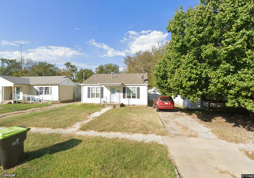
This home is located at 1025 S Stockton St, Ada, OK 74820 and is currently estimated at $101,441, approximately $112 per square foot. 1025 S Stockton St is a home located in Pontotoc County with nearby schools including ADA Early Childhood Center, Washington Elementary School, and Hayes Elementary School.
Ownership History
Date
Name
Owned For
Owner Type
Purchase Details
Closed on
Jul 12, 2021
Sold by
Lee Douglas Edward and Lee Priseilla
Bought by
Walls Kyle
Current Estimated Value
Home Financials for this Owner
Home Financials are based on the most recent Mortgage that was taken out on this home.
Original Mortgage
$83,300
Outstanding Balance
$69,395
Interest Rate
2.9%
Mortgage Type
Purchase Money Mortgage
Estimated Equity
$32,046
Purchase Details
Closed on
Aug 26, 2002
Sold by
James James F and James Myers
Bought by
Cynthia Lynn and Cynthia Saunders
Purchase Details
Closed on
Aug 2, 1994
Sold by
James Lane Etal
Bought by
James James F and James Myers
Create a Home Valuation Report for This Property
The Home Valuation Report is an in-depth analysis detailing your home's value as well as a comparison with similar homes in the area
Home Values in the Area
Average Home Value in this Area
Purchase History
| Date | Buyer | Sale Price | Title Company |
|---|---|---|---|
| Walls Kyle | $98,000 | None Available | |
| Cynthia Lynn | $32,500 | -- | |
| James James F | $25,000 | -- |
Source: Public Records
Mortgage History
| Date | Status | Borrower | Loan Amount |
|---|---|---|---|
| Open | Walls Kyle | $83,300 |
Source: Public Records
Tax History Compared to Growth
Tax History
| Year | Tax Paid | Tax Assessment Tax Assessment Total Assessment is a certain percentage of the fair market value that is determined by local assessors to be the total taxable value of land and additions on the property. | Land | Improvement |
|---|---|---|---|---|
| 2025 | $644 | $5,891 | $1,500 | $4,391 |
| 2024 | $644 | $6,180 | $1,500 | $4,680 |
| 2023 | $644 | $5,886 | $1,500 | $4,386 |
| 2022 | $596 | $5,882 | $1,500 | $4,382 |
| 2021 | $505 | $5,416 | $1,381 | $4,035 |
| 2020 | $495 | $5,158 | $1,315 | $3,843 |
| 2019 | $472 | $4,914 | $1,253 | $3,661 |
| 2018 | $432 | $4,679 | $1,193 | $3,486 |
| 2017 | $384 | $4,456 | $1,136 | $3,320 |
| 2016 | $367 | $4,245 | $1,056 | $3,189 |
| 2015 | $355 | $4,043 | $667 | $3,376 |
| 2014 | $315 | $3,850 | $800 | $3,050 |
Source: Public Records
Map
Nearby Homes
- 1031 S Stockton St
- 1106 S Stockton Ave
- 1018 S Cherry St
- 1310 S Cherry St
- 817 S Stockton St
- 120 Thompson Dr
- 500 W Kings Rd
- 622 W 23rd St
- 1100 S Broadway Ave
- 1108 S Broadway Ave
- 101 Hunter Dr
- 524 W 18th St
- 115 W 18th St
- 100 E Kings Rd
- 700 W Kings Rd
- 730 W 19th St
- 500 W 16th St
- 801 S Rennie St
- 503 S Johnston St
- 309 W 14th St
- 1023 S Stockton St
- 1027 S Stockton St
- 1021 S Stockton St
- 1112 S Cherry St
- 1122 S Cherry St
- 1101 S Stockton St
- 1110 S Cherry St
- 1124 S Cherry St
- 1019 S Stockton St
- 1108 S Cherry St
- 1030 S Stockton St
- 1103 S Stockton St
- 1118 S Cherry St
- 1026 S Stockton St
- 1106 S Cherry St
- 1100 S Stockton St
- 1017 S Stockton St
- 1120 S Cherry St
- 1020 S Stockton St