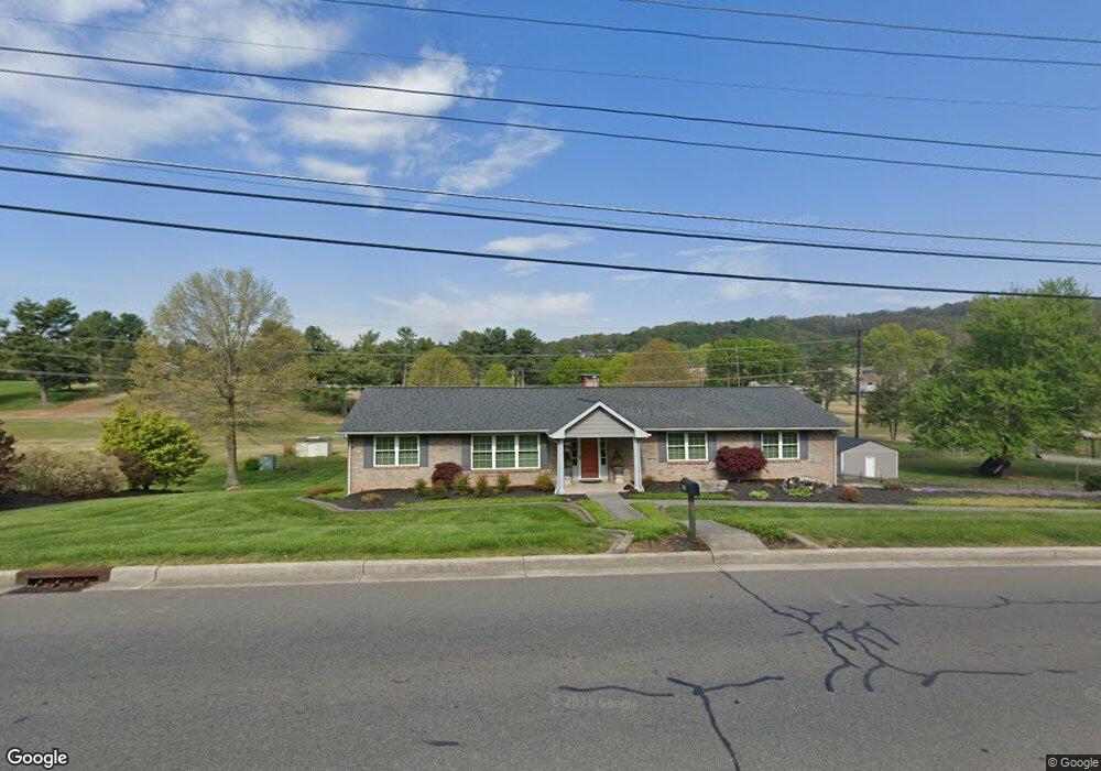
1025 Walters Dr Morristown, TN 37814
Estimated Value: $310,015 - $374,000
--
Bed
2
Baths
1,814
Sq Ft
$188/Sq Ft
Est. Value
About This Home
This home is located at 1025 Walters Dr, Morristown, TN 37814 and is currently estimated at $341,504, approximately $188 per square foot. 1025 Walters Dr is a home located in Hamblen County with nearby schools including West Elementary School, Lincoln Heights Middle School, and Morristown West High School.
Ownership History
Date
Name
Owned For
Owner Type
Purchase Details
Closed on
Feb 25, 1994
Sold by
Brock Margaret
Bought by
Glenn Thompson
Current Estimated Value
Purchase Details
Closed on
Jan 6, 1993
Bought by
Brock Margaret N and Thompson Barbara
Purchase Details
Closed on
Jan 3, 1992
Bought by
Brock Margaret N and Thompson Barbara
Purchase Details
Closed on
Dec 30, 1991
Bought by
Brock Margaret N and Thompson Barbara
Purchase Details
Closed on
Sep 29, 1980
Bought by
Brock Margaret N
Purchase Details
Closed on
Sep 14, 1977
Create a Home Valuation Report for This Property
The Home Valuation Report is an in-depth analysis detailing your home's value as well as a comparison with similar homes in the area
Home Values in the Area
Average Home Value in this Area
Purchase History
| Date | Buyer | Sale Price | Title Company |
|---|---|---|---|
| Glenn Thompson | $20,000 | -- | |
| Brock Margaret N | $20,000 | -- | |
| Brock Margaret N | $20,000 | -- | |
| Brock Margaret N | $20,000 | -- | |
| Brock Margaret N | -- | -- | |
| -- | -- | -- |
Source: Public Records
Tax History Compared to Growth
Tax History
| Year | Tax Paid | Tax Assessment Tax Assessment Total Assessment is a certain percentage of the fair market value that is determined by local assessors to be the total taxable value of land and additions on the property. | Land | Improvement |
|---|---|---|---|---|
| 2024 | $789 | $44,825 | $9,725 | $35,100 |
| 2023 | $789 | $44,825 | $0 | $0 |
| 2022 | $1,417 | $44,825 | $9,725 | $35,100 |
| 2021 | $789 | $44,825 | $9,725 | $35,100 |
| 2020 | $1,415 | $44,825 | $9,725 | $35,100 |
| 2019 | $1,430 | $42,075 | $11,150 | $30,925 |
| 2018 | $1,325 | $42,075 | $11,150 | $30,925 |
| 2017 | $1,304 | $42,075 | $11,150 | $30,925 |
| 2016 | $1,246 | $42,075 | $11,150 | $30,925 |
| 2015 | $1,159 | $42,075 | $11,150 | $30,925 |
| 2014 | -- | $42,075 | $11,150 | $30,925 |
| 2013 | -- | $46,425 | $0 | $0 |
Source: Public Records
Map
Nearby Homes
- 1033 Walters Dr
- 941 Heykoop Dr
- 1626 Cardinal Dr
- 2020 N Economy Rd
- 1613 Cardinal Dr
- 707 Walters Dr
- 2045 N Economy Rd Unit A3
- 1442 Darbee Dr
- 1230 Mcfarland St Unit 37
- 1230 Mcfarland St Unit 3
- 2310 Sandstone Dr
- 1318 Secretariat Dr
- 1476 Darbee Dr
- 2454 Sandstone Dr
- 2444 Sandstone Dr
- 2430 Sandstone Dr
- 1530 Rayburn Dr
- 1211 W 6th St N
- 1361 Appalachian Trace
- 1770 Walters Dr
- 1015 Walters Dr
- 1026 Walters Dr
- 1016 Walters Dr
- 1032 Walters Dr
- 1039 Walters Dr
- 1009 Walters Dr
- 1027 Heykoop Dr
- 1015 Heykoop Dr
- 1041 Walters Dr
- 1006 Walters Dr
- 1187 Heykoop Dr
- 1130 Walters Dr
- 1125 Heykoop Dr
- 1003 Walters Dr
- 1011 Heykoop Dr
- 1112 Heykoop Dr
- 1225 Walters Dr
- 1018 Heykoop Dr
- 1122 Heykoop Dr
- 1477 Walters Dr