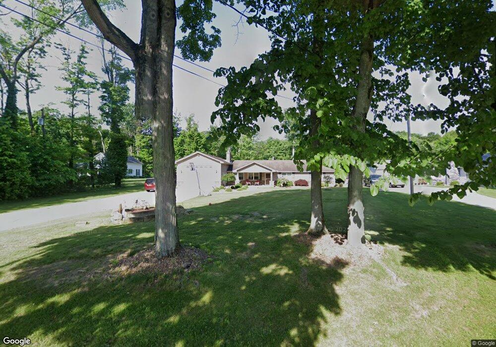
10250 New Buffalo Rd Canfield, OH 44406
Estimated Value: $333,446 - $625,000
4
Beds
3
Baths
2,188
Sq Ft
$196/Sq Ft
Est. Value
About This Home
This home is located at 10250 New Buffalo Rd, Canfield, OH 44406 and is currently estimated at $429,612, approximately $196 per square foot. 10250 New Buffalo Rd is a home located in Mahoning County with nearby schools including South Range Elementary School, South Range Middle School, and South Range High School.
Ownership History
Date
Name
Owned For
Owner Type
Purchase Details
Closed on
Jul 7, 2015
Sold by
Glista Joseph S and Glista Erin A
Bought by
Mcgrath Cheryl L
Current Estimated Value
Home Financials for this Owner
Home Financials are based on the most recent Mortgage that was taken out on this home.
Original Mortgage
$228,000
Outstanding Balance
$178,769
Interest Rate
4.02%
Mortgage Type
New Conventional
Estimated Equity
$250,843
Purchase Details
Closed on
Dec 11, 2009
Sold by
Loupe David
Bought by
Glista Joseph S and Glista Erin A
Purchase Details
Closed on
May 20, 1991
Sold by
Lepowsky Elaine
Bought by
Loupe David
Purchase Details
Closed on
Apr 17, 1991
Sold by
Loupe Wendell
Bought by
Loupe Jane C
Create a Home Valuation Report for This Property
The Home Valuation Report is an in-depth analysis detailing your home's value as well as a comparison with similar homes in the area
Home Values in the Area
Average Home Value in this Area
Purchase History
| Date | Buyer | Sale Price | Title Company |
|---|---|---|---|
| Mcgrath Cheryl L | $240,000 | Heritage Union Title Co Ltd | |
| Glista Joseph S | $75,000 | None Available | |
| Loupe David | -- | -- | |
| Loupe Jane C | -- | -- |
Source: Public Records
Mortgage History
| Date | Status | Borrower | Loan Amount |
|---|---|---|---|
| Open | Mcgrath Cheryl L | $228,000 |
Source: Public Records
Tax History Compared to Growth
Tax History
| Year | Tax Paid | Tax Assessment Tax Assessment Total Assessment is a certain percentage of the fair market value that is determined by local assessors to be the total taxable value of land and additions on the property. | Land | Improvement |
|---|---|---|---|---|
| 2024 | $4,032 | $83,020 | $6,180 | $76,840 |
| 2023 | $4,046 | $83,020 | $6,180 | $76,840 |
| 2022 | $3,893 | $69,400 | $5,690 | $63,710 |
| 2021 | $3,940 | $69,400 | $5,690 | $63,710 |
| 2020 | $3,957 | $69,400 | $5,690 | $63,710 |
| 2019 | $3,444 | $58,780 | $5,690 | $53,090 |
| 2018 | $3,398 | $58,780 | $5,690 | $53,090 |
| 2017 | $3,302 | $58,780 | $5,690 | $53,090 |
| 2016 | $3,210 | $54,150 | $4,550 | $49,600 |
| 2015 | $3,152 | $54,150 | $4,550 | $49,600 |
| 2014 | $2,387 | $40,510 | $4,550 | $35,960 |
| 2013 | $2,019 | $34,660 | $4,550 | $30,110 |
Source: Public Records
Map
Nearby Homes
- 9757 New Buffalo Rd
- 9501 New Buffalo Rd
- 11160 Detwiler Rd
- 1482 Lake Front Blvd
- 1486 Lake Front Blvd
- 635 Berklee Dr
- 1190 Calla Rd W
- 11695 Basinger Rd
- Lot 36 Berklee Dr
- 107 Berklee Dr
- 517 Berklee Dr
- 0 Sharrott Rd Unit 5174987
- 400 Calla Rd W
- 3555 W South Range Rd
- 9264 Sharrott Rd Unit 1803
- 9264 Sharrott Rd Unit 1001
- 9264 Sharrott Rd Unit 104
- 9264 Sharrott Rd Unit 1002
- 8516 Hitchcock Rd
- 1242 W Western Reserve Rd
- 10268 New Buffalo Rd
- 10286 New Buffalo Rd
- 10230 New Buffalo Rd
- 10202 New Buffalo Rd
- 10247 New Buffalo Rd
- 10277 New Buffalo Rd
- 10190 New Buffalo Rd
- 10302 New Buffalo Rd
- 10219 New Buffalo Rd
- 10299 New Buffalo Rd
- 10160 New Buffalo Rd
- 10191 New Buffalo Rd
- 10161 New Buffalo Rd
- 10135 New Buffalo Rd
- 10450 New Buffalo Rd
- 10116 New Buffalo Rd
- 3014 Lynn Rd
- 10090 New Buffalo Rd
- 10464 New Buffalo Rd
- 3046 Lynn Rd