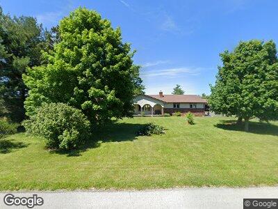
10254 Simonds Rd Bowling Green, OH 43402
Estimated Value: $290,323 - $372,000
3
Beds
2
Baths
2,004
Sq Ft
$164/Sq Ft
Est. Value
About This Home
This home is located at 10254 Simonds Rd, Bowling Green, OH 43402 and is currently estimated at $329,331, approximately $164 per square foot. 10254 Simonds Rd is a home located in Wood County with nearby schools including Bowling Green High School.
Ownership History
Date
Name
Owned For
Owner Type
Purchase Details
Closed on
Mar 25, 2022
Sold by
Dunn Melanie L
Bought by
Dunn Jason Michael and Dunn Melanie L
Current Estimated Value
Home Financials for this Owner
Home Financials are based on the most recent Mortgage that was taken out on this home.
Original Mortgage
$150,000
Outstanding Balance
$126,794
Interest Rate
3.14%
Mortgage Type
New Conventional
Estimated Equity
$205,550
Purchase Details
Closed on
Mar 21, 2016
Sold by
Marten Dixon L
Bought by
Campbell Melanie L
Home Financials for this Owner
Home Financials are based on the most recent Mortgage that was taken out on this home.
Original Mortgage
$164,957
Interest Rate
3.75%
Mortgage Type
FHA
Create a Home Valuation Report for This Property
The Home Valuation Report is an in-depth analysis detailing your home's value as well as a comparison with similar homes in the area
Home Values in the Area
Average Home Value in this Area
Purchase History
| Date | Buyer | Sale Price | Title Company |
|---|---|---|---|
| Dunn Jason Michael | -- | -- | |
| Campbell Melanie L | $168,000 | None Available |
Source: Public Records
Mortgage History
| Date | Status | Borrower | Loan Amount |
|---|---|---|---|
| Open | Dunn Jason Michael | $150,000 | |
| Previous Owner | Campbell Melanie L | $164,957 |
Source: Public Records
Tax History Compared to Growth
Tax History
| Year | Tax Paid | Tax Assessment Tax Assessment Total Assessment is a certain percentage of the fair market value that is determined by local assessors to be the total taxable value of land and additions on the property. | Land | Improvement |
|---|---|---|---|---|
| 2023 | $3,409 | $75,850 | $14,000 | $61,850 |
| 2021 | $2,935 | $63,280 | $10,500 | $52,780 |
| 2020 | $2,959 | $63,280 | $10,500 | $52,780 |
| 2019 | $2,655 | $54,500 | $10,500 | $44,000 |
| 2018 | $2,571 | $54,500 | $10,500 | $44,000 |
| 2017 | $2,542 | $54,500 | $10,500 | $44,000 |
| 2016 | $2,504 | $51,840 | $10,150 | $41,690 |
| 2015 | $2,504 | $51,840 | $10,150 | $41,690 |
| 2014 | $2,417 | $51,840 | $10,150 | $41,690 |
| 2013 | $1,322 | $51,840 | $10,150 | $41,690 |
Source: Public Records
Map
Nearby Homes
- 11628 Sugar Ridge Rd
- 12283 Devils Hole Rd
- 1724 Wexford Dr
- 1724 Wexford Dr
- 1724 Wexford Dr
- 1724 Wexford Dr
- 1724 Wexford Dr
- 24647 W Third St
- 761 Longford Dr
- 1724 Wexford
- 24577 W Third St
- 24537 W Third St
- 24557 W Third St
- 762 Longford Dr
- 1752 Wexford Dr
- 1747 Wexford Dr
- 1047 Lavender Ln
- 1044 Orchid Ln
- 1066 Orchid Ln
- 1740 Wexford
- 10254 Simonds Rd
- 10228 Simonds Rd
- 10190 Simonds Rd
- 10140 Simonds Rd
- 10088 Simonds Rd
- 10034 Simonds Rd
- 18691 Carter Rd
- 18767 Carter Rd
- 10635 Simonds Rd
- 18775 Carter Rd
- 18795 Carter Rd
- 18851 Carter Rd
- 10676 Simonds Rd
- 18176 Carter Rd
- 10225 Sugar Ridge Rd
- 10189 Sugar Ridge Rd
- 10139 Sugar Ridge Rd
- 10299 Sugar Ridge Rd
- 10073 Sugar Ridge Rd
- 18860 Carter Rd