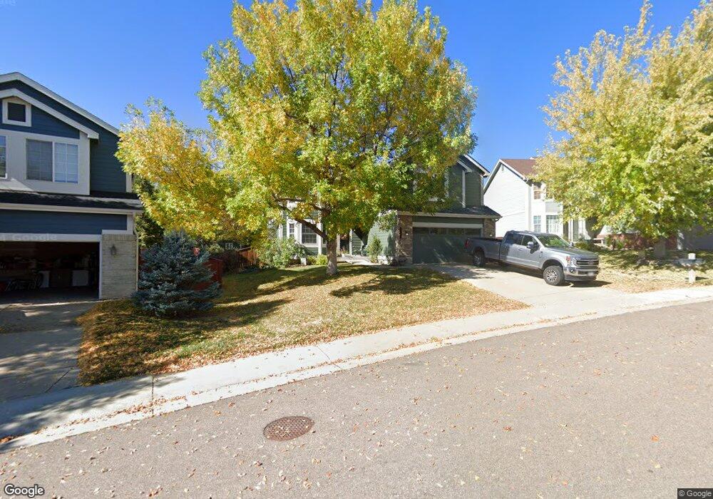
10257 Hexton Ct Lone Tree, CO 80124
Estimated Value: $770,020 - $827,000
4
Beds
3
Baths
2,603
Sq Ft
$309/Sq Ft
Est. Value
About This Home
This home is located at 10257 Hexton Ct, Lone Tree, CO 80124 and is currently estimated at $803,755, approximately $308 per square foot. 10257 Hexton Ct is a home located in Douglas County with nearby schools including Acres Green Elementary School, Cresthill Middle School, and Highlands Ranch High School.
Ownership History
Date
Name
Owned For
Owner Type
Purchase Details
Closed on
Jun 30, 1999
Sold by
Us Home Corp
Bought by
Visocky Michael J and Visocky Trina R
Current Estimated Value
Home Financials for this Owner
Home Financials are based on the most recent Mortgage that was taken out on this home.
Original Mortgage
$214,700
Outstanding Balance
$54,008
Interest Rate
7.21%
Estimated Equity
$749,747
Create a Home Valuation Report for This Property
The Home Valuation Report is an in-depth analysis detailing your home's value as well as a comparison with similar homes in the area
Home Values in the Area
Average Home Value in this Area
Purchase History
| Date | Buyer | Sale Price | Title Company |
|---|---|---|---|
| Visocky Michael J | $226,025 | First American Heritage Titl |
Source: Public Records
Mortgage History
| Date | Status | Borrower | Loan Amount |
|---|---|---|---|
| Open | Visocky Michael J | $214,700 |
Source: Public Records
Tax History
| Year | Tax Paid | Tax Assessment Tax Assessment Total Assessment is a certain percentage of the fair market value that is determined by local assessors to be the total taxable value of land and additions on the property. | Land | Improvement |
|---|---|---|---|---|
| 2025 | $4,496 | $49,200 | $10,710 | $38,490 |
| 2024 | $4,496 | $51,680 | $12,100 | $39,580 |
| 2023 | $4,541 | $51,680 | $12,100 | $39,580 |
| 2022 | $3,496 | $38,440 | $8,150 | $30,290 |
| 2021 | $3,635 | $38,440 | $8,150 | $30,290 |
| 2020 | $3,612 | $39,140 | $7,870 | $31,270 |
| 2019 | $3,624 | $39,140 | $7,870 | $31,270 |
| 2018 | $2,919 | $33,720 | $6,800 | $26,920 |
| 2017 | $3,300 | $33,720 | $6,800 | $26,920 |
| 2016 | $3,034 | $33,800 | $7,420 | $26,380 |
| 2015 | $3,101 | $33,800 | $7,420 | $26,380 |
| 2014 | $2,637 | $26,950 | $6,530 | $20,420 |
Source: Public Records
Map
Nearby Homes
- 7755 Barkway Ct
- 10091 Astoria Ct
- 9943 Cottoncreek Dr
- 10456 Carriage Club Dr
- 9838 Cypress Point Cir
- 7053 Leopard Dr
- 9853 Greensview Cir
- 9888 Falcon Creek Dr
- 7085 Leopard Gate
- 10653 Lieter Place
- 9873 Greensview Cir
- 9835 Firestone Cir
- 10146 Jill Ave
- 10330 Lions Path
- 8561 Colonial Dr
- 9631 Kemper Dr
- 6717 Millstone St
- 7459 La Quinta Place
- 10205 Bluffmont Dr
- 8356 Green Island Cir
- 10267 Hexton Ct
- 10247 Hexton Ct
- 7577 Lebrun Ct
- 7522 Bantry Ct
- 10277 Hexton Ct
- 7537 Lebrun Ct
- 10237 Hexton Ct
- 10248 Hexton Ct
- 7557 Lebrun Ct
- 10268 Hexton Ct
- 7536 Bantry Ct
- 10278 Hexton Ct
- 10227 Hexton Ct
- 7550 Bantry Ct
- 7507 Lebrun Ct
- 10228 Hexton Ct
- 7588 Lebrun Ct
- 7507 Bantry Ct
- 7598 Lebrun Ct
- 7641 Lebrun Ct
Your Personal Tour Guide
Ask me questions while you tour the home.