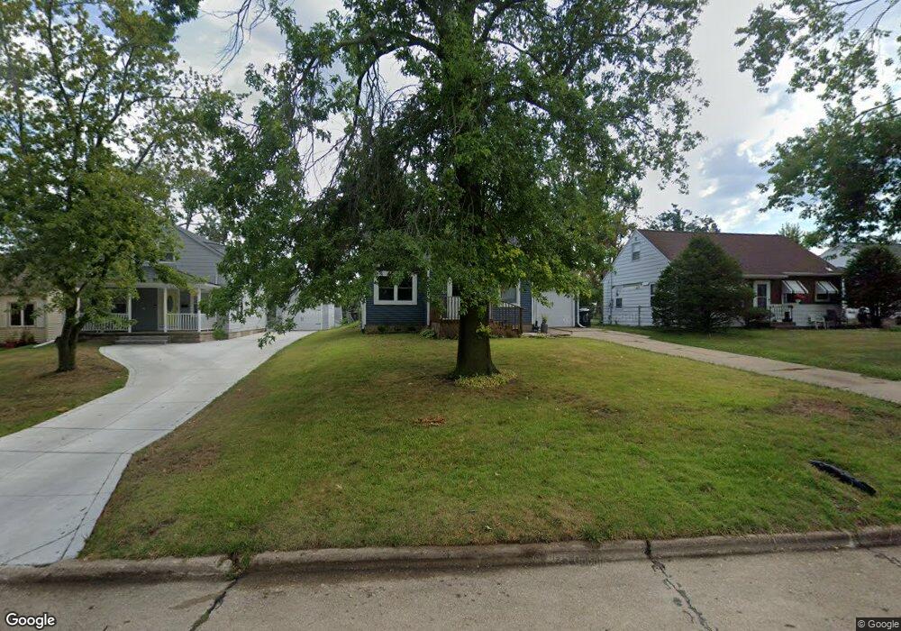
1026 32nd St SE Cedar Rapids, IA 52403
Estimated Value: $180,812 - $200,000
2
Beds
2
Baths
1,530
Sq Ft
$125/Sq Ft
Est. Value
About This Home
This home is located at 1026 32nd St SE, Cedar Rapids, IA 52403 and is currently estimated at $191,203, approximately $124 per square foot. 1026 32nd St SE is a home located in Linn County with nearby schools including Summit Elementary School, Erskine Elementary School, and McKinley STEAM Academy.
Ownership History
Date
Name
Owned For
Owner Type
Purchase Details
Closed on
Feb 24, 2022
Sold by
Henry Carol A
Bought by
Allison Angela M
Current Estimated Value
Purchase Details
Closed on
May 6, 2004
Sold by
Lasalle Bank Na
Bought by
Henry Carol A
Home Financials for this Owner
Home Financials are based on the most recent Mortgage that was taken out on this home.
Original Mortgage
$75,905
Interest Rate
5.74%
Mortgage Type
Unknown
Purchase Details
Closed on
Mar 12, 2004
Sold by
Lasalle Bank Na
Bought by
Henry Donald and Henry Carol A
Home Financials for this Owner
Home Financials are based on the most recent Mortgage that was taken out on this home.
Original Mortgage
$75,905
Interest Rate
5.74%
Mortgage Type
Unknown
Purchase Details
Closed on
Jan 6, 2004
Sold by
Mckee Donald D and Mckee Terri L
Bought by
Nationscredit Financial Services Corp
Create a Home Valuation Report for This Property
The Home Valuation Report is an in-depth analysis detailing your home's value as well as a comparison with similar homes in the area
Home Values in the Area
Average Home Value in this Area
Purchase History
| Date | Buyer | Sale Price | Title Company |
|---|---|---|---|
| Allison Angela M | -- | None Listed On Document | |
| Henry Carol A | -- | Iowa Title | |
| Henry Donald | $79,500 | -- | |
| Lasalle Bank Na | -- | -- | |
| Nationscredit Financial Services Corp | $86,632 | -- |
Source: Public Records
Mortgage History
| Date | Status | Borrower | Loan Amount |
|---|---|---|---|
| Previous Owner | Henry Donald | $75,905 |
Source: Public Records
Tax History Compared to Growth
Tax History
| Year | Tax Paid | Tax Assessment Tax Assessment Total Assessment is a certain percentage of the fair market value that is determined by local assessors to be the total taxable value of land and additions on the property. | Land | Improvement |
|---|---|---|---|---|
| 2025 | $2,766 | $169,000 | $30,300 | $138,700 |
| 2024 | $2,946 | $169,300 | $30,300 | $139,000 |
| 2023 | $2,946 | $156,300 | $27,500 | $128,800 |
| 2022 | $2,774 | $139,700 | $24,800 | $114,900 |
| 2021 | $2,792 | $133,900 | $24,800 | $109,100 |
| 2020 | $2,792 | $126,500 | $19,300 | $107,200 |
| 2019 | $2,608 | $121,000 | $19,300 | $101,700 |
| 2018 | $2,418 | $121,000 | $19,300 | $101,700 |
| 2017 | $2,308 | $110,500 | $19,300 | $91,200 |
| 2016 | $2,308 | $108,600 | $19,300 | $89,300 |
| 2015 | $2,356 | $110,681 | $19,250 | $91,431 |
| 2014 | $2,356 | $110,681 | $19,250 | $91,431 |
| 2013 | $2,304 | $110,681 | $19,250 | $91,431 |
Source: Public Records
Map
Nearby Homes
- 1013 36th St SE
- 2700 Mount Vernon Rd SE
- 1117 Crestview Dr SE
- 1135 Crestview Dr SE
- 3223 Mound Ave SE
- 1331 34th St SE
- 1158 28th St SE
- 651 34th St SE
- 639 32nd St SE
- 654 34th St SE
- 3200 Mound Ave SE
- 3630 Mt Vernon Rd SE Unit 6
- 2861 Seely Ave SE
- 1111 Brockman Dr SE
- 1521 Oak Ridge Ln SE Unit 3
- 1401 Harold Dr SE
- 3600 Bel Air Dr SE
- 700 Memorial Dr SE
- 1241 38th St SE
- 3510 Pioneer Ave SE
- 1100 32nd St SE
- 1022 32nd St SE
- 1016 32nd St SE
- 1112 32nd St SE
- 1014 32nd St SE
- 1021 33rd St SE
- 1101 33rd St SE
- 1017 33rd St SE
- 1116 32nd St SE
- 1105 33rd St SE
- 3028 11th Ave SE
- 3031 11th Ave SE
- 1111 33rd St SE
- 1015 32nd St SE
- 1000 32nd St SE
- 3211 Henderson Ave SE
- 3200 12th Ave SE
- 1117 33rd St SE
- 3021 11th Ave SE
- 3037 Henderson Ave SE