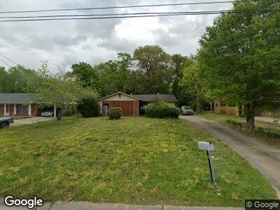
1026 Ashland Ave Columbus, GA 31907
Estimated Value: $118,000 - $145,000
3
Beds
3
Baths
1,323
Sq Ft
$100/Sq Ft
Est. Value
About This Home
This home is located at 1026 Ashland Ave, Columbus, GA 31907 and is currently estimated at $132,689, approximately $100 per square foot. 1026 Ashland Ave is a home located in Muscogee County with nearby schools including Lonnie Jackson Academy, Rothschild Leadership Academy, and Carver High School.
Ownership History
Date
Name
Owned For
Owner Type
Purchase Details
Closed on
Feb 20, 2015
Sold by
Abelard Manfred A
Bought by
Smith Laqiota S
Current Estimated Value
Home Financials for this Owner
Home Financials are based on the most recent Mortgage that was taken out on this home.
Original Mortgage
$67,750
Interest Rate
4.37%
Mortgage Type
FHA
Purchase Details
Closed on
Feb 2, 2012
Sold by
Sec Of Veterans Affa
Bought by
Abelard Angela L
Home Financials for this Owner
Home Financials are based on the most recent Mortgage that was taken out on this home.
Original Mortgage
$47,500
Interest Rate
3.92%
Mortgage Type
VA
Purchase Details
Closed on
May 3, 2011
Sold by
Phh Mtg Corp
Bought by
Sec Of Veterans Affairs
Create a Home Valuation Report for This Property
The Home Valuation Report is an in-depth analysis detailing your home's value as well as a comparison with similar homes in the area
Home Values in the Area
Average Home Value in this Area
Purchase History
| Date | Buyer | Sale Price | Title Company |
|---|---|---|---|
| Smith Laqiota S | $69,000 | -- | |
| Abelard Angela L | -- | -- | |
| Sec Of Veterans Affairs | $66,098 | -- | |
| Phh Mtg Corp | $66,098 | -- |
Source: Public Records
Mortgage History
| Date | Status | Borrower | Loan Amount |
|---|---|---|---|
| Open | Smith Laquita S | $67,434 | |
| Closed | Smith Laqiota S | $67,750 | |
| Previous Owner | Abelard Angela L | $47,500 |
Source: Public Records
Tax History Compared to Growth
Tax History
| Year | Tax Paid | Tax Assessment Tax Assessment Total Assessment is a certain percentage of the fair market value that is determined by local assessors to be the total taxable value of land and additions on the property. | Land | Improvement |
|---|---|---|---|---|
| 2024 | $548 | $42,968 | $7,232 | $35,736 |
| 2023 | $23 | $42,968 | $7,232 | $35,736 |
| 2022 | $571 | $26,716 | $7,232 | $19,484 |
| 2021 | $564 | $24,612 | $7,232 | $17,380 |
| 2020 | $564 | $24,612 | $7,232 | $17,380 |
| 2019 | $568 | $24,612 | $7,232 | $17,380 |
| 2018 | $568 | $24,612 | $7,232 | $17,380 |
| 2017 | $571 | $24,612 | $7,232 | $17,380 |
| 2016 | $575 | $27,200 | $5,250 | $21,950 |
| 2015 | $826 | $20,000 | $5,250 | $14,750 |
| 2014 | $827 | $20,000 | $5,250 | $14,750 |
| 2013 | -- | $32,159 | $5,250 | $26,909 |
Source: Public Records
Map
Nearby Homes
- 4029 Kenesaw Ct
- 4327 Kenesaw Dr
- 926 Rosewood Dr
- 1110 Woodburn Dr
- 914 Reynolds Rd
- 809 Dogwood Dr
- 1043 Quincy Dr
- 1361 Kevin Ct
- 4017 Merrywood Dr
- 815 Englewood Dr
- 754 Wright Dr
- 1405 Hunt Ave
- 636 Dogwood Dr
- 4459 Bermuda St
- 4812 Floyd Ct
- 4483 Oriole St
- 00 Floyd Ct
- 4 Clausen Dr
- 1310 Woodgren Ct
- 4935 Buena Vista Rd
- 1026 Ashland Ave
- 1018 Ashland Ave
- 1032 Ashland Ave
- 1012 Ashland Ave
- 1038 Ashland Ave
- 1033 Woodburn Dr
- 1027 Woodburn Dr
- 1043 Woodburn Dr
- 1021 Woodburn Dr
- 1029 Ashland Ave
- 1023 Ashland Ave
- 1006 Ashland Ave
- 1044 Ashland Ave
- 1035 Ashland Ave
- 1017 Ashland Ave
- 1049 Woodburn Dr
- 1015 Woodburn Dr Unit 9
- 1015 Woodburn Dr
- 1009 Ashland Ave
- 1002 Ashland Ave