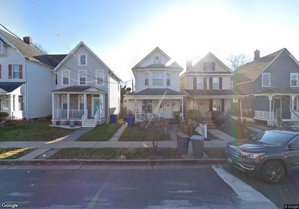
1026 Bangs Ave Asbury Park, NJ 07712
Estimated Value: $382,076 - $516,000
3
Beds
1
Bath
1,108
Sq Ft
$403/Sq Ft
Est. Value
About This Home
This home is located at 1026 Bangs Ave, Asbury Park, NJ 07712 and is currently estimated at $446,769, approximately $403 per square foot. 1026 Bangs Ave is a home located in Monmouth County with nearby schools including Asbury Park High School, Hope Academy Charter School, and Our Lady of Mount Carmel School.
Ownership History
Date
Name
Owned For
Owner Type
Purchase Details
Closed on
Apr 19, 2006
Sold by
Nsd Properties Llc
Bought by
Sander David
Current Estimated Value
Home Financials for this Owner
Home Financials are based on the most recent Mortgage that was taken out on this home.
Original Mortgage
$159,920
Outstanding Balance
$97,156
Interest Rate
7.37%
Mortgage Type
Adjustable Rate Mortgage/ARM
Estimated Equity
$349,613
Purchase Details
Closed on
Jun 3, 2004
Sold by
Baldwin Mamie
Bought by
Debellis Kerry
Home Financials for this Owner
Home Financials are based on the most recent Mortgage that was taken out on this home.
Original Mortgage
$130,450
Interest Rate
5.99%
Create a Home Valuation Report for This Property
The Home Valuation Report is an in-depth analysis detailing your home's value as well as a comparison with similar homes in the area
Home Values in the Area
Average Home Value in this Area
Purchase History
| Date | Buyer | Sale Price | Title Company |
|---|---|---|---|
| Sander David | $199,900 | -- | |
| Nsd Properties Llc | -- | -- | |
| Debellis Kerry | $144,971 | -- |
Source: Public Records
Mortgage History
| Date | Status | Borrower | Loan Amount |
|---|---|---|---|
| Open | Nsd Properties Llc | $159,920 | |
| Closed | Nsd Properties Llc | $159,920 | |
| Previous Owner | Debellis Kerry | $130,450 |
Source: Public Records
Tax History Compared to Growth
Tax History
| Year | Tax Paid | Tax Assessment Tax Assessment Total Assessment is a certain percentage of the fair market value that is determined by local assessors to be the total taxable value of land and additions on the property. | Land | Improvement |
|---|---|---|---|---|
| 2025 | $5,115 | $357,100 | $183,800 | $173,300 |
| 2024 | $4,681 | $323,300 | $146,400 | $176,900 |
| 2023 | $4,681 | $302,800 | $118,900 | $183,900 |
| 2022 | $3,820 | $266,200 | $99,100 | $167,100 |
| 2021 | $3,820 | $241,800 | $90,000 | $151,800 |
| 2020 | $3,478 | $220,800 | $85,200 | $135,600 |
| 2019 | $3,156 | $191,300 | $81,100 | $110,200 |
| 2018 | $2,901 | $162,800 | $73,800 | $89,000 |
| 2017 | $2,631 | $126,500 | $57,600 | $68,900 |
| 2016 | $2,706 | $126,200 | $53,600 | $72,600 |
| 2015 | $2,728 | $123,200 | $52,500 | $70,700 |
| 2014 | $2,663 | $122,900 | $62,500 | $60,400 |
Source: Public Records
Map
Nearby Homes
- 1407 Mattison Ave
- 1015 Mattison Ave
- 1001 Bangs Ave
- 916 Monroe Ave
- 603 Langford St
- 603 Comstock St
- 1111 Sewall Ave
- 1102 1/2 Asbury Ave
- 514 Prospect Ave
- 1123 Sewall Ave
- 1235 Washington Ave
- 614 Pine St
- 644 Church St
- 532 Prospect Ave
- 1255 Washington Ave
- 606 Asbury Ave
- 128 Dewitt Ave
- 126 Dewitt Ave
- 218 3rd Ave Unit 204
- 1405 Mattison Ave
- 1024 Bangs Ave
- 1028 Bangs Ave
- 1030 Bangs Ave
- 1022 Bangs Ave
- 1032 Bangs Ave Unit 1034
- 1027 Mattison Ave
- 1029 Mattison Ave
- 1029 Mattison Ave Unit 3
- 1018 Bangs Ave
- 1038 Bangs Ave
- 1033 Mattison Ave
- 1012 Bangs Ave
- 1042 Bangs Ave
- 1027 Bangs Ave
- 1031 Bangs Ave
- 1023 Bangs Ave
- 1015 Mattison Ave Unit A
- 1015 Mattison Ave Unit B
- 1035 Bangs Ave
- 1035 Mattison Ave