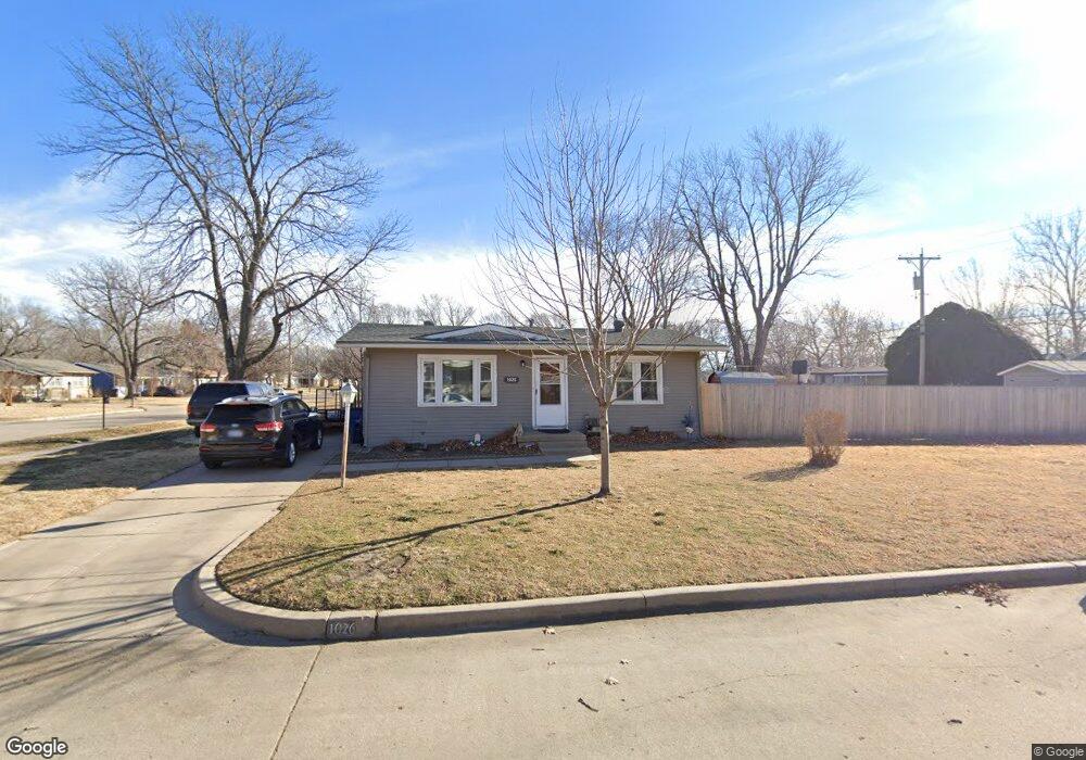
1026 N Nevada St Wichita, KS 67212
Orchard Park NeighborhoodEstimated Value: $142,053 - $160,000
2
Beds
1
Bath
816
Sq Ft
$185/Sq Ft
Est. Value
About This Home
This home is located at 1026 N Nevada St, Wichita, KS 67212 and is currently estimated at $151,027, approximately $185 per square foot. 1026 N Nevada St is a home located in Sedgwick County with nearby schools including Black Traditional Magnet Elementary School, Hadley Middle School, and Pleasant Valley Middle School.
Ownership History
Date
Name
Owned For
Owner Type
Purchase Details
Closed on
Mar 21, 2008
Sold by
Camp Michael D and Camp Paula R
Bought by
Hirsch Matthew
Current Estimated Value
Home Financials for this Owner
Home Financials are based on the most recent Mortgage that was taken out on this home.
Original Mortgage
$63,011
Outstanding Balance
$39,213
Interest Rate
5.72%
Mortgage Type
FHA
Estimated Equity
$111,814
Create a Home Valuation Report for This Property
The Home Valuation Report is an in-depth analysis detailing your home's value as well as a comparison with similar homes in the area
Home Values in the Area
Average Home Value in this Area
Purchase History
| Date | Buyer | Sale Price | Title Company |
|---|---|---|---|
| Hirsch Matthew | -- | Continental Title Company |
Source: Public Records
Mortgage History
| Date | Status | Borrower | Loan Amount |
|---|---|---|---|
| Open | Hirsch Matthew | $63,011 |
Source: Public Records
Tax History Compared to Growth
Tax History
| Year | Tax Paid | Tax Assessment Tax Assessment Total Assessment is a certain percentage of the fair market value that is determined by local assessors to be the total taxable value of land and additions on the property. | Land | Improvement |
|---|---|---|---|---|
| 2025 | $1,135 | $12,524 | $4,071 | $8,453 |
| 2023 | $1,135 | $10,558 | $2,381 | $8,177 |
| 2022 | $1,132 | $10,558 | $2,243 | $8,315 |
| 2021 | $1,087 | $9,684 | $2,243 | $7,441 |
| 2020 | $1,037 | $9,224 | $2,243 | $6,981 |
| 2019 | $979 | $8,706 | $2,243 | $6,463 |
| 2018 | $932 | $8,292 | $2,024 | $6,268 |
| 2017 | $932 | $0 | $0 | $0 |
| 2016 | $893 | $0 | $0 | $0 |
| 2015 | $914 | $0 | $0 | $0 |
| 2014 | $896 | $0 | $0 | $0 |
Source: Public Records
Map
Nearby Homes
- 115 N Colorado St
- 4314 W Del Sienno St
- 936 N Young St
- 805 N Colorado St
- 832 N Young St
- 757 N Dougherty Ave
- 1415 N West Lynn Ave
- 4702 W Murdock St
- 750 N Bebe St
- 1023 N Gow St
- 768 N Kessler St
- 729 N Bebe St
- 5315 W Robinson St
- 3601 W Central Ave
- 555 N Florence St
- 3503 W Central Ave
- 520 N Tracy St
- 812 N Mount Carmel Ave
- 1728 N Colorado St
- 1006 N Custer Ave
- 4215 W 10th St N
- 1025 N Nevada St
- 4209 W 10th St N
- 1102 N Nevada St
- 4220 W 10th St N
- 1020 N Nevada St
- 4214 W Edminster St
- 1103 N Nevada St
- 4214 W 10th St N
- 4203 W 10th St N
- 4309 W 10th St N
- 4208 W Edminster St
- 4308 W 10th St N
- 4208 W 10th St N
- 4310 W Edminster St
- 4315 W 10th St N
- 4119 W 10th St N
- 4202 W 10th St N
- 4314 W 10th St N
- 4221 W Memory Ln