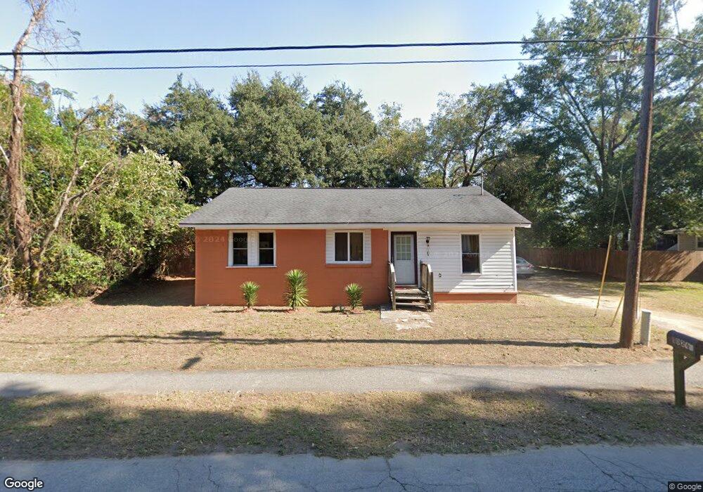
1026 Seaside Ln Unit B Charleston, SC 29412
James Island NeighborhoodEstimated Value: $232,000 - $515,000
3
Beds
1
Bath
988
Sq Ft
$400/Sq Ft
Est. Value
About This Home
This home is located at 1026 Seaside Ln Unit B, Charleston, SC 29412 and is currently estimated at $395,473, approximately $400 per square foot. 1026 Seaside Ln Unit B is a home located in Charleston County with nearby schools including Stiles Point Elementary School, Camp Road Middle, and James Island Charter High School.
Ownership History
Date
Name
Owned For
Owner Type
Purchase Details
Closed on
Sep 13, 2016
Sold by
White Felicia
Bought by
White Lorenzo M
Current Estimated Value
Purchase Details
Closed on
Dec 13, 2012
Sold by
Mcdaniel Willie
Bought by
Mcdaniel Gloria
Purchase Details
Closed on
Sep 17, 2007
Sold by
The Bank Of New York Trust Co Na
Bought by
Mcdaniel Willie
Purchase Details
Closed on
May 21, 2007
Sold by
Smith Samuel A and Smith Paulette E
Bought by
The Bank Of New York Trust Co Na and Jp Morgan Chase Bank Na
Purchase Details
Closed on
Apr 27, 2005
Sold by
Smith Samuel A
Bought by
Smith Samuel
Purchase Details
Closed on
Jun 2, 2004
Sold by
Smith Samuel A
Bought by
Smith Samuel and Smith Samuel John
Purchase Details
Closed on
Jun 4, 2001
Sold by
Beck W Peter and Smith Samuel
Bought by
Smith Samuel and Smith John
Create a Home Valuation Report for This Property
The Home Valuation Report is an in-depth analysis detailing your home's value as well as a comparison with similar homes in the area
Home Values in the Area
Average Home Value in this Area
Purchase History
| Date | Buyer | Sale Price | Title Company |
|---|---|---|---|
| White Lorenzo M | -- | -- | |
| Mcdaniel Gloria | -- | -- | |
| Mcdaniel Willie | $52,000 | Attorney | |
| The Bank Of New York Trust Co Na | $143,220 | None Available | |
| Smith Samuel | -- | -- | |
| Smith Samuel | -- | -- | |
| Smith Samuel A | -- | -- | |
| Smith Samuel | -- | -- |
Source: Public Records
Tax History Compared to Growth
Tax History
| Year | Tax Paid | Tax Assessment Tax Assessment Total Assessment is a certain percentage of the fair market value that is determined by local assessors to be the total taxable value of land and additions on the property. | Land | Improvement |
|---|---|---|---|---|
| 2024 | $2,182 | $7,500 | $0 | $0 |
| 2023 | $2,182 | $7,500 | $0 | $0 |
| 2022 | $1,975 | $7,500 | $0 | $0 |
| 2021 | $1,967 | $7,500 | $0 | $0 |
| 2020 | $1,927 | $7,500 | $0 | $0 |
| 2019 | $2,039 | $7,500 | $0 | $0 |
| 2017 | $1,998 | $7,500 | $0 | $0 |
| 2016 | $521 | $1,570 | $0 | $0 |
| 2015 | $494 | $1,570 | $0 | $0 |
| 2014 | $1,199 | $0 | $0 | $0 |
| 2011 | -- | $0 | $0 | $0 |
Source: Public Records
Map
Nearby Homes
- 1032 Greenhill Rd Unit A
- 1024 Greenhill Rd
- 1102 Williams Rd
- 1120 Seaside Ln
- 954 Harbortowne Rd
- 1076 Williams Rd
- 1149 Quail Dr
- 1129 Quail Dr
- 1098 Blue Marlin Dr
- 965 Mooring Dr
- 1137 Oceanview Rd
- 800 Heyward Cove Place
- 1192 Julian Clark Rd Unit C11
- 804 Porcari St
- 816 Porcari St
- 932 Portabella Ln
- 1075 Wayfarer Ln
- 1174 Fort Johnson Rd
- 939 Mikell Dr
- 1427 Rivers Cotton Rd
- 1026 Seaside Ln
- 1026 Seaside Ln
- 1034 Seaside Ln
- 1036 Seaside Ln
- 1040 Seaside Ln
- 1037 Seaside Ln
- 1018 Seaside Ln
- 1044 Seaside Ln
- 1045 Seaside Ln Unit A
- 1045 Seaside Ln Unit A & B
- 1045 Seaside Ln Unit B
- 1051 Seaside Ln
- 1050 Seaside Ln
- 1048 Greenhill Rd
- 1042 Greenhill Rd
- 1047 Seaside Ln
- 1053 Seaside Ln
- 1009 Seaside Ln
- 0 Greenhill Rd