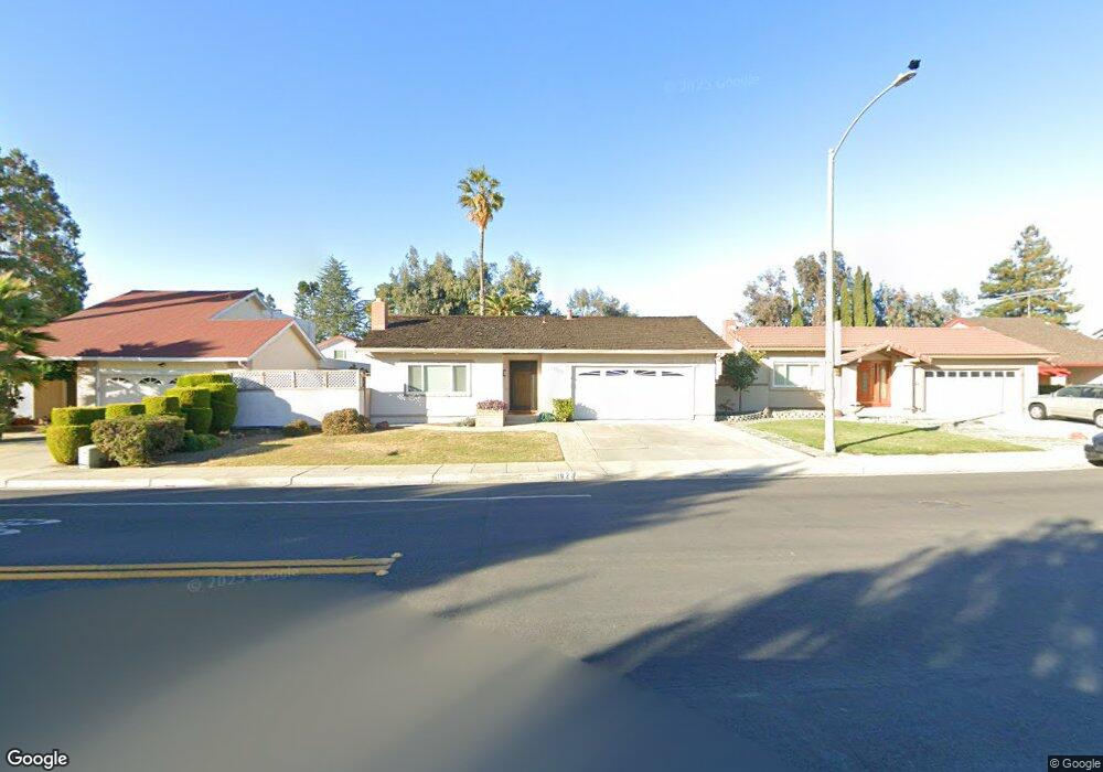
1027 Bryant Way Sunnyvale, CA 94087
Birdland Neighbors NeighborhoodEstimated Value: $2,355,483 - $2,643,000
3
Beds
2
Baths
1,521
Sq Ft
$1,652/Sq Ft
Est. Value
About This Home
This home is located at 1027 Bryant Way, Sunnyvale, CA 94087 and is currently estimated at $2,512,121, approximately $1,651 per square foot. 1027 Bryant Way is a home located in Santa Clara County with nearby schools including Laurelwood Elementary School, Marian A. Peterson Middle School, and Adrian Wilcox High School.
Ownership History
Date
Name
Owned For
Owner Type
Purchase Details
Closed on
Dec 17, 2018
Sold by
Nakashima Terry Satoshi
Bought by
Nakashima Terry S and The Terry And Suzanne Nakashim
Current Estimated Value
Purchase Details
Closed on
Mar 25, 2005
Sold by
Ohara Harry S and Ohara Jeanne M
Bought by
Ohara Harry S and Ohara Jeanne M
Create a Home Valuation Report for This Property
The Home Valuation Report is an in-depth analysis detailing your home's value as well as a comparison with similar homes in the area
Home Values in the Area
Average Home Value in this Area
Purchase History
| Date | Buyer | Sale Price | Title Company |
|---|---|---|---|
| Nakashima Terry S | -- | None Available | |
| Ohara Harry S | -- | -- | |
| Ohara Harry S | -- | -- |
Source: Public Records
Tax History Compared to Growth
Tax History
| Year | Tax Paid | Tax Assessment Tax Assessment Total Assessment is a certain percentage of the fair market value that is determined by local assessors to be the total taxable value of land and additions on the property. | Land | Improvement |
|---|---|---|---|---|
| 2025 | $4,960 | $425,582 | $146,410 | $279,172 |
| 2024 | $4,960 | $417,239 | $143,540 | $273,699 |
| 2023 | $4,909 | $409,059 | $140,726 | $268,333 |
| 2022 | $4,830 | $401,039 | $137,967 | $263,072 |
| 2021 | $4,810 | $393,176 | $135,262 | $257,914 |
| 2020 | $4,722 | $389,146 | $133,876 | $255,270 |
| 2019 | $4,717 | $381,516 | $131,251 | $250,265 |
| 2018 | $4,417 | $374,036 | $128,678 | $245,358 |
| 2017 | $4,391 | $366,703 | $126,155 | $240,548 |
| 2016 | $4,335 | $359,514 | $123,682 | $235,832 |
| 2015 | $4,318 | $354,115 | $121,825 | $232,290 |
| 2014 | $4,116 | $347,179 | $119,439 | $227,740 |
Source: Public Records
Map
Nearby Homes
- 1007 Bryant Way Unit B
- 1201 Sycamore Terrace Unit 148
- 1760 Halford Ave Unit 167
- 1014 Teal Dr
- 929 E El Camino Real Unit 320E
- 1472 Hampton Dr
- 3725 Terstena Place Unit 140
- 3715 Terstena Place Unit 202
- 3705 Terstena Place Unit 201
- 1550 Meadowlark Ln
- 836 Mist Flower Terrace Unit 2
- 1496 Mcpherson St
- 3510 Cabrillo Ave
- 861 Flin Way
- 1626 S Wolfe Rd
- 932 Leighton Way
- 1661 Nobili Ave
- 1155 London Ave
- 826 Flin Way
- 863 Laburnum Dr
- 1031 Bryant Way
- 1023 Bryant Way
- 1340 Henderson Ave
- 1035 Bryant Way
- 1342 Sage Hen Way
- 1039 Bryant Way
- 1348 Sage Hen Way
- 1335 Spoonbill Way
- 1043 Bryant Way
- 1339 Henderson Ave Unit E
- 1339 Henderson Ave Unit D
- 1339 Henderson Ave Unit C
- 1339 Henderson Ave Unit B
- 1339 Henderson Ave Unit A
- 1341 Spoonbill Way
- 1354 Sage Hen Way
- 1047 Bryant Way
- 1347 Spoonbill Way
- 1007 Bryant Way Unit K
- 1007 Bryant Way Unit E