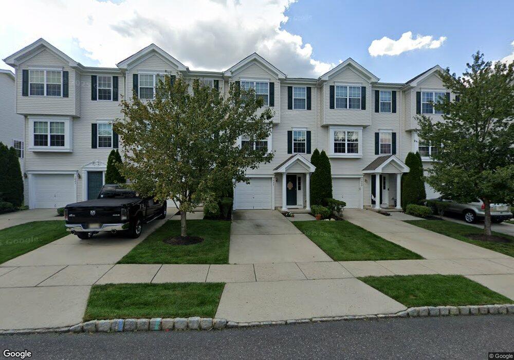
1027 Moore Rd Thorofare, NJ 08086
Estimated Value: $308,071 - $357,000
Studio
--
Bath
1,962
Sq Ft
$172/Sq Ft
Est. Value
About This Home
This home is located at 1027 Moore Rd, Thorofare, NJ 08086 and is currently estimated at $337,018, approximately $171 per square foot. 1027 Moore Rd is a home located in Gloucester County with nearby schools including Green-Fields Elementary School, Oakview Elementary School, and Red Bank Elementary School.
Ownership History
Date
Name
Owned For
Owner Type
Purchase Details
Closed on
Apr 10, 2019
Sold by
Poreddy Ramsubash and Commonwealth Land Title Insura
Bought by
17 Chatham Rd Llc
Current Estimated Value
Purchase Details
Closed on
Dec 10, 2007
Sold by
Castle Cardiff Enterprises Llc
Bought by
Poreddy Ramsubash
Purchase Details
Closed on
Mar 2, 2007
Sold by
Poreddy Ramsubash
Bought by
Castle Cardiff Enterprises Llc
Purchase Details
Closed on
Mar 28, 2006
Sold by
Inc-Nj D R Horton
Bought by
Ramsubash Poreddy
Home Financials for this Owner
Home Financials are based on the most recent Mortgage that was taken out on this home.
Original Mortgage
$182,315
Interest Rate
6.26%
Mortgage Type
Purchase Money Mortgage
Create a Home Valuation Report for This Property
The Home Valuation Report is an in-depth analysis detailing your home's value as well as a comparison with similar homes in the area
Home Values in the Area
Average Home Value in this Area
Purchase History
| Date | Buyer | Sale Price | Title Company |
|---|---|---|---|
| 17 Chatham Rd Llc | $149,000 | None Available | |
| Poreddy Ramsubash | -- | None Available | |
| Castle Cardiff Enterprises Llc | -- | -- | |
| Ramsubash Poreddy | $191,910 | -- |
Source: Public Records
Mortgage History
| Date | Status | Borrower | Loan Amount |
|---|---|---|---|
| Previous Owner | Ramsubash Poreddy | $182,315 |
Source: Public Records
Tax History
| Year | Tax Paid | Tax Assessment Tax Assessment Total Assessment is a certain percentage of the fair market value that is determined by local assessors to be the total taxable value of land and additions on the property. | Land | Improvement |
|---|---|---|---|---|
| 2025 | $6,341 | $181,600 | $40,000 | $141,600 |
| 2024 | $6,260 | $181,600 | $40,000 | $141,600 |
Source: Public Records
Map
Nearby Homes
- 1007 Moore Rd
- 1080 Buckingham Dr
- 115 Lionheart Ln
- 62 Highbridge Ln
- 125 Lionheart Ln Unit C125
- 16 Maplewood Ct
- 59 Willowwood Ct
- 87 Woodway Dr Unit 87
- 9 Harvest Dr Unit 9
- 1218 Royal Ln
- 1102 Barnesdale Rd
- 296 Ogden Station Rd
- 109 River Road Dr
- 28 Ash Ave
- 2 Beech Place
- 751 Garrison Ct
- 6 Cypress Cir
- 0 Greenwood & Shivers Ave
- 827 Saint Regis Ct
- 445 Durham Ct Unit 445
- 1020 Moore Rd
- 1023 Moore Rd
- 1024 Moore Rd
- 1016 Moore Rd
- 1014 Moore Rd
- 1019 Moore Rd Unit 10
- 1012 Moore Rd Unit 6
- 1026 Moore Rd
- 1028 Moore Rd
- 1010 Moore Rd Unit 5
- 1022 Moore Rd
- 1008 Moore Rd
- 1030 Moore Rd
- 1032 Moore Rd
- 1018 Moore Rd Unit 9
- 1021 Moore Rd
- 1017 Moore Rd
- 1025 Moore Rd
- 1006 Moore Rd
- 1013 Moore Rd
Your Personal Tour Guide
Ask me questions while you tour the home.