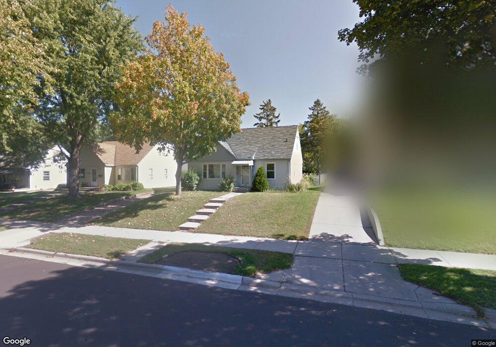
1028 1028 Sperl St West St. Paul, MN 55118
Estimated Value: $312,203 - $342,000
3
Beds
1
Bath
1,072
Sq Ft
$305/Sq Ft
Est. Value
About This Home
This home is located at 1028 1028 Sperl St, West St. Paul, MN 55118 and is currently estimated at $326,551, approximately $304 per square foot. 1028 1028 Sperl St is a home located in Dakota County with nearby schools including Moreland Arts & Health Sciences Magnet School, Heritage E-STEM Magnet School, and Two Rivers High School.
Ownership History
Date
Name
Owned For
Owner Type
Purchase Details
Closed on
Jun 15, 2023
Sold by
Martinusen Janet and Martinusen Jack
Bought by
Howe Casey and Howe Jerri
Current Estimated Value
Home Financials for this Owner
Home Financials are based on the most recent Mortgage that was taken out on this home.
Original Mortgage
$328,932
Outstanding Balance
$320,136
Interest Rate
6.39%
Mortgage Type
New Conventional
Estimated Equity
$6,415
Purchase Details
Closed on
Jul 8, 2016
Sold by
Wick Adam and Wick Shalane
Bought by
Fihn Jason and Wallin Anthony
Home Financials for this Owner
Home Financials are based on the most recent Mortgage that was taken out on this home.
Original Mortgage
$191,468
Interest Rate
3.48%
Mortgage Type
FHA
Purchase Details
Closed on
Oct 29, 1998
Sold by
Decuffa Gerardo Anthony and Decuffa Mary Ellen
Bought by
Vondrasek David M
Create a Home Valuation Report for This Property
The Home Valuation Report is an in-depth analysis detailing your home's value as well as a comparison with similar homes in the area
Home Values in the Area
Average Home Value in this Area
Purchase History
| Date | Buyer | Sale Price | Title Company |
|---|---|---|---|
| Howe Casey | $341,500 | -- | |
| Fihn Jason | $195,000 | Home Title Inc | |
| Vondrasek David M | $105,000 | -- |
Source: Public Records
Mortgage History
| Date | Status | Borrower | Loan Amount |
|---|---|---|---|
| Open | Howe Casey | $328,932 | |
| Previous Owner | Fihn Jason | $191,468 |
Source: Public Records
Tax History Compared to Growth
Tax History
| Year | Tax Paid | Tax Assessment Tax Assessment Total Assessment is a certain percentage of the fair market value that is determined by local assessors to be the total taxable value of land and additions on the property. | Land | Improvement |
|---|---|---|---|---|
| 2024 | $3,474 | $277,700 | $67,800 | $209,900 |
| 2023 | $3,474 | $280,300 | $71,100 | $209,200 |
| 2022 | $2,896 | $271,200 | $70,900 | $200,300 |
| 2021 | $2,690 | $233,900 | $61,600 | $172,300 |
| 2020 | $2,578 | $217,900 | $58,700 | $159,200 |
| 2019 | $2,388 | $204,600 | $55,900 | $148,700 |
| 2018 | $2,172 | $183,800 | $52,300 | $131,500 |
| 2017 | $1,928 | $175,900 | $49,800 | $126,100 |
| 2016 | $1,917 | $153,900 | $45,300 | $108,600 |
| 2015 | $1,745 | $129,748 | $37,603 | $92,145 |
| 2014 | -- | $113,943 | $33,846 | $80,097 |
| 2013 | -- | $108,711 | $30,852 | $77,859 |
Source: Public Records
Map
Nearby Homes
- 254 Arion St E
- 273 Butler Ave E
- 235 Mainzer St
- 297 Hurley St E
- 1107 Oakdale Ave
- 1616 Stickney Ave
- 1560 Stickney Ave
- 377 Winona St E
- 1425 Evans Ave
- 1421 Evans Ave
- 180 Wyoming St E
- 203 Moreland Ave E
- 369 Belvidere St E Unit 369B
- 1436 Stickney Ave
- 751 Woodbury St
- 492 Curtice St E
- 1251 Macarthur Ave
- 255 Curtice St E
- 230 Stanley Ave
- 344 Page St E