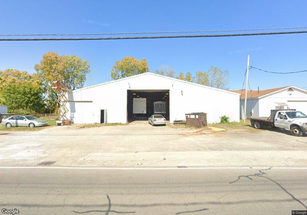
1028 W Center St Marion, OH 43302
Estimated Value: $123,024
--
Bed
--
Bath
8,000
Sq Ft
$15/Sq Ft
Est. Value
About This Home
This home is located at 1028 W Center St, Marion, OH 43302 and is currently estimated at $123,024, approximately $15 per square foot. 1028 W Center St is a home located in Marion County with nearby schools including James A. Garfield Elementary School, Ulysses S. Grant Middle School, and Harding High School.
Ownership History
Date
Name
Owned For
Owner Type
Purchase Details
Closed on
Oct 18, 2023
Sold by
Marke Lyon Commercial Property Llc
Bought by
Turner Lonnie
Current Estimated Value
Purchase Details
Closed on
Dec 11, 2018
Sold by
1028 W Center Street Llc
Bought by
Marke Lyon Commercial Realty Llc
Purchase Details
Closed on
Jun 1, 2016
Sold by
Lyon Marke A and Lyon Denise M
Bought by
1028 W Ceter Street Llc
Home Financials for this Owner
Home Financials are based on the most recent Mortgage that was taken out on this home.
Original Mortgage
$75,000
Interest Rate
3.45%
Mortgage Type
Purchase Money Mortgage
Purchase Details
Closed on
Sep 1, 2009
Sold by
Goss James H and Goss Marion Y
Bought by
Lyon Marke A and Lyon Denise M
Purchase Details
Closed on
Oct 15, 1996
Bought by
Lyon Marke A and Surv Denise M
Create a Home Valuation Report for This Property
The Home Valuation Report is an in-depth analysis detailing your home's value as well as a comparison with similar homes in the area
Home Values in the Area
Average Home Value in this Area
Purchase History
| Date | Buyer | Sale Price | Title Company |
|---|---|---|---|
| Turner Lonnie | $110,000 | None Listed On Document | |
| Turner Lonnie | $110,000 | None Listed On Document | |
| Marke Lyon Commercial Realty Llc | $62,500 | None Available | |
| 1028 W Ceter Street Llc | $75,000 | Pm Title | |
| Lyon Marke A | $75,000 | None Available | |
| Lyon Marke A | $48,000 | -- |
Source: Public Records
Mortgage History
| Date | Status | Borrower | Loan Amount |
|---|---|---|---|
| Previous Owner | 1028 W Ceter Street Llc | $75,000 |
Source: Public Records
Tax History Compared to Growth
Tax History
| Year | Tax Paid | Tax Assessment Tax Assessment Total Assessment is a certain percentage of the fair market value that is determined by local assessors to be the total taxable value of land and additions on the property. | Land | Improvement |
|---|---|---|---|---|
| 2024 | $1,015 | $21,270 | $9,170 | $12,100 |
| 2023 | $1,015 | $21,270 | $9,170 | $12,100 |
| 2022 | $933 | $21,270 | $9,170 | $12,100 |
| 2021 | $1,475 | $21,270 | $9,170 | $12,100 |
| 2020 | $1,027 | $21,270 | $9,170 | $12,100 |
| 2019 | $1,023 | $21,270 | $9,170 | $12,100 |
| 2018 | $1,293 | $27,450 | $8,750 | $18,700 |
| 2017 | $1,299 | $27,450 | $8,750 | $18,700 |
| 2016 | $1,473 | $31,020 | $8,750 | $22,270 |
| 2015 | $1,489 | $31,020 | $8,750 | $22,270 |
| 2014 | $1,488 | $31,020 | $8,750 | $22,270 |
| 2012 | $1,395 | $28,690 | $3,170 | $25,520 |
Source: Public Records
Map
Nearby Homes
- 355 Lee St
- 383 Brentwood Dr
- 213 Sharp St
- 407 Latourette St
- 472 Clinton St
- 678 Marshall St
- 434 Scranton Ave
- 403 Uncapher Ave
- 523 Thompson St
- 690 Meadow St
- 531 Toledo Ave
- 473 Avondale Ave
- 520 Toledo Ave
- 468 Avondale Ave
- 512 Henry St
- 641 Blake Ave
- 625 Rochelle Dr
- 579 Henry St
- 178 Leader St
- 950 Oak Grove Ave
- 1034 W Center St
- 1040 W Center St
- 1052 W Center St
- 994 W Center St
- 1054 W Center St
- 1055 W Center St
- 1065 W Center St
- 1083 W Center St
- 1088 W Center St
- 128 Plymouth St
- 134 Plymouth St
- 1098 W Center St
- 148 Plymouth St
- 143 Glad St
- 977 Curve St
- 1108 W Center St
- 152 Plymouth St
- 151 Glad St
- 157 Glad St
- 168 Nye St