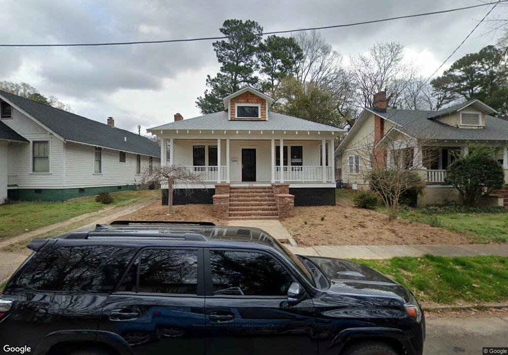
1028 W South St Raleigh, NC 27603
Boylan Heights NeighborhoodEstimated Value: $624,000 - $756,000
3
Beds
1
Bath
1,195
Sq Ft
$592/Sq Ft
Est. Value
About This Home
This home is located at 1028 W South St, Raleigh, NC 27603 and is currently estimated at $707,799, approximately $592 per square foot. 1028 W South St is a home located in Wake County with nearby schools including Wiley Elementary, Oberlin Middle School, and Broughton Magnet High School.
Ownership History
Date
Name
Owned For
Owner Type
Purchase Details
Closed on
Jan 21, 2021
Sold by
Burton Linda J and Burton Ray T
Bought by
Davis Bryan S and Todd Melissa J
Current Estimated Value
Home Financials for this Owner
Home Financials are based on the most recent Mortgage that was taken out on this home.
Original Mortgage
$514,140
Interest Rate
2.7%
Mortgage Type
Construction
Purchase Details
Closed on
Jan 1, 1979
Bought by
Brannan Larue
Create a Home Valuation Report for This Property
The Home Valuation Report is an in-depth analysis detailing your home's value as well as a comparison with similar homes in the area
Home Values in the Area
Average Home Value in this Area
Purchase History
| Date | Buyer | Sale Price | Title Company |
|---|---|---|---|
| Davis Bryan S | $337,500 | Investors Title | |
| Brannan Larue | $23,000 | -- |
Source: Public Records
Mortgage History
| Date | Status | Borrower | Loan Amount |
|---|---|---|---|
| Previous Owner | Davis Bryan S | $514,140 |
Source: Public Records
Tax History Compared to Growth
Tax History
| Year | Tax Paid | Tax Assessment Tax Assessment Total Assessment is a certain percentage of the fair market value that is determined by local assessors to be the total taxable value of land and additions on the property. | Land | Improvement |
|---|---|---|---|---|
| 2025 | $6,349 | $725,675 | $460,000 | $265,675 |
| 2024 | $6,322 | $725,675 | $460,000 | $265,675 |
| 2023 | $5,277 | $482,310 | $300,000 | $182,310 |
| 2022 | $4,514 | $482,310 | $300,000 | $182,310 |
| 2021 | $3,432 | $350,660 | $300,000 | $50,660 |
| 2020 | $3,370 | $350,660 | $300,000 | $50,660 |
| 2019 | $3,319 | $284,662 | $170,000 | $114,662 |
| 2018 | $0 | $284,662 | $170,000 | $114,662 |
| 2017 | $2,981 | $284,662 | $170,000 | $114,662 |
| 2016 | $2,920 | $284,662 | $170,000 | $114,662 |
| 2015 | $3,195 | $306,651 | $179,550 | $127,101 |
| 2014 | $3,031 | $306,651 | $179,550 | $127,101 |
Source: Public Records
Map
Nearby Homes
- 504 S Saunders St
- 710 Independence Place Unit 301
- 515 W Lenoir St Unit 102
- 515 W Lenoir St Unit 101
- 333 Black Caviar Way
- 523 S West St Unit 404
- 523 S West St Unit 402
- 1317 Curfman St
- 217 W Martin St Unit C2-5
- 217 W Martin St Unit A1-2
- 217 W Martin St Unit B4-8
- 217 W Martin St Unit C4-14
- 317 W Morgan St Unit 304
- 317 W Morgan St Unit 302
- 224 St Marys St
- 222 Glenwood Ave Unit 313
- 222 Glenwood Ave Unit 304
- 222 Glenwood Ave Unit 703
- 222 Glenwood Ave Unit 413
- 222 Glenwood Ave Unit 709
- 1026 W South St
- 1030 W South St
- 1024 W South St
- 1022 W South St
- 1003 W Cabarrus St
- 1009 W Lenoir St
- 1020 W South St
- 1007 W Lenoir St
- 1033 W South St
- 1004 W Cabarrus St
- 1010 W Cabarrus St
- 1012 W Cabarrus St
- 1031 W South St
- 1029 W South St
- 1014 W Cabarrus St
- 1002 W Cabarrus St
- 1027 W South St
- 1008 W South St
- 1016 W Cabarrus St
- 1025 W South St