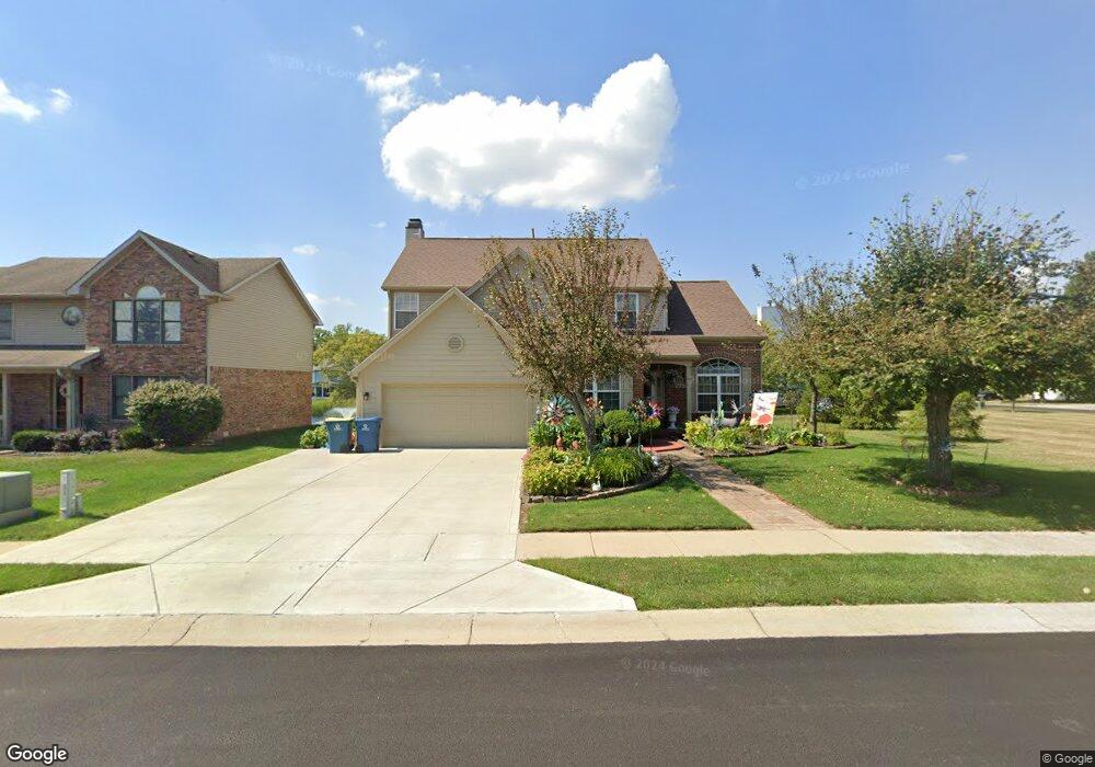
10283 Packard Dr Fishers, IN 46037
Estimated Value: $393,000 - $497,000
4
Beds
3
Baths
3,560
Sq Ft
$122/Sq Ft
Est. Value
About This Home
This home is located at 10283 Packard Dr, Fishers, IN 46037 and is currently estimated at $434,133, approximately $121 per square foot. 10283 Packard Dr is a home located in Hamilton County with nearby schools including Sigourney Elementary School, Lantern Road Elementary School, and Riverside Junior High School.
Ownership History
Date
Name
Owned For
Owner Type
Purchase Details
Closed on
Jun 26, 2009
Sold by
Nunez Greg
Bought by
Bellido Mauricio A and Bellido Elsa
Current Estimated Value
Home Financials for this Owner
Home Financials are based on the most recent Mortgage that was taken out on this home.
Original Mortgage
$215,000
Outstanding Balance
$140,394
Interest Rate
5.32%
Mortgage Type
VA
Estimated Equity
$293,739
Purchase Details
Closed on
Aug 13, 2008
Sold by
Nunez Mireya
Bought by
Nunez Greg
Purchase Details
Closed on
Jul 11, 2003
Sold by
Ocean City Investments Llc
Bought by
Nunez Greg and Nunez Mireya
Home Financials for this Owner
Home Financials are based on the most recent Mortgage that was taken out on this home.
Original Mortgage
$128,000
Interest Rate
5.36%
Mortgage Type
Purchase Money Mortgage
Create a Home Valuation Report for This Property
The Home Valuation Report is an in-depth analysis detailing your home's value as well as a comparison with similar homes in the area
Home Values in the Area
Average Home Value in this Area
Purchase History
| Date | Buyer | Sale Price | Title Company |
|---|---|---|---|
| Bellido Mauricio A | -- | None Available | |
| Nunez Greg | -- | None Available | |
| Nunez Greg | -- | -- |
Source: Public Records
Mortgage History
| Date | Status | Borrower | Loan Amount |
|---|---|---|---|
| Open | Bellido Mauricio A | $215,000 | |
| Previous Owner | Nunez Greg | $128,000 |
Source: Public Records
Tax History Compared to Growth
Tax History
| Year | Tax Paid | Tax Assessment Tax Assessment Total Assessment is a certain percentage of the fair market value that is determined by local assessors to be the total taxable value of land and additions on the property. | Land | Improvement |
|---|---|---|---|---|
| 2024 | $3,806 | $396,200 | $45,800 | $350,400 |
| 2023 | $3,806 | $382,300 | $45,800 | $336,500 |
| 2022 | $3,684 | $340,800 | $45,800 | $295,000 |
| 2021 | $2,863 | $281,300 | $45,800 | $235,500 |
| 2020 | $2,870 | $278,200 | $45,800 | $232,400 |
| 2019 | $2,784 | $271,600 | $42,900 | $228,700 |
| 2018 | $2,701 | $266,000 | $42,900 | $223,100 |
| 2017 | $2,335 | $243,300 | $42,900 | $200,400 |
| 2016 | $2,094 | $227,900 | $42,900 | $185,000 |
| 2014 | $1,795 | $217,400 | $42,900 | $174,500 |
| 2013 | $1,795 | $205,400 | $42,900 | $162,500 |
Source: Public Records
Map
Nearby Homes
- 10334 Hillsborough Dr
- 10515 Collingswood Rd
- 10384 Glenn Abbey Ln
- 10244 Red Tail Dr
- 10272 Whitetail Cir
- 10737 Springston Ct
- 10844 Fairwoods Dr
- 10290 Glenn Abbey Ln
- 10602 Fall Rd
- 10661 Burning Ridge Ln
- 10518 Greenway Dr
- 10026 Parkway Dr
- 9972 Woods Edge Dr
- 9831 Carefree Dr
- 11216 Windermere Blvd
- 10132 Lauren Pass
- 11240 E 106th St
- 10563 Brixton Ln
- 10747 Red Pine Dr
- 10019 Niagara Dr
- 10289 Packard Dr
- 10397 Hillsborough Dr
- 10299 Packard Dr
- 10280 Packard Dr
- 10284 Packard Dr
- 10278 Packard Dr
- 10288 Packard Dr
- 10305 Packard Dr
- 10398 Hillsborough Dr
- 10371 Hillsborough Dr
- 10307 Packard Dr
- 10390 Hillsborough Dr
- 10290 Packard Dr
- 10349 Hillsborough D
- 10405 Packard Dr
- 10345 Hillsborough Dr
- 10349 Hillsborough Dr
- 10345 Hillsborough D
- 10315 Packard Dr
- 10378 Hillsborough Dr