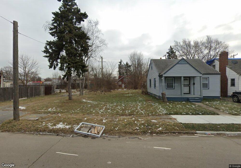
10284 Nottingham Rd Detroit, MI 48224
Outer Drive-Hayes NeighborhoodEstimated Value: $63,000 - $72,000
--
Bed
--
Bath
867
Sq Ft
$78/Sq Ft
Est. Value
About This Home
This home is located at 10284 Nottingham Rd, Detroit, MI 48224 and is currently estimated at $67,500, approximately $77 per square foot. 10284 Nottingham Rd is a home with nearby schools including Wayne Elementary School, Edward 'Duke' Ellington Conservatory of Music and Art, and Charles L. Spain Elementary-Middle School.
Ownership History
Date
Name
Owned For
Owner Type
Purchase Details
Closed on
Oct 30, 2014
Sold by
The City Of Detroit
Bought by
The Detroit Land Bank Authority
Current Estimated Value
Purchase Details
Closed on
Jun 5, 2009
Sold by
Wojtowicz Raymond J
Bought by
Planning & Development Dept City Of Detr
Purchase Details
Closed on
Nov 2, 2005
Sold by
Charter County Of Wayne
Bought by
Shah Mohammed
Purchase Details
Closed on
Sep 9, 2003
Sold by
Davis Janice K
Bought by
Davis Mark K
Create a Home Valuation Report for This Property
The Home Valuation Report is an in-depth analysis detailing your home's value as well as a comparison with similar homes in the area
Home Values in the Area
Average Home Value in this Area
Purchase History
| Date | Buyer | Sale Price | Title Company |
|---|---|---|---|
| The Detroit Land Bank Authority | -- | None Available | |
| Planning & Development Dept City Of Detr | -- | None Available | |
| Shah Mohammed | -- | None Available | |
| Davis Mark K | -- | -- |
Source: Public Records
Tax History Compared to Growth
Tax History
| Year | Tax Paid | Tax Assessment Tax Assessment Total Assessment is a certain percentage of the fair market value that is determined by local assessors to be the total taxable value of land and additions on the property. | Land | Improvement |
|---|---|---|---|---|
| 2025 | -- | $0 | $0 | $0 |
| 2024 | -- | $0 | $0 | $0 |
| 2023 | $0 | $0 | $0 | $0 |
| 2022 | -- | $0 | $0 | $0 |
| 2021 | $0 | $0 | $0 | $0 |
| 2020 | $240 | $0 | $0 | $0 |
| 2019 | $240 | $0 | $0 | $0 |
| 2018 | $0 | $0 | $0 | $0 |
| 2017 | $0 | $0 | $0 | $0 |
| 2016 | $240 | $0 | $0 | $0 |
| 2015 | -- | $0 | $0 | $0 |
| 2013 | -- | $0 | $0 | $0 |
| 2010 | -- | $623 | $623 | $0 |
Source: Public Records
Map
Nearby Homes
- 10172 Somerset Ave
- 10029 Balfour Rd
- 10468 Nottingham Rd
- 10390 Somerset Ave
- 10404 Somerset Ave
- 10508 Nottingham Rd
- 9610 Whittier St
- 10597 Beaconsfield St
- 10345 Greensboro St
- 9801 Kensington Ave
- 10731 Roxbury St
- 10521 Roxbury St
- 9344 Courville St
- 10551 Somerset Ave
- 10713 Beaconsfield St
- 10811 Roxbury St
- 9910 Somerset Ave
- 9510 Whittier St
- 10446 Balfour Rd
- 10415 Roxbury St
- 10278 Nottingham Rd
- 10270 Nottingham Rd
- 10264 Nottingham Rd
- 10258 Nottingham Rd
- 10279 Nottingham Rd
- 10285 Nottingham Rd
- 10271 Nottingham Rd
- 10185 Somerset Ave
- 10177 Somerset Ave
- 10169 Somerset Ave
- 10265 Nottingham Rd
- 10407 Whittier St
- 10250 Nottingham Rd
- 10163 Somerset Ave
- 10259 Nottingham Rd
- 10242 Nottingham Rd
- 10155 Somerset Ave
- 10251 Nottingham Rd
- 10746 Whittier Ave
- 10750 Whittier Ave