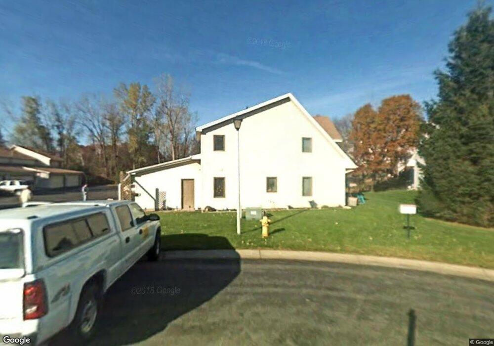
1029 124th Cir NW Coon Rapids, MN 55448
Estimated Value: $218,618 - $256,000
3
Beds
1
Bath
1,326
Sq Ft
$175/Sq Ft
Est. Value
About This Home
This home is located at 1029 124th Cir NW, Coon Rapids, MN 55448 and is currently estimated at $232,155, approximately $175 per square foot. 1029 124th Cir NW is a home located in Anoka County with nearby schools including Sand Creek Elementary School, Northdale Middle School, and Green Valley High School.
Ownership History
Date
Name
Owned For
Owner Type
Purchase Details
Closed on
May 26, 2015
Sold by
Axis Property Llc
Bought by
Yu Yim Wing and Cheung Corbet
Current Estimated Value
Purchase Details
Closed on
Apr 17, 2015
Sold by
U S Bank National Association
Bought by
Axis Property Llc
Purchase Details
Closed on
Feb 7, 2014
Sold by
Greenwaldt Neil P
Bought by
U S Bank National Association
Purchase Details
Closed on
Oct 24, 2003
Sold by
Engstrom Caleb and Engstrom Melissa
Bought by
Strom Justin L and Strom Kanesha L
Purchase Details
Closed on
May 31, 2002
Sold by
Robinson Joshua W and Robinson Kristin
Bought by
Engstrom Caleb and Duggan Melissa
Purchase Details
Closed on
Sep 28, 1996
Sold by
Portfolio Development Inc
Bought by
Bartl Nancy J
Purchase Details
Closed on
Jul 10, 1996
Sold by
Hatley James M and Hatley Crystal K
Bought by
Portfolio Development Inc
Purchase Details
Closed on
Nov 28, 1995
Sold by
Curti Burckhardt
Bought by
Burckhardt Curtis E
Create a Home Valuation Report for This Property
The Home Valuation Report is an in-depth analysis detailing your home's value as well as a comparison with similar homes in the area
Home Values in the Area
Average Home Value in this Area
Purchase History
| Date | Buyer | Sale Price | Title Company |
|---|---|---|---|
| Yu Yim Wing | $85,000 | Bridge Title Llc | |
| Axis Property Llc | $55,000 | Attorney | |
| U S Bank National Association | $69,550 | None Available | |
| Strom Justin L | $152,400 | -- | |
| Engstrom Caleb | $132,000 | -- | |
| Bartl Nancy J | $79,900 | -- | |
| Portfolio Development Inc | -- | -- | |
| Burckhardt Curtis E | $78,000 | -- |
Source: Public Records
Mortgage History
| Date | Status | Borrower | Loan Amount |
|---|---|---|---|
| Closed | Burckhardt Curtis E | -- |
Source: Public Records
Tax History Compared to Growth
Tax History
| Year | Tax Paid | Tax Assessment Tax Assessment Total Assessment is a certain percentage of the fair market value that is determined by local assessors to be the total taxable value of land and additions on the property. | Land | Improvement |
|---|---|---|---|---|
| 2025 | $2,737 | $192,500 | $45,000 | $147,500 |
| 2024 | $2,737 | $185,800 | $45,000 | $140,800 |
| 2023 | $2,679 | $199,000 | $45,000 | $154,000 |
| 2022 | $2,545 | $197,300 | $35,500 | $161,800 |
| 2021 | $2,539 | $161,900 | $43,000 | $118,900 |
| 2020 | $2,452 | $157,300 | $35,000 | $122,300 |
| 2019 | $2,352 | $143,200 | $30,000 | $113,200 |
| 2018 | $2,207 | $130,600 | $0 | $0 |
| 2017 | $2,103 | $114,900 | $0 | $0 |
| 2016 | $2,040 | $97,200 | $0 | $0 |
| 2015 | $1,011 | $97,200 | $14,800 | $82,400 |
| 2014 | -- | $82,300 | $6,700 | $75,600 |
Source: Public Records
Map
Nearby Homes
- 12488 Unity St NW
- 899 123rd Ln NW
- 12357 Magnolia St NW
- 1234 128th Cir NW
- 12463 Drake St NW
- 1450 126th Ln NW
- 11923 Wintergreen St NW
- 1593 126th Ln NW
- 1625 124th Ave NW
- 11852 Yellow Pine St NW
- 12010 Eagle St NW
- 12554 Grouse St NW
- 633 Sand Creek Dr NW
- 1449 119th Ln NW
- 1520 129th Ave NW
- 12365 Jay St NW
- 1727 121st Ln NW
- 12759 Ibis St NW
- 1930 127th Cir NW
- 11640 Larch St NW
- 1031 124th Cir NW
- 1033 124th Cir NW
- 1035 124th Cir NW
- 1023 124th Cir NW
- 1037 124th Cir NW
- 1019 124th Cir NW
- 1030 124th Cir NW
- 1039 124th Cir NW
- 1015 124th Cir NW
- 1032 124th Cir NW
- 1034 124th Cir NW
- 1036 124th Cir NW
- 1017 124th Cir NW
- 1026 124th Cir NW
- 1011 124th Cir NW
- 1038 124th Cir NW
- 1038 124th Cir NW
- 12450 Unity St NW
- 12450 12450 Unity-Street-nw
- 12450 12450 Unity St NW