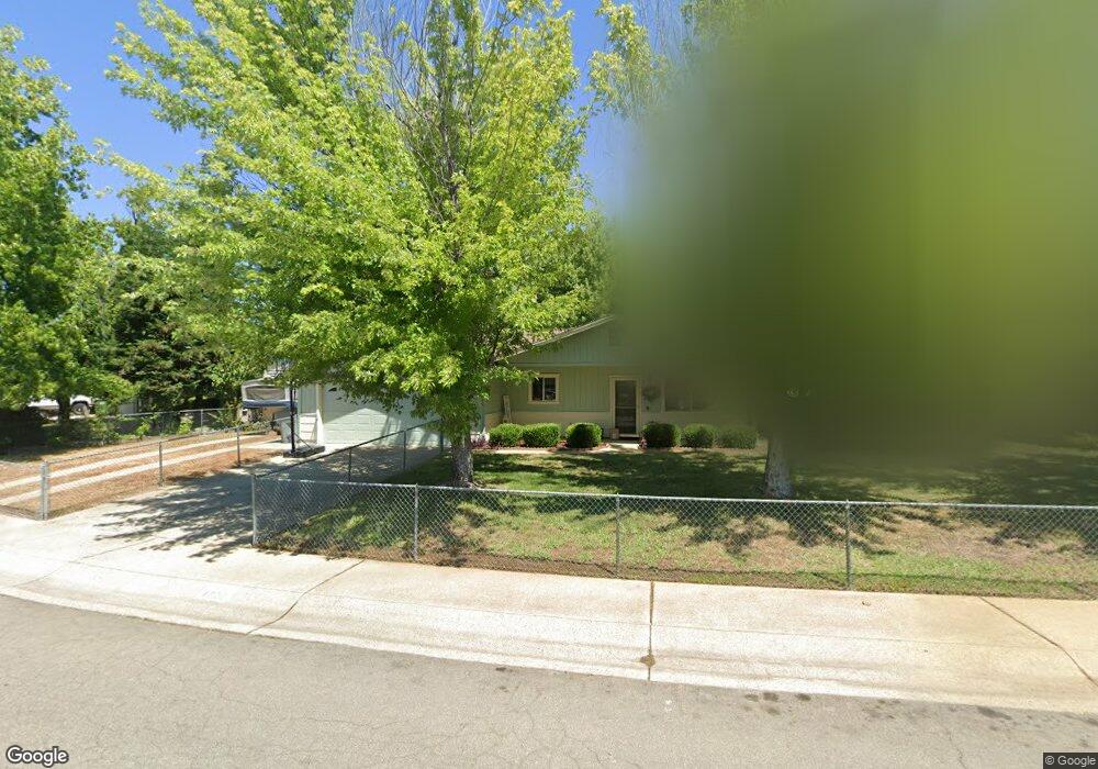
1029 Camelot Ct Redding, CA 96003
Buckeye NeighborhoodEstimated Value: $264,000 - $344,000
3
Beds
2
Baths
1,364
Sq Ft
$225/Sq Ft
Est. Value
About This Home
This home is located at 1029 Camelot Ct, Redding, CA 96003 and is currently estimated at $307,003, approximately $225 per square foot. 1029 Camelot Ct is a home located in Shasta County with nearby schools including Rocky Point Charter School.
Ownership History
Date
Name
Owned For
Owner Type
Purchase Details
Closed on
Aug 7, 2018
Sold by
Rollins Joanne
Bought by
Mchenry Sherri
Current Estimated Value
Purchase Details
Closed on
Jan 26, 2006
Sold by
Rollins Joanne
Bought by
Rollins Joanne
Home Financials for this Owner
Home Financials are based on the most recent Mortgage that was taken out on this home.
Original Mortgage
$105,849
Interest Rate
6.21%
Mortgage Type
VA
Purchase Details
Closed on
Oct 8, 2002
Sold by
Rollins Darrell Eugene and Rollins Joanne
Bought by
Rollins Darrell Eugene and Rollins Joanne
Home Financials for this Owner
Home Financials are based on the most recent Mortgage that was taken out on this home.
Original Mortgage
$96,192
Interest Rate
6.09%
Mortgage Type
VA
Purchase Details
Closed on
Apr 29, 1999
Sold by
Rollins Darrell E and Rollins Joanne
Bought by
Rollins Darrell Eugene and Rollins Joanne
Create a Home Valuation Report for This Property
The Home Valuation Report is an in-depth analysis detailing your home's value as well as a comparison with similar homes in the area
Home Values in the Area
Average Home Value in this Area
Purchase History
| Date | Buyer | Sale Price | Title Company |
|---|---|---|---|
| Mchenry Sherri | -- | None Available | |
| Rollins Joanne | -- | First American Title Co | |
| Rollins Darrell Eugene | -- | New Century Title Company | |
| Rollins Darrell Eugene | -- | -- |
Source: Public Records
Mortgage History
| Date | Status | Borrower | Loan Amount |
|---|---|---|---|
| Previous Owner | Rollins Joanne | $105,849 | |
| Previous Owner | Rollins Darrell Eugene | $96,192 |
Source: Public Records
Tax History
| Year | Tax Paid | Tax Assessment Tax Assessment Total Assessment is a certain percentage of the fair market value that is determined by local assessors to be the total taxable value of land and additions on the property. | Land | Improvement |
|---|---|---|---|---|
| 2025 | $1,893 | $174,174 | $54,367 | $119,807 |
| 2024 | $1,857 | $170,759 | $53,301 | $117,458 |
| 2023 | $1,857 | $167,411 | $52,256 | $115,155 |
| 2022 | $1,808 | $164,130 | $51,232 | $112,898 |
| 2021 | $1,784 | $160,913 | $50,228 | $110,685 |
| 2020 | $1,776 | $159,264 | $49,713 | $109,551 |
| 2019 | $1,722 | $156,142 | $48,739 | $107,403 |
| 2018 | $237 | $153,082 | $47,784 | $105,298 |
| 2017 | $247 | $150,082 | $46,848 | $103,234 |
| 2016 | $245 | $147,140 | $45,930 | $101,210 |
| 2015 | $233 | $144,931 | $45,241 | $99,690 |
| 2014 | $222 | $142,093 | $44,355 | $97,738 |
Source: Public Records
Map
Nearby Homes
- 3588 Magnums Way
- 3586 E Keswick Dam Rd
- 1070 Dara Ct
- 1439 Calexico Dr
- 1450 Calexico Dr
- 836 August Way
- 3605 Tamarack Dr
- 3345 Golden Heights Dr
- 3105 Jordan Ln
- 852 Lake Blvd
- 830 Middle St
- 750 Oleta Dr
- 1220 Pershing St
- 1702/1720 Mckinney Ln
- 0 Lake Blvd
- 4098 Saint Patricks Ave
- 3130 Lakey Ln
- 4288 Bradley Dr
- 3082, 3060 Keswick Dam Rd
- 3150 Haley Ln
- 1045 Camelot Ct
- 3630 Santa Rosa Way
- 3620 Santa Rosa Way
- 3642 Santa Rosa Way
- 1071 Camelot Ct
- 1020 Camelot Ct
- 3654 Santa Rosa Way
- 1014 Camelot Ct
- 1034 Camelot Ct
- 1040 Camelot Ct
- 1052 Camelot Ct
- 1000 Camelot Ct
- 3668 Santa Rosa Way
- 1064 Camelot Ct Unit 1
- 1077 Camelot Ct Unit 1
- 3627 Santa Rosa Way
- 3540 Santa Rosa Way
- 3615 Santa Rosa Way
- 1085 Camelot Ct
- 3680 Santa Rosa Way
Your Personal Tour Guide
Ask me questions while you tour the home.