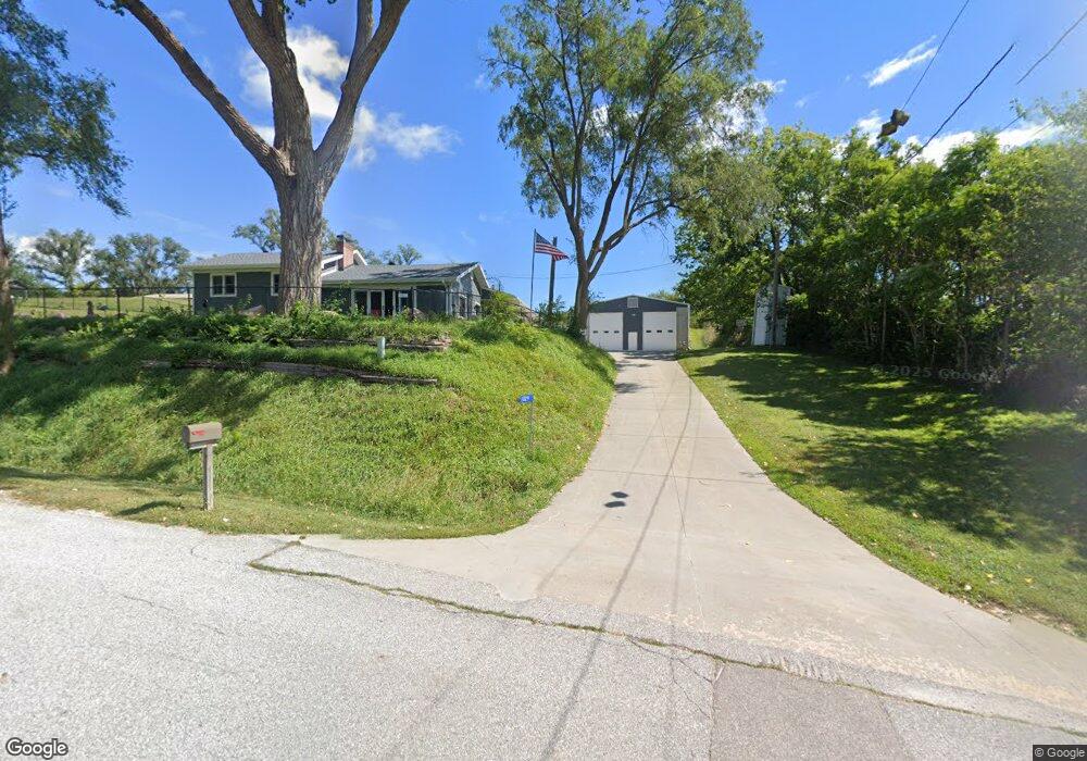
1029 Jennings Ave Council Bluffs, IA 51503
Estimated Value: $392,000 - $460,000
3
Beds
2
Baths
1,748
Sq Ft
$249/Sq Ft
Est. Value
About This Home
This home is located at 1029 Jennings Ave, Council Bluffs, IA 51503 and is currently estimated at $435,081, approximately $248 per square foot. 1029 Jennings Ave is a home located in Pottawattamie County with nearby schools including College View Elementary School, Crescent Elementary School, and Gerald W. Kirn Middle School.
Ownership History
Date
Name
Owned For
Owner Type
Purchase Details
Closed on
Apr 29, 2016
Sold by
Fernald Frank W and Fernald Debra J
Bought by
Swanson Jeffrey B and Mcginn Tamara Jo
Current Estimated Value
Home Financials for this Owner
Home Financials are based on the most recent Mortgage that was taken out on this home.
Original Mortgage
$188,000
Outstanding Balance
$117,264
Interest Rate
3.71%
Mortgage Type
Future Advance Clause Open End Mortgage
Estimated Equity
$317,817
Purchase Details
Closed on
Jun 5, 2013
Sold by
Good Randy L and Good Paula M
Bought by
Fernald Frank W
Create a Home Valuation Report for This Property
The Home Valuation Report is an in-depth analysis detailing your home's value as well as a comparison with similar homes in the area
Home Values in the Area
Average Home Value in this Area
Purchase History
| Date | Buyer | Sale Price | Title Company |
|---|---|---|---|
| Swanson Jeffrey B | $235,000 | Attorney | |
| Fernald Frank W | $1,272 | None Available |
Source: Public Records
Mortgage History
| Date | Status | Borrower | Loan Amount |
|---|---|---|---|
| Open | Swanson Jeffrey B | $188,000 |
Source: Public Records
Tax History Compared to Growth
Tax History
| Year | Tax Paid | Tax Assessment Tax Assessment Total Assessment is a certain percentage of the fair market value that is determined by local assessors to be the total taxable value of land and additions on the property. | Land | Improvement |
|---|---|---|---|---|
| 2025 | $5,120 | $433,600 | $74,900 | $358,700 |
| 2024 | $5,120 | $372,600 | $65,200 | $307,400 |
| 2023 | $5,080 | $372,600 | $65,200 | $307,400 |
| 2022 | $4,500 | $279,100 | $65,600 | $213,500 |
| 2021 | $6,668 | $279,100 | $65,600 | $213,500 |
| 2020 | $4,230 | $247,700 | $58,200 | $189,500 |
| 2019 | $4,382 | $247,700 | $58,200 | $189,500 |
| 2018 | $4,058 | $247,700 | $58,200 | $189,500 |
| 2017 | $4,058 | $191,900 | $44,037 | $147,863 |
| 2015 | $3,348 | $191,900 | $44,037 | $147,863 |
| 2014 | $3,352 | $191,900 | $44,037 | $147,863 |
Source: Public Records
Map
Nearby Homes
- 1778 Jennings Ave
- 1.12 AC Railroad Ave & Hwy 6
- 605 Ridge Rd N
- 944 Mckenzie Ave
- 627 Spencer Ave
- 37 Indian Hills Rd
- 638 Simms Ave
- 18843 Evergreen Ln
- 500 Spencer Ave
- 440 Simms Ave
- 407 Spencer Ave
- 401 Spencer Ave
- 415 Midland Dr
- 116 Spencer Ave
- 162 N Linden Ave
- LOT 12 Mcpherson Ave
- 19404 Mudhollow Rd
- 155 S Linden Ave
- 22143 Hackberry Rd
- 269 Elmwood Dr
- 1073 Jennings Ave
- HWY 191 Jennings Ave
- 95 Jennings Rd
- 98 Jennings Rd
- 97 Jennings Rd
- 19090 Hawthorne Ave
- 96 Jennings Rd
- 19136 Hawthorne Ave
- 19140 Hawthorne Ave
- 2822 Railroad Hwy
- 1117 Jennings Ave
- 93 Jennings Rd
- 1154 Jennings Ave
- 2909 Railroad Hwy
- 19180 Hawthorne Ave
- 94 Jennings Rd
- 94 Jennings Rd
- 19065 Hawthorne Ave
- 1164 Jennings Ave
- 19194 Hawthorne Ave