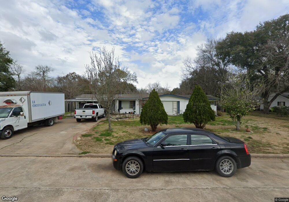
1029 Lindsey Dr Rosenberg, TX 77471
Estimated Value: $235,739 - $295,000
2
Beds
2
Baths
1,860
Sq Ft
$140/Sq Ft
Est. Value
About This Home
This home is located at 1029 Lindsey Dr, Rosenberg, TX 77471 and is currently estimated at $260,185, approximately $139 per square foot. 1029 Lindsey Dr is a home located in Fort Bend County with nearby schools including Smith Elementary School, J J Wessendorff Middle School, and Lamar Junior High School.
Ownership History
Date
Name
Owned For
Owner Type
Purchase Details
Closed on
Sep 20, 2002
Sold by
Powell Jane A and Cole Calvin D
Bought by
Martinez Roberto
Current Estimated Value
Home Financials for this Owner
Home Financials are based on the most recent Mortgage that was taken out on this home.
Original Mortgage
$65,455
Outstanding Balance
$27,263
Interest Rate
6.2%
Mortgage Type
Stand Alone First
Estimated Equity
$232,922
Purchase Details
Closed on
Jun 24, 1994
Sold by
Hanzelka Victor J
Bought by
Martinez Roberto
Create a Home Valuation Report for This Property
The Home Valuation Report is an in-depth analysis detailing your home's value as well as a comparison with similar homes in the area
Home Values in the Area
Average Home Value in this Area
Purchase History
| Date | Buyer | Sale Price | Title Company |
|---|---|---|---|
| Martinez Roberto | -- | Alamo Title Company | |
| Martinez Roberto | -- | -- |
Source: Public Records
Mortgage History
| Date | Status | Borrower | Loan Amount |
|---|---|---|---|
| Open | Martinez Roberto | $65,455 |
Source: Public Records
Tax History Compared to Growth
Tax History
| Year | Tax Paid | Tax Assessment Tax Assessment Total Assessment is a certain percentage of the fair market value that is determined by local assessors to be the total taxable value of land and additions on the property. | Land | Improvement |
|---|---|---|---|---|
| 2025 | $2,085 | $170,482 | $21,970 | $148,512 |
| 2024 | $2,085 | $185,687 | -- | $220,249 |
| 2023 | $2,085 | $168,806 | $0 | $221,071 |
| 2022 | $2,399 | $153,460 | $0 | $200,900 |
| 2021 | $2,895 | $139,510 | $21,220 | $118,290 |
| 2020 | $2,692 | $126,830 | $21,220 | $105,610 |
| 2019 | $2,633 | $115,300 | $21,220 | $94,080 |
| 2018 | $2,433 | $104,820 | $21,220 | $83,600 |
| 2017 | $2,224 | $95,290 | $21,220 | $74,070 |
| 2016 | $2,022 | $86,630 | $21,220 | $65,410 |
| 2015 | $1,400 | $78,750 | $21,220 | $57,530 |
| 2014 | $1,517 | $76,890 | $21,220 | $55,670 |
Source: Public Records
Map
Nearby Homes
- 1109 Frances Dr
- 4602 Avenue H
- 1806 Cedar Dr
- 1809 Hawthorn Dr
- 1805 Hawthorn Dr
- 5002 Quebec Blvd
- 5027 Quebec Blvd
- 4502 River Rd
- 5303 Rivers Edge Dr
- 5319 Rivers Edge Dr
- 1922 Teakwood St
- 5121 Alderney Ct
- 4707 E Parma Dr
- 1504 Radio Ln
- 512 and 514 Travis St
- 1004 Country Club Dr
- 5106 Alderney Ct
- 6219 Deep Gulch Dr
- 6215 Deep Gulch Dr
- 6218 Deep Gulch Dr
- 1025 Lindsey Dr
- 1033 Lindsey Dr
- 1024 Frances Dr
- 1020 Frances Dr
- 1026 Frances Dr
- 1023 Lindsey Dr
- 1028 Lindsey Dr
- 5516 Taylor
- 1018 Frances Dr
- 1026 Lindsey Dr
- 1028 Frances Dr
- 1034 Lindsey Dr
- 1021 Lindsey Dr
- 1037 Lindsey Dr
- 1024 Lindsey Dr
- 1016 Frances Dr
- 1019 Lindsey Dr
- 1038 Lindsey Dr
- 1021 Frances Dr
- 1053 Sally Anne Dr