Estimated Value: $146,208 - $198,000
5
Beds
2
Baths
1,490
Sq Ft
$118/Sq Ft
Est. Value
About This Home
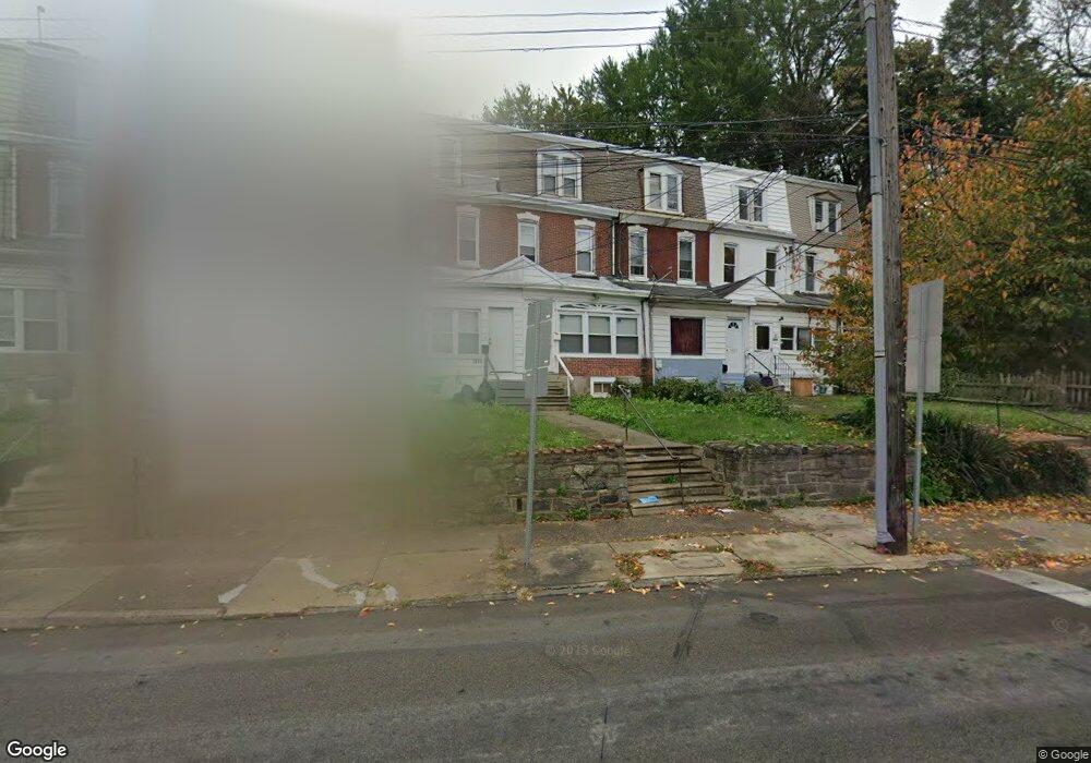
This home is located at 1029 Main St, Darby, PA 19023 and is currently estimated at $175,802, approximately $117 per square foot. 1029 Main St is a home located in Delaware County with nearby schools including Park Lane Elementary School, Penn Wood Middle School, and Penn Wood High School - Cypress Street Campus.
Ownership History
Date
Name
Owned For
Owner Type
Purchase Details
Closed on
Oct 6, 2017
Sold by
Payne Between Jarrett
Bought by
Browning Properties Llc
Current Estimated Value
Purchase Details
Closed on
Jun 7, 2017
Sold by
Oneal Calvin
Bought by
Payne Jarrett
Purchase Details
Closed on
Jul 30, 2010
Sold by
Greenpoint Mortgage Funding Inc
Bought by
Oneal Calvin
Purchase Details
Closed on
Jul 2, 2001
Sold by
Hud
Bought by
Bryant Maeso
Purchase Details
Closed on
Mar 6, 2001
Sold by
Midfirst Bank
Bought by
Hud
Purchase Details
Closed on
Jul 12, 2000
Sold by
Anthony Gwendoline A
Bought by
Midfirst Bank
Purchase Details
Closed on
Oct 25, 1996
Sold by
Har Pat Corp
Bought by
Anthony Gwendoline A
Home Financials for this Owner
Home Financials are based on the most recent Mortgage that was taken out on this home.
Original Mortgage
$36,810
Interest Rate
7.81%
Mortgage Type
FHA
Create a Home Valuation Report for This Property
The Home Valuation Report is an in-depth analysis detailing your home's value as well as a comparison with similar homes in the area
Home Values in the Area
Average Home Value in this Area
Purchase History
| Date | Buyer | Sale Price | Title Company |
|---|---|---|---|
| Browning Properties Llc | $1,500 | None Available | |
| Payne Jarrett | $3,192 | None Available | |
| Oneal Calvin | $10,000 | None Available | |
| Bryant Maeso | $14,000 | -- | |
| Hud | -- | -- | |
| Midfirst Bank | -- | -- | |
| Anthony Gwendoline A | $36,500 | Commonwealth Land Title Ins |
Source: Public Records
Mortgage History
| Date | Status | Borrower | Loan Amount |
|---|---|---|---|
| Previous Owner | Anthony Gwendoline A | $36,810 |
Source: Public Records
Tax History Compared to Growth
Tax History
| Year | Tax Paid | Tax Assessment Tax Assessment Total Assessment is a certain percentage of the fair market value that is determined by local assessors to be the total taxable value of land and additions on the property. | Land | Improvement |
|---|---|---|---|---|
| 2025 | $3,575 | $72,200 | $20,020 | $52,180 |
| 2024 | $3,575 | $72,200 | $20,020 | $52,180 |
| 2023 | $3,364 | $72,200 | $20,020 | $52,180 |
| 2022 | $3,272 | $72,200 | $20,020 | $52,180 |
| 2021 | $4,566 | $72,200 | $20,020 | $52,180 |
| 2020 | $3,464 | $47,420 | $12,580 | $34,840 |
| 2019 | $3,317 | $47,420 | $12,580 | $34,840 |
| 2018 | $3,277 | $47,420 | $0 | $0 |
| 2017 | $3,217 | $47,420 | $0 | $0 |
| 2016 | $266 | $47,420 | $0 | $0 |
| 2015 | $266 | $47,420 | $0 | $0 |
| 2014 | $266 | $47,420 | $0 | $0 |
Source: Public Records
Map
Nearby Homes
- 1115 Chestnut St
- 1143 Chestnut St
- 1127 Kenwood Rd
- 932 Forrester Ave
- 108 Weymouth Rd
- 1210 Berkley Rd
- 925 Maple Terrace
- 902 Maple Terrace
- 957 Springfield Rd
- 1007 Tyler Ave
- 221 N 9th St
- 220 Weymouth Rd
- 17 Florence Ave
- 1008 Springfield Rd
- 240 Spring Valley Rd
- 215 N 9th St
- 834 842 Main St
- 108 Whitely Terrace
- 14 Winthrop Rd
- 33 Mermont Cir
- 1027 Main St
- 1031 Main St
- 1033 Main St
- 1025 Main St
- 1035 Main St
- 1023 Main St
- 1037 Main St
- 10 N Macdade Blvd
- 1039 Main St
- 12 N Macdade Blvd
- 14 N Macdade Blvd Unit 2
- 14 N Macdade Blvd
- 16 N Macdade Blvd
- 18 N Macdade Blvd
- 20 N Macdade Blvd
- 22 N Macdade Blvd
- 24 N Macdade Blvd
- 26 N Macdade Blvd
- 1102 Main St
- 28 N Macdade Blvd