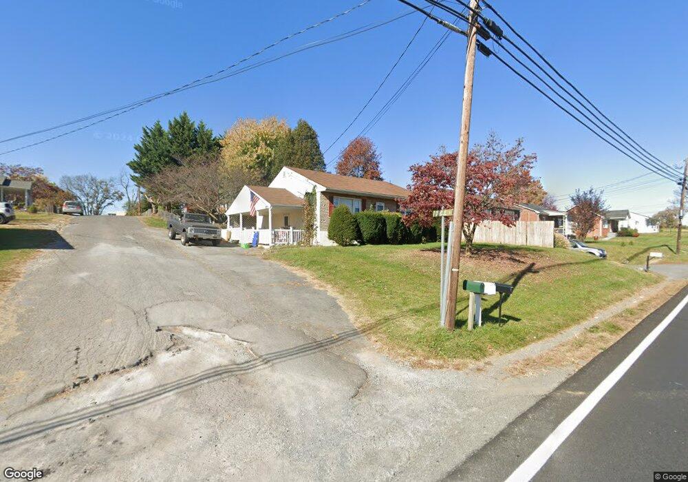
1029 N Mildred St Ranson, WV 25438
Estimated Value: $192,000 - $260,087
2
Beds
1
Bath
1,020
Sq Ft
$213/Sq Ft
Est. Value
About This Home
This home is located at 1029 N Mildred St, Ranson, WV 25438 and is currently estimated at $217,272, approximately $213 per square foot. 1029 N Mildred St is a home located in Jefferson County with nearby schools including Ranson Elementary School, Wildwood Middle School, and Jefferson High School.
Ownership History
Date
Name
Owned For
Owner Type
Purchase Details
Closed on
Feb 28, 2020
Sold by
Burkcer Douglas Faron
Bought by
Wilt Gunnar S
Current Estimated Value
Home Financials for this Owner
Home Financials are based on the most recent Mortgage that was taken out on this home.
Original Mortgage
$116,161
Outstanding Balance
$102,633
Interest Rate
3.6%
Mortgage Type
New Conventional
Estimated Equity
$114,639
Create a Home Valuation Report for This Property
The Home Valuation Report is an in-depth analysis detailing your home's value as well as a comparison with similar homes in the area
Home Values in the Area
Average Home Value in this Area
Purchase History
| Date | Buyer | Sale Price | Title Company |
|---|---|---|---|
| Wilt Gunnar S | $115,000 | Ct |
Source: Public Records
Mortgage History
| Date | Status | Borrower | Loan Amount |
|---|---|---|---|
| Open | Wilt Gunnar S | $116,161 |
Source: Public Records
Tax History
| Year | Tax Paid | Tax Assessment Tax Assessment Total Assessment is a certain percentage of the fair market value that is determined by local assessors to be the total taxable value of land and additions on the property. | Land | Improvement |
|---|---|---|---|---|
| 2025 | $1,185 | $102,000 | $44,600 | $57,400 |
| 2024 | $1,132 | $96,700 | $44,600 | $52,100 |
| 2023 | $1,129 | $96,700 | $44,600 | $52,100 |
| 2022 | $1,074 | $90,100 | $44,600 | $45,500 |
| 2021 | $964 | $79,400 | $38,500 | $40,900 |
| 2020 | $1,502 | $66,000 | $26,300 | $39,700 |
| 2019 | $1,438 | $62,000 | $22,300 | $39,700 |
| 2018 | $1,438 | $61,200 | $22,300 | $38,900 |
| 2017 | $1,438 | $61,200 | $22,300 | $38,900 |
| 2016 | $1,305 | $55,700 | $16,200 | $39,500 |
| 2015 | $1,100 | $46,700 | $16,200 | $30,500 |
| 2014 | $952 | $40,500 | $12,300 | $28,200 |
Source: Public Records
Map
Nearby Homes
- 3 Monroe Ave
- 2 Monroe Ave
- 1 Monroe Ave
- 203 Apple Tree Dr
- 12 Monroe Ave
- 0 N Mildred St Unit WVJF2016660
- 197 Ellery St
- 42 Trout Lily Dr
- HomeSite 1985 Huntwell West Ave
- 124 Huntwell West Ave
- 804 N Reymann St
- 200 Huntwell Ave W
- 209 Huntwell West Ave
- 198 Ellery St
- 7 Sherman Ave
- 225 Huntwell West Ave
- 206 E Fourteenth Ave
- 264 Huntwell West Ave
- 248 Huntwell West Ave
- 271 Huntwell West Ave
- 1041 N Mildred St
- 15 Circle St
- 1051 N Mildred St
- 42 Circle St
- 35 Circle St
- 49 Circle St
- 602604 N Mildred St
- 1136 N Mildred St
- 62 Circle St
- 135 Circle St
- 1026 N Mildred St
- 67 Circle St
- 1089 N Mildred St
- 804 N Mildred St Unit 4
- 103 Topper Ave
- 0 Peters Ave Unit WVJF2018930
- 0 Peters Ave Unit WVJF2017300
- 0 Peters Ave Unit WVJF2015076
- 0 Peters Ave Unit WVJF2012302
- 0 Peters Ave Unit WVJF2010290
Your Personal Tour Guide
Ask me questions while you tour the home.