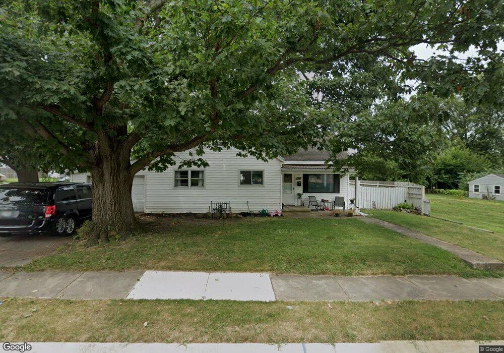
1029 S Maple Ave Fairborn, OH 45324
Estimated Value: $129,000 - $158,000
3
Beds
1
Bath
1,424
Sq Ft
$99/Sq Ft
Est. Value
About This Home
This home is located at 1029 S Maple Ave, Fairborn, OH 45324 and is currently estimated at $141,145, approximately $99 per square foot. 1029 S Maple Ave is a home located in Greene County with nearby schools including Fairborn Primary School, Fairborn Intermediate School, and Fairborn Middle School.
Ownership History
Date
Name
Owned For
Owner Type
Purchase Details
Closed on
Jun 20, 2014
Sold by
Cook William L
Bought by
Houghton Jeremy
Current Estimated Value
Home Financials for this Owner
Home Financials are based on the most recent Mortgage that was taken out on this home.
Original Mortgage
$61,355
Outstanding Balance
$46,965
Interest Rate
4.37%
Mortgage Type
FHA
Estimated Equity
$94,180
Purchase Details
Closed on
Jul 8, 2004
Sold by
Us Bank Na
Bought by
Cook William L
Home Financials for this Owner
Home Financials are based on the most recent Mortgage that was taken out on this home.
Original Mortgage
$41,400
Interest Rate
5.95%
Mortgage Type
Unknown
Purchase Details
Closed on
Oct 10, 2003
Sold by
Cole Michael L
Bought by
Us Bank Na
Create a Home Valuation Report for This Property
The Home Valuation Report is an in-depth analysis detailing your home's value as well as a comparison with similar homes in the area
Home Values in the Area
Average Home Value in this Area
Purchase History
| Date | Buyer | Sale Price | Title Company |
|---|---|---|---|
| Houghton Jeremy | $62,500 | First Ohio Title Insurance | |
| Cook William L | $46,000 | -- | |
| Us Bank Na | $49,000 | -- |
Source: Public Records
Mortgage History
| Date | Status | Borrower | Loan Amount |
|---|---|---|---|
| Open | Houghton Jeremy | $61,355 | |
| Previous Owner | Cook William L | $41,400 |
Source: Public Records
Tax History
| Year | Tax Paid | Tax Assessment Tax Assessment Total Assessment is a certain percentage of the fair market value that is determined by local assessors to be the total taxable value of land and additions on the property. | Land | Improvement |
|---|---|---|---|---|
| 2024 | $1,460 | $30,270 | $3,240 | $27,030 |
| 2023 | $1,450 | $30,270 | $3,240 | $27,030 |
| 2022 | $1,252 | $22,010 | $2,160 | $19,850 |
| 2021 | $1,271 | $22,010 | $2,160 | $19,850 |
| 2020 | $1,277 | $22,010 | $2,160 | $19,850 |
| 2019 | $1,077 | $18,590 | $2,210 | $16,380 |
| 2018 | $1,089 | $18,590 | $2,210 | $16,380 |
| 2017 | $1,089 | $18,590 | $2,210 | $16,380 |
| 2016 | $1,089 | $18,590 | $2,210 | $16,380 |
| 2015 | $1,039 | $18,590 | $2,210 | $16,380 |
| 2014 | $1,005 | $18,590 | $2,210 | $16,380 |
Source: Public Records
Map
Nearby Homes
- 1108 Lexington Ave
- 12 Canova Ct
- 38 Lindway Dr
- 1267 Beech St
- 818 Flintridge Dr
- 849 Flintridge Dr
- 1237 Hemlock Dr
- 153 Diana Ln N
- 45 Regina Dr
- 0 W Garland Ave
- 421 Marchmont Dr
- 1878 Wildflower Rd
- 234-236 High St
- 1373 Rawlings Dr
- 201 State St
- 315 Greene St
- 504 Greene St
- 1408 Mapleridge Dr
- 35 S Grand Ave Unit 33
- 315 W Dayton Dr
- 1025 S Maple Ave
- 1040 S Maple Ave
- 1101 S Maple Ave
- 1021 S Maple Ave
- 115 E Mclaughlin Ave
- 1036 Lexington Ave
- 114 E Mclaughlin Ave
- 1028 Lexington Ave
- 13 Westport Dr
- 1017 S Maple Ave
- 1109 S Maple Ave
- 1104 Lexington Ave
- 1108 S Maple Ave
- 1013 S Maple Ave
- 1020 Lexington Ave
- 1020 Lexington Ave
- 19 Westport Dr
- 20 Westport Dr
- 1112 Lexington Ave
- 1009 S Maple Ave
Your Personal Tour Guide
Ask me questions while you tour the home.