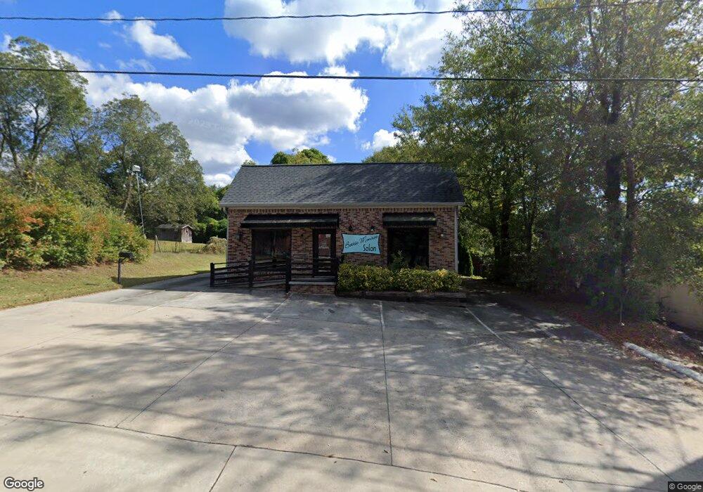
103 Broad St Dacula, GA 30019
Estimated Value: $326,000
2
Beds
1
Bath
1,112
Sq Ft
$293/Sq Ft
Est. Value
About This Home
This home is located at 103 Broad St, Dacula, GA 30019 and is currently estimated at $326,000, approximately $293 per square foot. 103 Broad St is a home located in Gwinnett County with nearby schools including Dacula Elementary School, Dacula Middle School, and Dacula High School.
Ownership History
Date
Name
Owned For
Owner Type
Purchase Details
Closed on
Oct 7, 2024
Sold by
Bettie Monroe Llc
Bought by
2Nd & Broad Llc
Current Estimated Value
Purchase Details
Closed on
Nov 13, 2012
Sold by
Us Bank National Associati
Bought by
Tonnessen Chris Eric
Home Financials for this Owner
Home Financials are based on the most recent Mortgage that was taken out on this home.
Original Mortgage
$56,000
Interest Rate
3.4%
Mortgage Type
New Conventional
Purchase Details
Closed on
Aug 7, 2012
Sold by
Curran Tim A
Bought by
Us Bank National Association T
Create a Home Valuation Report for This Property
The Home Valuation Report is an in-depth analysis detailing your home's value as well as a comparison with similar homes in the area
Home Values in the Area
Average Home Value in this Area
Purchase History
| Date | Buyer | Sale Price | Title Company |
|---|---|---|---|
| 2Nd & Broad Llc | $315,000 | -- | |
| Tonnessen Chris Eric | $70,000 | -- | |
| Us Bank National Association T | -- | -- |
Source: Public Records
Mortgage History
| Date | Status | Borrower | Loan Amount |
|---|---|---|---|
| Previous Owner | Tonnessen Chris Eric | $56,000 |
Source: Public Records
Tax History Compared to Growth
Tax History
| Year | Tax Paid | Tax Assessment Tax Assessment Total Assessment is a certain percentage of the fair market value that is determined by local assessors to be the total taxable value of land and additions on the property. | Land | Improvement |
|---|---|---|---|---|
| 2025 | -- | $66,760 | $25,080 | $41,680 |
| 2024 | $3,490 | $100,000 | $21,600 | $78,400 |
| 2023 | $3,490 | $100,000 | $21,600 | $78,400 |
| 2022 | $3,500 | $139,200 | $21,600 | $117,600 |
| 2021 | $1,357 | $24,920 | $9,240 | $15,680 |
| 2020 | $1,364 | $24,920 | $9,240 | $15,680 |
| 2019 | $1,329 | $24,920 | $9,240 | $15,680 |
| 2018 | $1,170 | $20,800 | $11,440 | $9,360 |
| 2016 | $824 | $20,800 | $11,440 | $9,360 |
| 2015 | $839 | $20,800 | $11,440 | $9,360 |
| 2014 | $848 | $20,800 | $11,440 | $9,360 |
Source: Public Records
Map
Nearby Homes
- 1265 Winder Hwy
- 2728 Argento Cir
- 2328 Argento Cir
- 206 Silverton Dr
- 2718 Argento Cir
- 2699 Argento Cir
- 2419 Argento Cir
- 929 Hilltop Park Ct
- 1939 Van Allen Ct
- 1919 Van Allen Ct
- 1950 Van Allen Ct
- 1940 Van Allen Ct
- 1278 Hollingsworth Way
- 1949 Van Allen Ct
- Splendor Plan at Silverton
- Europa Plan at Silverton
- 2493 2nd Ave
- 2493 2nd Ave Unit 2495
- 2493 2nd Ave
- 2491 2nd Ave
- 2505 2nd Ave
- 107 Broad St
- 2515 2nd Ave
- 0 2nd Ave Unit 8396694
- 0 2nd Ave Unit 3037986
- 0 2nd Ave
- 2nd 2nd Ave Unit 2495
- 2nd 2nd Ave
- 217 Wilson St
- 2525 2nd Ave
- 1234 Soapstone Rd
- 1214 Soapstone Rd
- 2640 Tract Way
- 2096 Crossway Ln
- 2033 Weatherby
- 1591 Torrington