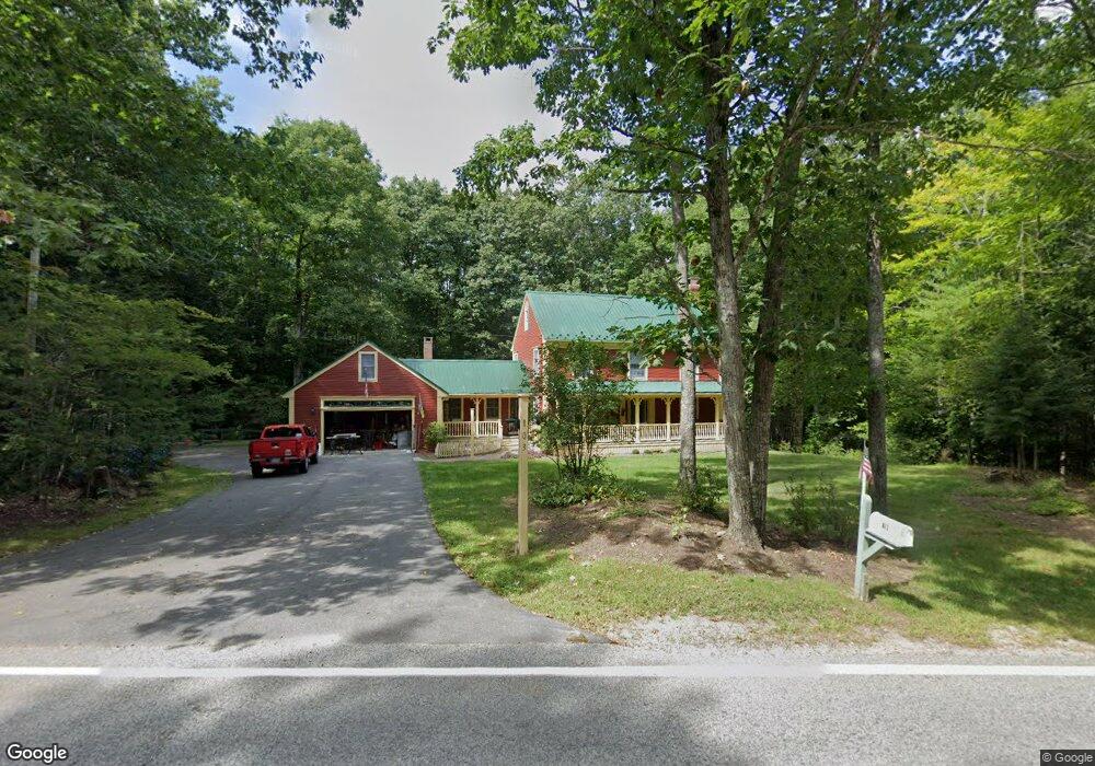
103 Burnham Rd Gorham, ME 04038
Estimated Value: $591,000 - $689,000
4
Beds
2
Baths
2,142
Sq Ft
$300/Sq Ft
Est. Value
About This Home
This home is located at 103 Burnham Rd, Gorham, ME 04038 and is currently estimated at $641,862, approximately $299 per square foot. 103 Burnham Rd is a home with nearby schools including Narragansett Elementary School, Gorham Middle School, and Gorham High School.
Create a Home Valuation Report for This Property
The Home Valuation Report is an in-depth analysis detailing your home's value as well as a comparison with similar homes in the area
Home Values in the Area
Average Home Value in this Area
Tax History
| Year | Tax Paid | Tax Assessment Tax Assessment Total Assessment is a certain percentage of the fair market value that is determined by local assessors to be the total taxable value of land and additions on the property. | Land | Improvement |
|---|---|---|---|---|
| 2025 | $6,775 | $457,800 | $78,100 | $379,700 |
| 2024 | $6,730 | $457,800 | $78,100 | $379,700 |
| 2023 | $6,295 | $457,800 | $78,100 | $379,700 |
| 2022 | $5,883 | $457,800 | $78,100 | $379,700 |
| 2021 | $4,871 | $251,100 | $65,500 | $185,600 |
| 2020 | $4,771 | $251,100 | $65,500 | $185,600 |
| 2019 | $4,758 | $251,100 | $65,500 | $185,600 |
| 2018 | $4,570 | $251,100 | $65,500 | $185,600 |
| 2017 | $4,280 | $250,300 | $65,500 | $184,800 |
| 2016 | $4,255 | $250,300 | $65,500 | $184,800 |
| 2015 | $4,080 | $250,300 | $65,500 | $184,800 |
| 2014 | $4,561 | $262,100 | $71,000 | $191,100 |
| 2013 | $4,534 | $262,100 | $71,000 | $191,100 |
Source: Public Records
Map
Nearby Homes
- lot 2 Meserve Farm Rd
- 4 Meserve Farm Rd
- 10 Cowbell Dr
- 5 Forest Cir
- 213 Burnham Rd
- 16 Thistle Dr Unit C
- 4 Small Pond Rd
- 12 Maple Dr
- 64 Maple Dr
- 3 S Branch Dr
- 4 Abbi Ln
- Lot 72 Martell Way
- 3 Dunn Estates Dr
- 77 Beech Ridge Rd
- 138 Beech Ridge Rd
- 14 David Dr
- 76 County Rd
- 25 Fairway Commons Dr Unit 7
- 20 Fairway Commons Dr Unit 2
- Unit 13 Fairway Commons Dr Unit 13
Your Personal Tour Guide
Ask me questions while you tour the home.