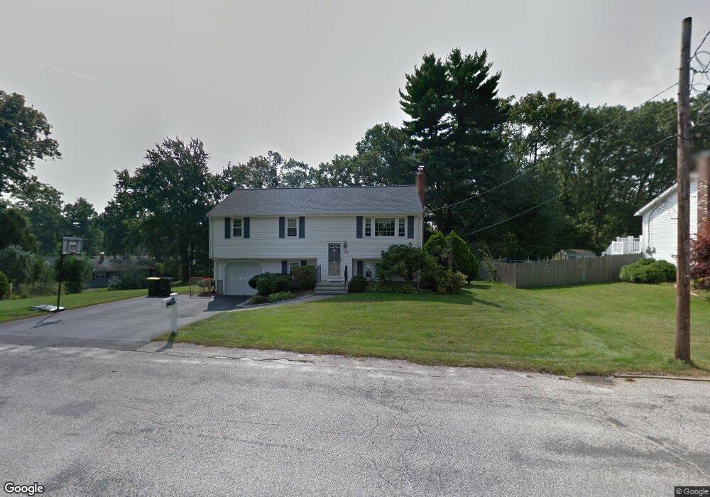
103 Clarence Rd Bellingham, MA 02019
Estimated Value: $535,003 - $578,000
3
Beds
2
Baths
1,705
Sq Ft
$328/Sq Ft
Est. Value
About This Home
This home is located at 103 Clarence Rd, Bellingham, MA 02019 and is currently estimated at $558,751, approximately $327 per square foot. 103 Clarence Rd is a home located in Norfolk County with nearby schools including Stall Brook Elementary School, Bellingham High School, and Bethany Christian Academy.
Ownership History
Date
Name
Owned For
Owner Type
Purchase Details
Closed on
Jan 19, 1996
Sold by
Herman Gerald H and Herman Jacqueline
Bought by
Clancy James F and Clancy Christine A
Current Estimated Value
Purchase Details
Closed on
May 10, 1990
Sold by
Martin David G
Bought by
Clarence Rt
Create a Home Valuation Report for This Property
The Home Valuation Report is an in-depth analysis detailing your home's value as well as a comparison with similar homes in the area
Home Values in the Area
Average Home Value in this Area
Purchase History
| Date | Buyer | Sale Price | Title Company |
|---|---|---|---|
| Clancy James F | $143,000 | -- | |
| Clarence Rt | $35,000 | -- |
Source: Public Records
Mortgage History
| Date | Status | Borrower | Loan Amount |
|---|---|---|---|
| Open | Clarence Rt | $10,000 | |
| Open | Clarence Rt | $106,000 | |
| Closed | Clarence Rt | $15,000 |
Source: Public Records
Tax History Compared to Growth
Tax History
| Year | Tax Paid | Tax Assessment Tax Assessment Total Assessment is a certain percentage of the fair market value that is determined by local assessors to be the total taxable value of land and additions on the property. | Land | Improvement |
|---|---|---|---|---|
| 2025 | $5,367 | $427,300 | $150,500 | $276,800 |
| 2024 | $5,158 | $401,100 | $137,400 | $263,700 |
| 2023 | $4,972 | $381,000 | $130,900 | $250,100 |
| 2022 | $4,877 | $346,400 | $109,100 | $237,300 |
| 2021 | $4,719 | $327,500 | $109,100 | $218,400 |
| 2020 | $4,188 | $294,500 | $109,100 | $185,400 |
| 2019 | $4,097 | $288,300 | $109,100 | $179,200 |
| 2018 | $3,737 | $259,300 | $104,900 | $154,400 |
| 2017 | $3,632 | $253,300 | $104,900 | $148,400 |
| 2016 | $3,467 | $242,600 | $103,200 | $139,400 |
| 2015 | $3,322 | $233,100 | $99,200 | $133,900 |
| 2014 | $3,331 | $227,200 | $96,900 | $130,300 |
Source: Public Records
Map
Nearby Homes
- 6 Lisa Ann Dr
- 49 Horseshoe Dr
- 49 Monique Dr
- 108 N Main St
- 22 Roger Belanger Dr
- 0 Hartford Ave
- 29 Rawson Rd
- 123-125 Mendon St
- 370 S Main St
- 133 Grove St
- 1136 S Main St
- 1099 S Main St
- 6 Mellen St
- 270 S Main St
- 7 Debra Ln
- 267 S Main St
- 256 S Main St
- 17 Pine St
- 125 Blackstone St
- 501 Old Bridge Ln Unit 501
- 97 Clarence Rd
- 356 Theresa Rd
- 219 Caroline Dr
- 227 Caroline Dr
- 104 Clarence Rd
- 93 Clarence Rd
- 211 Caroline Dr
- 235 Caroline Dr
- 346 Theresa Rd
- 90 Clarence Rd
- 201 Caroline Dr
- 218 Caroline Dr
- 245 Caroline Dr
- 347 Theresa Rd
- 208 Caroline Dr
- 39 Porter Rd
- 83 Clarence Rd
- 228 Caroline Dr
- 193 Caroline Dr
- 24 Arbend Cir