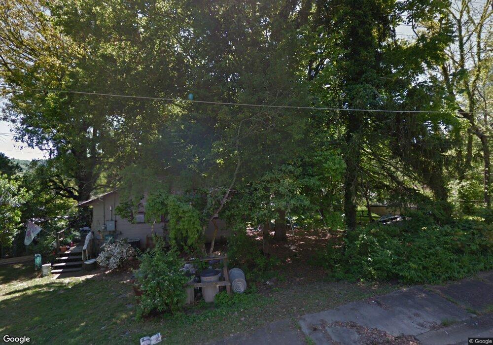
103 Jay Ln Oak Ridge, TN 37830
Estimated Value: $202,925 - $259,000
--
Bed
--
Bath
1,132
Sq Ft
$209/Sq Ft
Est. Value
About This Home
This home is located at 103 Jay Ln, Oak Ridge, TN 37830 and is currently estimated at $236,308, approximately $208 per square foot. 103 Jay Ln is a home located in Anderson County with nearby schools including Willow Brook Elementary, Robertsville Middle School, and Oak Ridge High School.
Ownership History
Date
Name
Owned For
Owner Type
Purchase Details
Closed on
Apr 16, 2018
Sold by
Aid To Ditressed Families Of Appalachain
Bought by
Benjamin Takeera
Current Estimated Value
Home Financials for this Owner
Home Financials are based on the most recent Mortgage that was taken out on this home.
Original Mortgage
$103,479
Outstanding Balance
$88,907
Interest Rate
4.4%
Mortgage Type
FHA
Estimated Equity
$147,401
Purchase Details
Closed on
Jun 2, 2015
Sold by
Oak Ridge Land Bank Inc
Bought by
Aid To Distressed Families Of Appalachia
Purchase Details
Closed on
Dec 17, 2014
Sold by
City Of Oak Ridge
Bought by
Oak Ridge Land Bank Inc
Purchase Details
Closed on
Aug 14, 2014
Sold by
Smith Betty L
Bought by
City Of Oak Ridge
Create a Home Valuation Report for This Property
The Home Valuation Report is an in-depth analysis detailing your home's value as well as a comparison with similar homes in the area
Home Values in the Area
Average Home Value in this Area
Purchase History
| Date | Buyer | Sale Price | Title Company |
|---|---|---|---|
| Benjamin Takeera | $109,000 | Crossland Title Inc | |
| Aid To Distressed Families Of Appalachia | -- | -- | |
| Aid To Distressed Families Of Appalachia | -- | -- | |
| Oak Ridge Land Bank Inc | -- | -- | |
| City Of Oak Ridge | -- | -- |
Source: Public Records
Mortgage History
| Date | Status | Borrower | Loan Amount |
|---|---|---|---|
| Open | Benjamin Takeera | $103,479 |
Source: Public Records
Tax History Compared to Growth
Tax History
| Year | Tax Paid | Tax Assessment Tax Assessment Total Assessment is a certain percentage of the fair market value that is determined by local assessors to be the total taxable value of land and additions on the property. | Land | Improvement |
|---|---|---|---|---|
| 2024 | $637 | $25,925 | $6,625 | $19,300 |
| 2023 | $637 | $25,925 | $0 | $0 |
| 2022 | $1,237 | $25,925 | $6,625 | $19,300 |
| 2021 | $1,237 | $25,925 | $6,625 | $19,300 |
| 2020 | $1,407 | $25,925 | $6,625 | $19,300 |
| 2019 | $1,439 | $27,400 | $5,700 | $21,700 |
| 2018 | $1,312 | $27,400 | $5,700 | $21,700 |
| 2017 | $292 | $5,700 | $5,700 | $0 |
| 2016 | $292 | $5,700 | $5,700 | $0 |
| 2015 | -- | $3,600 | $3,600 | $0 |
| 2014 | -- | $3,600 | $3,600 | $0 |
| 2013 | -- | $3,600 | $0 | $0 |
Source: Public Records
Map
Nearby Homes
- 107 Jay Ln
- 113 Johnson Rd
- 290 Jefferson Ave
- 133 Lasalle Rd
- 617 W Outer Dr
- 296 N Illinois Ave
- 420 Robertsville Rd
- 442 Robertsville Rd
- 145 Latimer Rd
- 143 Wellington Cir
- 461 Robertsville Rd
- 158 Wellington Cir
- 167 Warrior Cir
- 204 Waltham Place
- 558 W Outer Dr
- 108 Lewis Ln
- 178 Robertsville Rd
- 128 Sheridan Cir
- 100 N Walker Ln
- 128 E Wadsworth Cir