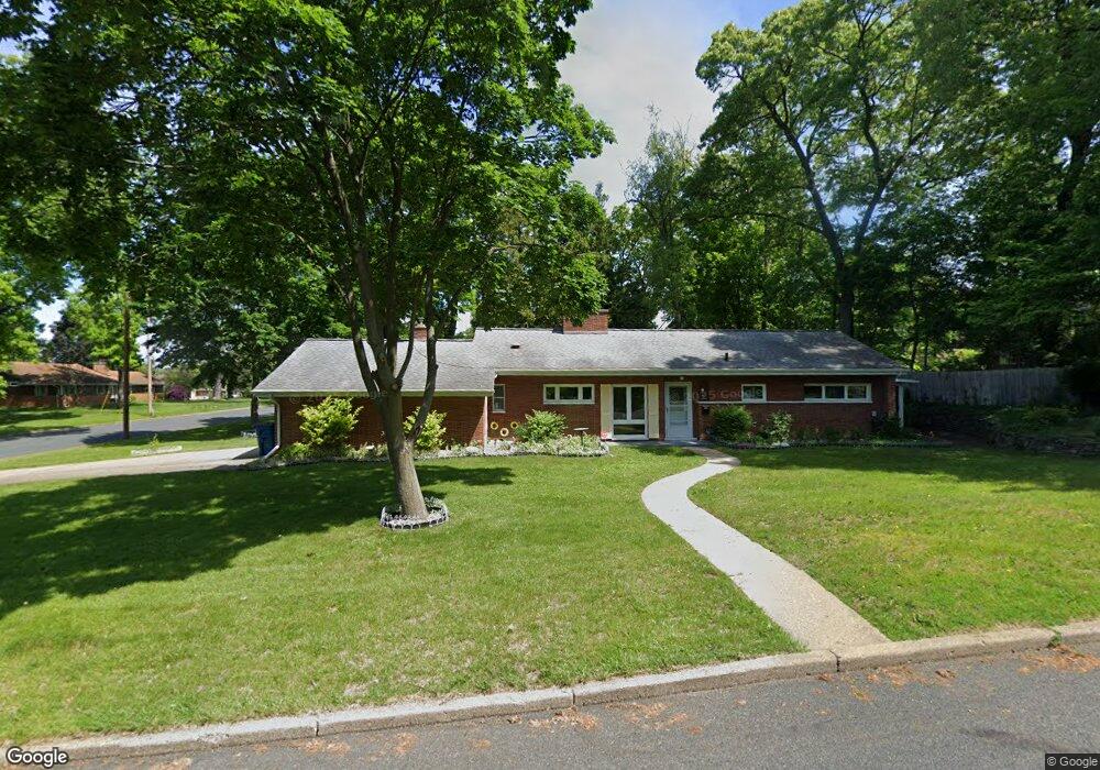
103 Laurel Dr Battle Creek, MI 49017
Northeast Battle Creek NeighborhoodEstimated Value: $186,228 - $221,000
3
Beds
2
Baths
1,574
Sq Ft
$128/Sq Ft
Est. Value
About This Home
This home is located at 103 Laurel Dr, Battle Creek, MI 49017 and is currently estimated at $201,057, approximately $127 per square foot. 103 Laurel Dr is a home located in Calhoun County with nearby schools including Northwestern Middle School, Battle Creek Central High School, and Battle Creek Christian School.
Ownership History
Date
Name
Owned For
Owner Type
Purchase Details
Closed on
Dec 23, 2016
Sold by
Wieckowski Betty
Bought by
Wieckowski Betty and Living Trust Of Betty Wieckows
Current Estimated Value
Purchase Details
Closed on
Apr 21, 2000
Sold by
Brutsche Rebecca A
Bought by
Wieckowski Betty
Purchase Details
Closed on
Dec 11, 1997
Bought by
Brutsche
Purchase Details
Closed on
Jun 26, 1997
Bought by
Armour
Create a Home Valuation Report for This Property
The Home Valuation Report is an in-depth analysis detailing your home's value as well as a comparison with similar homes in the area
Home Values in the Area
Average Home Value in this Area
Purchase History
| Date | Buyer | Sale Price | Title Company |
|---|---|---|---|
| Wieckowski Betty | -- | Attorney | |
| Wieckowski Betty | $104,900 | -- | |
| Brutsche | $90,000 | -- | |
| Armour | $80,000 | -- |
Source: Public Records
Tax History Compared to Growth
Tax History
| Year | Tax Paid | Tax Assessment Tax Assessment Total Assessment is a certain percentage of the fair market value that is determined by local assessors to be the total taxable value of land and additions on the property. | Land | Improvement |
|---|---|---|---|---|
| 2025 | -- | $80,300 | $0 | $0 |
| 2024 | $2,253 | $77,574 | $0 | $0 |
| 2023 | $2,576 | $65,454 | $0 | $0 |
| 2022 | $2,035 | $62,730 | $0 | $0 |
| 2021 | $2,430 | $60,091 | $0 | $0 |
| 2020 | $2,285 | $60,613 | $0 | $0 |
| 2019 | $2,276 | $57,224 | $0 | $0 |
| 2018 | $2,276 | $56,850 | $2,203 | $54,647 |
| 2017 | $2,207 | $54,705 | $0 | $0 |
| 2016 | $2,203 | $53,468 | $0 | $0 |
| 2015 | $2,158 | $48,079 | $3,766 | $44,313 |
| 2014 | $2,158 | $46,822 | $3,766 | $43,056 |
Source: Public Records
Map
Nearby Homes
- 332 Orchard Ave
- 333 Orchard Ave
- 115 Laurel Dr
- 314 Orchard Ave
- 116 Laurel Dr
- 342 Orchard Ave
- 172 Pleasantview Dr
- 93 Clinton Dr W
- 315 Orchard Ave
- 300 Orchard Ave
- 343 Orchard Ave
- 188 Pleasantview Dr
- 85 Clinton Dr W
- 75 Laurel Dr
- 297 Orchard Ave
- 165 Pleasantview Dr
- 290 Orchard Ave
- 98 Clinton Dr W
- 400 Orchard Ave
- 183 Pleasantview Dr