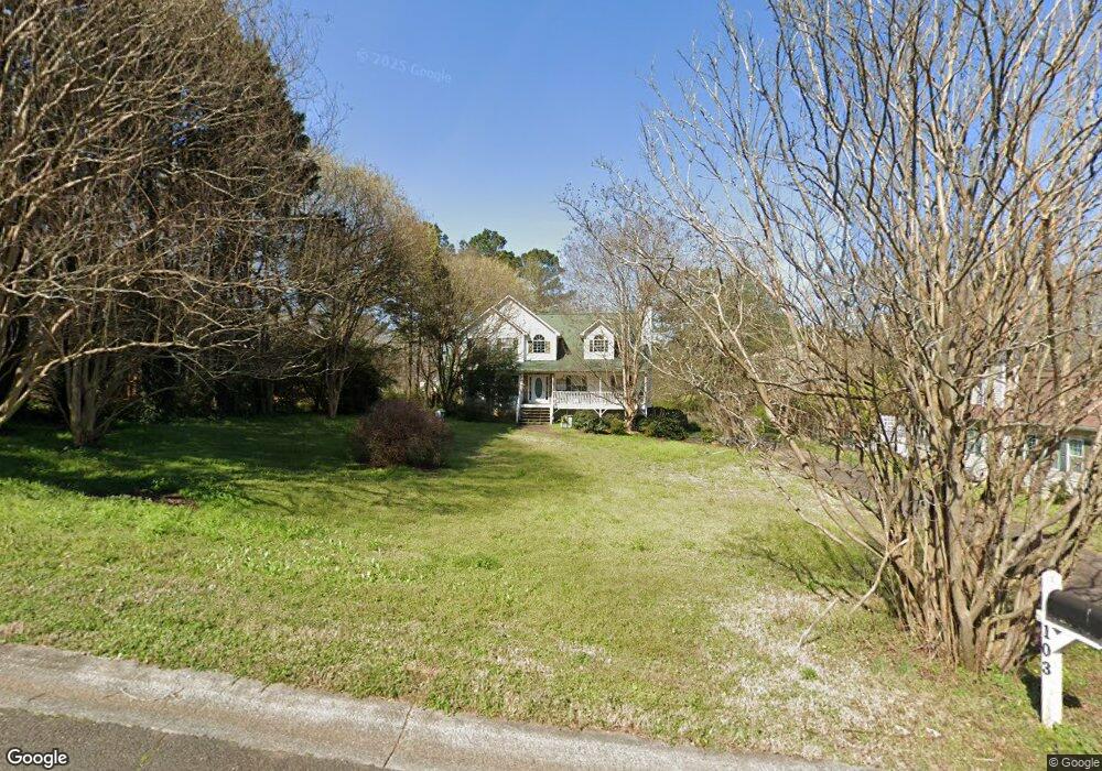
103 Logan Cole Dr Acworth, GA 30102
Oak Grove NeighborhoodEstimated Value: $395,000 - $397,582
3
Beds
3
Baths
2,136
Sq Ft
$186/Sq Ft
Est. Value
About This Home
This home is located at 103 Logan Cole Dr, Acworth, GA 30102 and is currently estimated at $396,291, approximately $185 per square foot. 103 Logan Cole Dr is a home located in Cherokee County with nearby schools including Oak Grove Elementary School, E. T. Booth Middle School, and Etowah High School.
Ownership History
Date
Name
Owned For
Owner Type
Purchase Details
Closed on
Sep 2, 2005
Sold by
Thomas Daniel E and Thomas Donna
Bought by
Westbrook Glenn E and Westbrook Penny
Current Estimated Value
Home Financials for this Owner
Home Financials are based on the most recent Mortgage that was taken out on this home.
Original Mortgage
$540,000
Interest Rate
5.37%
Mortgage Type
New Conventional
Purchase Details
Closed on
Oct 28, 1996
Sold by
Witherow Christy L and Cagle Chris A
Bought by
Thomas Daniel E Donna H
Create a Home Valuation Report for This Property
The Home Valuation Report is an in-depth analysis detailing your home's value as well as a comparison with similar homes in the area
Home Values in the Area
Average Home Value in this Area
Purchase History
| Date | Buyer | Sale Price | Title Company |
|---|---|---|---|
| Westbrook Glenn E | $196,600 | -- | |
| Thomas Daniel E Donna H | $137,000 | -- |
Source: Public Records
Mortgage History
| Date | Status | Borrower | Loan Amount |
|---|---|---|---|
| Closed | Westbrook Glenn E | $540,000 | |
| Closed | Thomas Daniel E Donna H | $0 |
Source: Public Records
Tax History Compared to Growth
Tax History
| Year | Tax Paid | Tax Assessment Tax Assessment Total Assessment is a certain percentage of the fair market value that is determined by local assessors to be the total taxable value of land and additions on the property. | Land | Improvement |
|---|---|---|---|---|
| 2025 | $3,241 | $138,676 | $30,000 | $108,676 |
| 2024 | $3,235 | $139,524 | $30,000 | $109,524 |
| 2023 | $2,546 | $127,452 | $30,000 | $97,452 |
| 2022 | $2,426 | $99,736 | $13,400 | $86,336 |
| 2021 | $2,305 | $85,904 | $13,400 | $72,504 |
| 2020 | $2,206 | $81,560 | $13,400 | $68,160 |
| 2019 | $2,096 | $76,840 | $13,400 | $63,440 |
| 2018 | $1,964 | $70,960 | $13,400 | $57,560 |
| 2017 | $1,955 | $175,300 | $13,400 | $56,720 |
| 2016 | $1,917 | $170,400 | $13,400 | $54,760 |
| 2015 | $1,818 | $160,300 | $13,400 | $50,720 |
| 2014 | $1,840 | $161,900 | $13,400 | $51,360 |
Source: Public Records
Map
Nearby Homes
- 206 Cameron Ct
- 302 Seth Way
- 6147 Little Ridge Rd
- 6155 Little Ridge Rd
- 6137 Little Ridge Rd
- 577 Oakside Place
- 6312 Woodstock Rd
- 313 Maltibie Dr
- 6222 Westridge Trace
- 6226 Westridge Trace
- 6375 Caladium Dr
- 536 Rendezvous Rd
- 271 Oak Grove Way
- 240 Ridge Mill Dr
- 108 Creekwood Trail
- 320 Oak Leaf Place
- 626 Spanish Oak Dr
- 402 Royal Oak Dr
- 6390 Woodstock Rd
- 100 Creekwood Trail
- 105 Logan Cole Dr
- 6247 Little Ridge Rd
- 6245 Little Ridge Rd
- 104 Logan Cole Dr
- 107 Logan Cole Dr
- 6235 Little Ridge Rd
- 6250 Little Ridge Rd
- 102 Logan Cole Dr
- 6249 Little Ridge Rd
- 6262 Little Ridge Rd
- 0 Logan Cole Dr Unit 7016874
- 0 Logan Cole Dr Unit 8586936
- 0 Logan Cole Dr Unit 8212251
- 0 Logan Cole Dr Unit 8415502
- 0 Logan Cole Dr Unit 3199576
- 0 Logan Cole Dr
- 109 Logan Cole Dr
- 203 Cameron Ct
- 106 Logan Cole Dr
- 6225 Little Ridge Rd