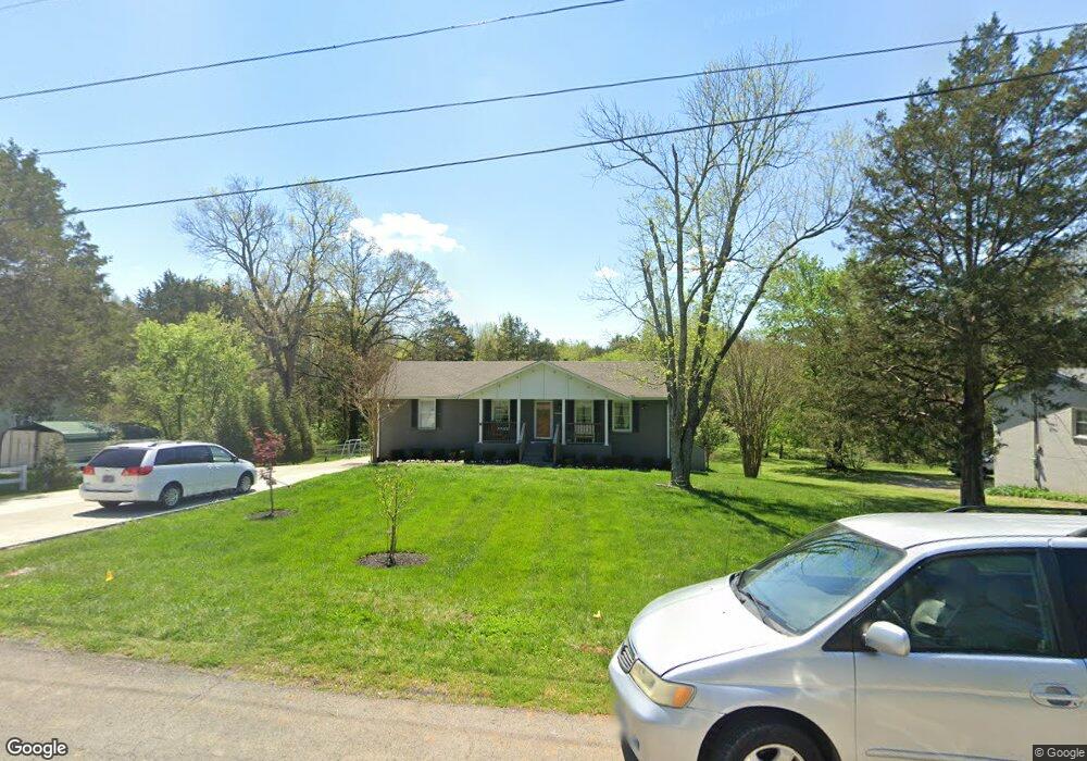
103 Long Rifle Rd Smyrna, TN 37167
Estimated Value: $304,802 - $342,000
--
Bed
3
Baths
1,125
Sq Ft
$290/Sq Ft
Est. Value
About This Home
This home is located at 103 Long Rifle Rd, Smyrna, TN 37167 and is currently estimated at $326,201, approximately $289 per square foot. 103 Long Rifle Rd is a home located in Rutherford County with nearby schools including Stewartsboro Elementary School, Rocky Fork Middle School, and Smyrna High School.
Ownership History
Date
Name
Owned For
Owner Type
Purchase Details
Closed on
Jul 2, 2018
Sold by
Whitworth Real Estate Llc
Bought by
Rosales Erick A De Leon and Leon Anne Elizabeth De
Current Estimated Value
Home Financials for this Owner
Home Financials are based on the most recent Mortgage that was taken out on this home.
Original Mortgage
$203,500
Outstanding Balance
$176,753
Interest Rate
4.6%
Mortgage Type
FHA
Estimated Equity
$149,448
Purchase Details
Closed on
Jan 3, 2017
Sold by
The Perkins Family Land Trust
Bought by
Whiteworth Real Estate Inc
Home Financials for this Owner
Home Financials are based on the most recent Mortgage that was taken out on this home.
Original Mortgage
$161,600
Interest Rate
4.13%
Mortgage Type
Commercial
Purchase Details
Closed on
Jul 15, 2016
Sold by
Perkins Gaynell N
Bought by
Perkins Jerry N and Perkins Gaynel N
Create a Home Valuation Report for This Property
The Home Valuation Report is an in-depth analysis detailing your home's value as well as a comparison with similar homes in the area
Home Values in the Area
Average Home Value in this Area
Purchase History
| Date | Buyer | Sale Price | Title Company |
|---|---|---|---|
| Rosales Erick A De Leon | $219,000 | Providence Titel Llc | |
| Whiteworth Real Estate Inc | -- | Nashville Title Ins Corp | |
| Perkins Jerry N | -- | None Available |
Source: Public Records
Mortgage History
| Date | Status | Borrower | Loan Amount |
|---|---|---|---|
| Open | Rosales Erick A De Leon | $203,500 | |
| Previous Owner | Whiteworth Real Estate Inc | $161,600 |
Source: Public Records
Tax History Compared to Growth
Tax History
| Year | Tax Paid | Tax Assessment Tax Assessment Total Assessment is a certain percentage of the fair market value that is determined by local assessors to be the total taxable value of land and additions on the property. | Land | Improvement |
|---|---|---|---|---|
| 2025 | $1,665 | $69,325 | $13,750 | $55,575 |
| 2024 | $1,665 | $69,325 | $13,750 | $55,575 |
| 2023 | $1,462 | $60,850 | $13,750 | $47,100 |
| 2022 | $1,303 | $60,850 | $13,750 | $47,100 |
| 2021 | $1,178 | $40,325 | $7,750 | $32,575 |
| 2020 | $1,178 | $40,325 | $7,750 | $32,575 |
| 2019 | $1,178 | $40,325 | $7,750 | $32,575 |
| 2018 | $1,130 | $37,875 | $0 | $0 |
| 2017 | $1,104 | $30,975 | $0 | $0 |
| 2016 | $1,104 | $30,975 | $0 | $0 |
| 2015 | $1,104 | $30,975 | $0 | $0 |
| 2014 | $770 | $30,975 | $0 | $0 |
| 2013 | -- | $30,400 | $0 | $0 |
Source: Public Records
Map
Nearby Homes
- 308 Custer Ct
- 203 Longfellow Ln
- 109 Longfellow Ln
- 101 Longfellow Ln
- 121 Crockett Ct
- 1026 Rosemont Terrace
- 1014 Rosemont Terrace
- 340 Stewarts Landing Cir
- 2110 Alteras Dr
- 211 Stewarts Landing Cir
- 1023 Avery Park Dr
- 213 Stewarts Landing Cir
- 335 Longhorn Dr
- 321 Longhorn Dr
- 320 Longhorn Dr
- 374 Longhorn Dr
- 304 Belgian Ln
- 202 George Matthew Dr
- 212 Eusa Cantrell Ln
- 226 Hamburg Rd
- 105 Long Rifle Rd
- 101 Long Rifle Rd
- 107 Long Rifle Rd
- 100 Long Rifle Rd
- 104 Long Rifle Rd
- 102 Long Rifle Rd
- 109 Long Rifle Rd
- 313 Pioneer Dr
- 315 Pioneer Dr
- 311 Pioneer Dr
- 302 Custer Ct
- 317 Pioneer Dr
- 111 Long Rifle Rd
- 319 Pioneer Dr
- 312 Custer Ct
- 304 Custer Ct
- 309 Pioneer Dr
- 113 Long Rifle Rd
- 321 Pioneer Dr
- 316 Pioneer Dr