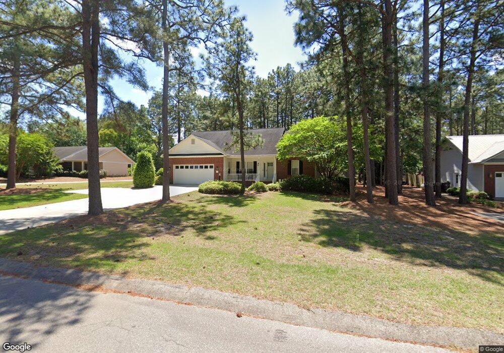
103 Michael Ln Aberdeen, NC 28315
Estimated Value: $312,865 - $346,000
3
Beds
2
Baths
1,674
Sq Ft
$201/Sq Ft
Est. Value
About This Home
This home is located at 103 Michael Ln, Aberdeen, NC 28315 and is currently estimated at $336,216, approximately $200 per square foot. 103 Michael Ln is a home located in Moore County with nearby schools including Aberdeen Elementary School, Southern Middle School, and Pinecrest High School.
Ownership History
Date
Name
Owned For
Owner Type
Purchase Details
Closed on
Dec 21, 2017
Sold by
Mabe Robbie Grant and Mabe Rebecca
Bought by
Bosworth Jaime Mcdonald
Current Estimated Value
Home Financials for this Owner
Home Financials are based on the most recent Mortgage that was taken out on this home.
Original Mortgage
$99,500
Outstanding Balance
$69,165
Interest Rate
3.62%
Mortgage Type
Adjustable Rate Mortgage/ARM
Estimated Equity
$267,051
Create a Home Valuation Report for This Property
The Home Valuation Report is an in-depth analysis detailing your home's value as well as a comparison with similar homes in the area
Home Values in the Area
Average Home Value in this Area
Purchase History
| Date | Buyer | Sale Price | Title Company |
|---|---|---|---|
| Bosworth Jaime Mcdonald | -- | None Available |
Source: Public Records
Mortgage History
| Date | Status | Borrower | Loan Amount |
|---|---|---|---|
| Open | Bosworth Jaime Mcdonald | $99,500 |
Source: Public Records
Tax History
| Year | Tax Paid | Tax Assessment Tax Assessment Total Assessment is a certain percentage of the fair market value that is determined by local assessors to be the total taxable value of land and additions on the property. | Land | Improvement |
|---|---|---|---|---|
| 2024 | $2,076 | $270,500 | $40,000 | $230,500 |
| 2023 | $2,130 | $270,500 | $40,000 | $230,500 |
| 2022 | $1,916 | $188,810 | $30,000 | $158,810 |
| 2021 | $1,964 | $188,810 | $30,000 | $158,810 |
| 2020 | $1,983 | $185,070 | $30,000 | $155,070 |
| 2019 | $1,011 | $188,810 | $30,000 | $158,810 |
| 2018 | $1,824 | $187,100 | $25,000 | $162,100 |
| 2017 | $1,806 | $187,100 | $25,000 | $162,100 |
| 2015 | $1,712 | $187,100 | $25,000 | $162,100 |
| 2014 | $1,679 | $183,510 | $25,000 | $158,510 |
| 2013 | -- | $183,510 | $25,000 | $158,510 |
Source: Public Records
Map
Nearby Homes
- 1203 Wilshire Cir
- 314 N Poplar St
- 305 3rd St
- 723 N Chapin Rd
- 110 Lightwater Dr
- 213 Telluride Ct
- 101 Pinebrae Ln
- 205 Telluride Ct
- 220 Telluride Ct
- 726 Sun Rd
- 225 Telluride Ct
- 229 Telluride Ct
- 221 Telluride Ct
- Tbd Thomas Ave
- 1608 Crest Dr
- 1709 N Poplar St
- 404 Summit St
- 418 Summit St
- 410 Summit St
- 408 Summit St
- 107 Michael Ln
- 101 Michael Ln
- 324 John McQueen Rd
- 111 Michael Ln
- 318 John McQueen Rd
- 326 John McQueen Rd
- 102 Michael Ln
- 1200 Wilshire Cir
- 1202 Wilshire Cir
- 1204 Wilshire Cir
- 115 Michael Ln
- 110 Michael Ln
- 314 John McQueen Rd
- 1206 Wilshire Cir
- 400 John McQueen Rd
- 1201 Wilshire Cir
- 114 Michael Ln
- 321 John McQueen Rd
- 323 John McQueen Rd
- 1208 Wilshire Cir
Your Personal Tour Guide
Ask me questions while you tour the home.