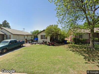
103 N B St Duncan, OK 73533
Estimated Value: $41,049 - $56,000
2
Beds
1
Bath
922
Sq Ft
$51/Sq Ft
Est. Value
About This Home
This home is located at 103 N B St, Duncan, OK 73533 and is currently estimated at $47,262, approximately $51 per square foot. 103 N B St is a home located in Stephens County with nearby schools including Velma-Alma Elementary School, Velma-Alma Middle School, and Velma-Alma High School.
Ownership History
Date
Name
Owned For
Owner Type
Purchase Details
Closed on
Feb 25, 2014
Sold by
Price Kord R and Price Tamra
Bought by
Meadows Darrell and Meadows Barbara
Current Estimated Value
Purchase Details
Closed on
May 19, 2005
Sold by
Selby Rental Properties Llc
Bought by
Price Kord R
Home Financials for this Owner
Home Financials are based on the most recent Mortgage that was taken out on this home.
Original Mortgage
$12,875
Interest Rate
5.92%
Mortgage Type
Purchase Money Mortgage
Purchase Details
Closed on
May 16, 2005
Sold by
Dwyer Nancy J
Bought by
Price Kord and Price Kord K
Home Financials for this Owner
Home Financials are based on the most recent Mortgage that was taken out on this home.
Original Mortgage
$12,875
Interest Rate
5.92%
Mortgage Type
Purchase Money Mortgage
Purchase Details
Closed on
Nov 30, 1992
Sold by
Mcguire Allen
Create a Home Valuation Report for This Property
The Home Valuation Report is an in-depth analysis detailing your home's value as well as a comparison with similar homes in the area
Home Values in the Area
Average Home Value in this Area
Purchase History
| Date | Buyer | Sale Price | Title Company |
|---|---|---|---|
| Meadows Darrell | $24,000 | None Available | |
| Price Kord R | $42,500 | None Available | |
| Price Kord | $15,000 | None Available | |
| -- | $11,000 | -- |
Source: Public Records
Mortgage History
| Date | Status | Borrower | Loan Amount |
|---|---|---|---|
| Previous Owner | Price Kord R | $12,875 |
Source: Public Records
Tax History Compared to Growth
Tax History
| Year | Tax Paid | Tax Assessment Tax Assessment Total Assessment is a certain percentage of the fair market value that is determined by local assessors to be the total taxable value of land and additions on the property. | Land | Improvement |
|---|---|---|---|---|
| 2024 | $229 | $2,688 | $297 | $2,391 |
| 2023 | $229 | $2,688 | $297 | $2,391 |
| 2022 | $207 | $2,560 | $297 | $2,263 |
| 2021 | $207 | $2,438 | $297 | $2,141 |
| 2020 | $191 | $2,211 | $297 | $1,914 |
| 2019 | $182 | $2,106 | $297 | $1,809 |
| 2018 | $179 | $2,006 | $297 | $1,709 |
| 2017 | $179 | $2,080 | $297 | $1,783 |
| 2016 | $225 | $2,651 | $297 | $2,354 |
| 2015 | $191 | $2,651 | $297 | $2,354 |
| 2014 | $191 | $2,403 | $369 | $2,034 |
Source: Public Records
Map
Nearby Homes
- 185280 N 2920 Rd
- 291975 E 1710 Rd
- ? N 2955 Rd
- 7701 7701 Lehman Ln
- 7611 7611 E Saddle Ln
- 7611 E Saddle Ln
- 176464 176464 N 2920
- 175492 175492 N 2950 Rd
- 3 N F St
- 7204 Duncan Lake Rd
- 6812 E Reeder Rd
- 0000 Reeder Rd
- 6108 E Reeder Rd
- East E Terry Rd
- 176764 Hummingbird Ln
- Blk 1 Lot 4a Blk 1 Lot 4a Trail Unit Dr
- 905 905 Pine W
- ROUTE 1 BOX 28 Route 1 Box 28 S Pruitt Dr
- 172801 172801 Trail Unit Dr
- 1705 1705 Foxboro