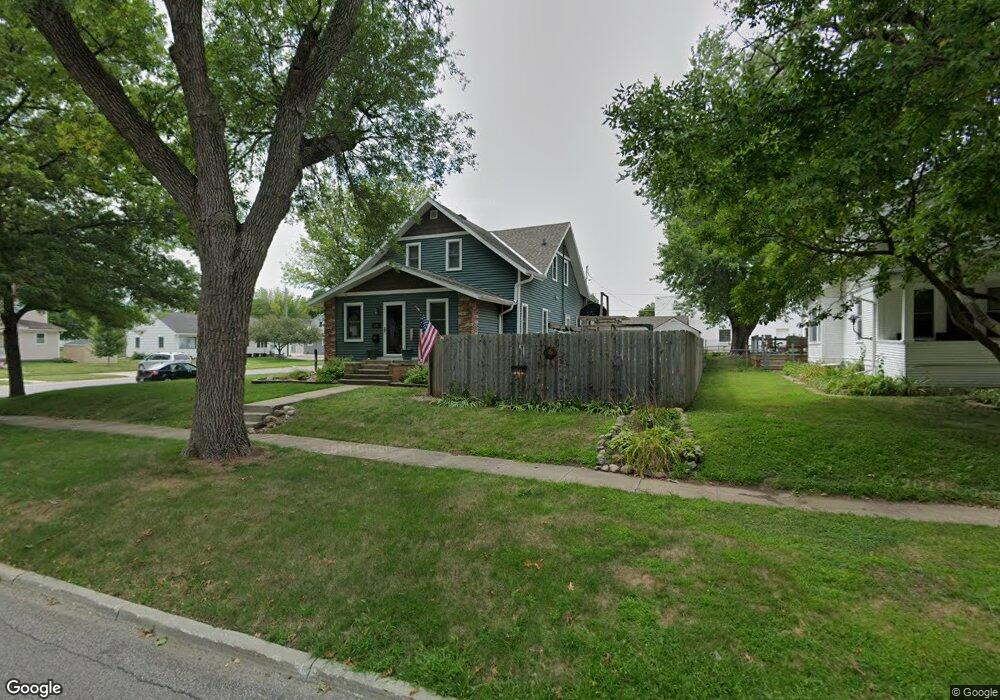
103 N Walnut St Carroll, IA 51401
Estimated Value: $179,000 - $223,000
4
Beds
2
Baths
2,021
Sq Ft
$102/Sq Ft
Est. Value
About This Home
This home is located at 103 N Walnut St, Carroll, IA 51401 and is currently estimated at $206,862, approximately $102 per square foot. 103 N Walnut St is a home with nearby schools including Fairview Elementary School, Adams Elementary School, and Carroll Middle School.
Ownership History
Date
Name
Owned For
Owner Type
Purchase Details
Closed on
May 8, 2025
Sold by
Mauch Daniel S and Mauch Sara M
Bought by
Daniel S And Sara M Mauch Trust and Mauch
Current Estimated Value
Purchase Details
Closed on
Dec 14, 2006
Sold by
Boes Eleanor
Bought by
Mauch Daniel S and Mauch Sara M
Home Financials for this Owner
Home Financials are based on the most recent Mortgage that was taken out on this home.
Original Mortgage
$81,520
Interest Rate
6.27%
Mortgage Type
FHA
Create a Home Valuation Report for This Property
The Home Valuation Report is an in-depth analysis detailing your home's value as well as a comparison with similar homes in the area
Home Values in the Area
Average Home Value in this Area
Purchase History
| Date | Buyer | Sale Price | Title Company |
|---|---|---|---|
| Daniel S And Sara M Mauch Trust | -- | None Listed On Document | |
| Mauch Daniel S | $83,000 | Security Title & Investment |
Source: Public Records
Mortgage History
| Date | Status | Borrower | Loan Amount |
|---|---|---|---|
| Previous Owner | Mauch Daniel S | $81,520 |
Source: Public Records
Tax History Compared to Growth
Tax History
| Year | Tax Paid | Tax Assessment Tax Assessment Total Assessment is a certain percentage of the fair market value that is determined by local assessors to be the total taxable value of land and additions on the property. | Land | Improvement |
|---|---|---|---|---|
| 2025 | $2,434 | $226,730 | $16,730 | $210,000 |
| 2024 | $2,382 | $195,770 | $16,730 | $179,040 |
| 2023 | $1,529 | $195,770 | $16,730 | $179,040 |
| 2022 | $1,448 | $108,820 | $16,730 | $92,090 |
| 2021 | $1,448 | $108,820 | $16,730 | $92,090 |
| 2020 | $1,483 | $108,820 | $16,730 | $92,090 |
| 2019 | $1,432 | $108,820 | $16,730 | $92,090 |
| 2018 | $1,346 | $108,820 | $16,730 | $92,090 |
| 2017 | $1,346 | $102,667 | $11,396 | $91,271 |
| 2016 | $1,248 | $95,950 | $0 | $0 |
| 2015 | $1,248 | $97,580 | $0 | $0 |
| 2014 | $1,258 | $97,580 | $0 | $0 |
Source: Public Records
Map
Nearby Homes
- 519 E 1st St
- 120 E 1st St Unit 2
- 409 E Valley Dr
- 804 N Clark St
- 121 S West St
- 807 N Court St
- 308 Prairie View Dr
- 19383 U S 30
- Deer Creek Ln Lot 36
- 332 N Crawford St
- 727 N Adams St
- 926 N Court St
- 1026 N Clark St
- 619 W 2nd St
- 407 Westridge Dr
- 0 Deer Creek Ln Unit 6302348
- 0 Monterey Dr Unit 6307161
- 0 Monterey Dr Unit 6137563
- 1102 N Main St
- 1015 N Adams St