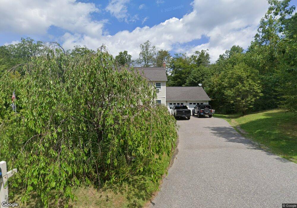
103 Nalette Dr Winsted, CT 06098
Estimated Value: $395,000 - $426,650
3
Beds
2
Baths
2,080
Sq Ft
$198/Sq Ft
Est. Value
About This Home
This home is located at 103 Nalette Dr, Winsted, CT 06098 and is currently estimated at $412,413, approximately $198 per square foot. 103 Nalette Dr is a home located in Litchfield County with nearby schools including Pearson School and St Anthony School.
Ownership History
Date
Name
Owned For
Owner Type
Purchase Details
Closed on
Apr 11, 2016
Sold by
Vaccari Michael and Vaccari Kimberly
Bought by
Smith Thomas R and Smith Casey
Current Estimated Value
Home Financials for this Owner
Home Financials are based on the most recent Mortgage that was taken out on this home.
Original Mortgage
$235,554
Outstanding Balance
$186,764
Interest Rate
3.62%
Mortgage Type
FHA
Estimated Equity
$225,649
Purchase Details
Closed on
Oct 29, 2002
Sold by
Nalette Richard E
Bought by
Vaccari Michael and Vaccari Kimberly
Create a Home Valuation Report for This Property
The Home Valuation Report is an in-depth analysis detailing your home's value as well as a comparison with similar homes in the area
Home Values in the Area
Average Home Value in this Area
Purchase History
| Date | Buyer | Sale Price | Title Company |
|---|---|---|---|
| Smith Thomas R | $239,900 | -- | |
| Smith Thomas R | $239,900 | -- | |
| Vaccari Michael | $39,000 | -- | |
| Vaccari Michael | $39,000 | -- |
Source: Public Records
Mortgage History
| Date | Status | Borrower | Loan Amount |
|---|---|---|---|
| Open | Smith Thomas R | $235,554 | |
| Closed | Smith Thomas R | $235,554 |
Source: Public Records
Tax History Compared to Growth
Tax History
| Year | Tax Paid | Tax Assessment Tax Assessment Total Assessment is a certain percentage of the fair market value that is determined by local assessors to be the total taxable value of land and additions on the property. | Land | Improvement |
|---|---|---|---|---|
| 2025 | $6,334 | $217,140 | $45,780 | $171,360 |
| 2024 | $5,915 | $217,140 | $45,780 | $171,360 |
| 2023 | $5,730 | $217,140 | $45,780 | $171,360 |
| 2022 | $5,280 | $157,430 | $33,180 | $124,250 |
| 2021 | $5,280 | $157,430 | $33,180 | $124,250 |
| 2020 | $5,280 | $157,430 | $33,180 | $124,250 |
| 2019 | $5,280 | $157,430 | $33,180 | $124,250 |
| 2018 | $5,280 | $157,430 | $33,180 | $124,250 |
| 2017 | $5,304 | $158,130 | $31,710 | $126,420 |
| 2016 | $5,726 | $170,730 | $31,710 | $139,020 |
| 2015 | $5,583 | $170,730 | $31,710 | $139,020 |
| 2014 | $5,448 | $170,730 | $31,710 | $139,020 |
Source: Public Records
Map
Nearby Homes
- 39 S Main St
- 174 Wallens St Unit H1
- 130 Stanton Ave
- 57 Main St
- 408 New Hartford Rd
- 49 Walnut St
- 55 Walnut St
- 38 Riveredge Dr Unit 38
- 52 White St
- 40 Old New Hartford Rd
- 62 Fruit St Unit 64
- 25 Center St
- 32 Charles St
- 19 Hill St
- 27 Thibault Ave
- 157 Elm St
- 135 Elm St Unit 137
- 166 Torringford St
- 48 Bridge St
- 436 Main St
- 101 Nalette Dr
- 102 Nalette Dr
- 100 Nalette Dr
- 93 Sunny Ridge Dr
- 98 Sunny Ridge Dr
- 100 Sunny Ridge Dr
- 99 Nalette Dr
- 94 Sunny Ridge Dr
- 98 Nalette Dr
- 97 Nalette Dr
- 95 Nalette Dr
- 100 Oakdale Ave
- 102 Oakdale Ave
- 106 Oakdale Ave
- 105 Oakdale Ave
- 101 Oakdale Ave
- 103 Oakdale Ave
- 99 Oakdale Ave
- 107 Oakdale Ave
- 97 Oakdale Ave