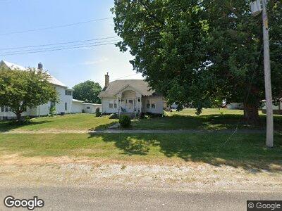
103 W Main St Neponset, IL 61345
Estimated Value: $45,000 - $94,000
--
Bed
--
Bath
--
Sq Ft
0.44
Acres
About This Home
This home is located at 103 W Main St, Neponset, IL 61345 and is currently estimated at $61,914. 103 W Main St is a home located in Bureau County with nearby schools including Kewanee High School.
Ownership History
Date
Name
Owned For
Owner Type
Purchase Details
Closed on
Sep 23, 2020
Sold by
Dana Glen A
Bought by
Dzekunskas Jill F
Current Estimated Value
Purchase Details
Closed on
Jan 4, 2018
Sold by
Dana Glen A and Dana Patricia K
Bought by
Dana Glen A
Home Financials for this Owner
Home Financials are based on the most recent Mortgage that was taken out on this home.
Original Mortgage
$28,000
Interest Rate
4.15%
Mortgage Type
New Conventional
Purchase Details
Closed on
Jul 28, 2011
Sold by
Weber Charles R
Bought by
Dana W Varnum and Dana Patricia K
Home Financials for this Owner
Home Financials are based on the most recent Mortgage that was taken out on this home.
Original Mortgage
$28,000
Interest Rate
5.25%
Mortgage Type
Future Advance Clause Open End Mortgage
Create a Home Valuation Report for This Property
The Home Valuation Report is an in-depth analysis detailing your home's value as well as a comparison with similar homes in the area
Home Values in the Area
Average Home Value in this Area
Purchase History
| Date | Buyer | Sale Price | Title Company |
|---|---|---|---|
| Dzekunskas Jill F | $40,000 | None Available | |
| Dana Glen A | -- | None Available | |
| Dana W Varnum | $35,000 | None Available |
Source: Public Records
Mortgage History
| Date | Status | Borrower | Loan Amount |
|---|---|---|---|
| Previous Owner | Dana Glen A | $28,000 | |
| Previous Owner | Dana W Varnum | $28,000 |
Source: Public Records
Tax History Compared to Growth
Tax History
| Year | Tax Paid | Tax Assessment Tax Assessment Total Assessment is a certain percentage of the fair market value that is determined by local assessors to be the total taxable value of land and additions on the property. | Land | Improvement |
|---|---|---|---|---|
| 2024 | $1,022 | $17,103 | $3,128 | $13,975 |
| 2023 | $1,022 | $15,932 | $2,914 | $13,018 |
| 2022 | $1,046 | $14,721 | $2,624 | $12,097 |
| 2021 | $1,064 | $13,586 | $2,422 | $11,164 |
| 2020 | $1,289 | $13,406 | $2,390 | $11,016 |
| 2019 | $1,289 | $13,156 | $2,345 | $10,811 |
| 2018 | $1,223 | $12,505 | $2,229 | $10,276 |
| 2017 | $1,210 | $12,224 | $2,179 | $10,045 |
| 2016 | $1,158 | $11,836 | $2,110 | $9,726 |
| 2015 | -- | $9,372 | $0 | $9,372 |
| 2014 | -- | $11,405 | $2,033 | $9,372 |
| 2013 | -- | $11,685 | $2,083 | $9,602 |
Source: Public Records
Map
Nearby Homes
- 405 N 4th St
- 204 E South St
- 302 W Cook St
- 130 S Park St
- 0 County Road 00 E
- 418 High St
- 220 N Pine St
- 12393 State Highway 78
- 16716 County Road 300 E
- 121 E 4th St
- 15242 Township Road 1200 E
- 306 N East St
- 818 N Elm St
- 416 S Maple Ave
- 216 E 2nd St
- 708 Williams St
- 440 S Vine St
- 307 E Central Blvd
- 518 E Division St
- 220 E Prospect St