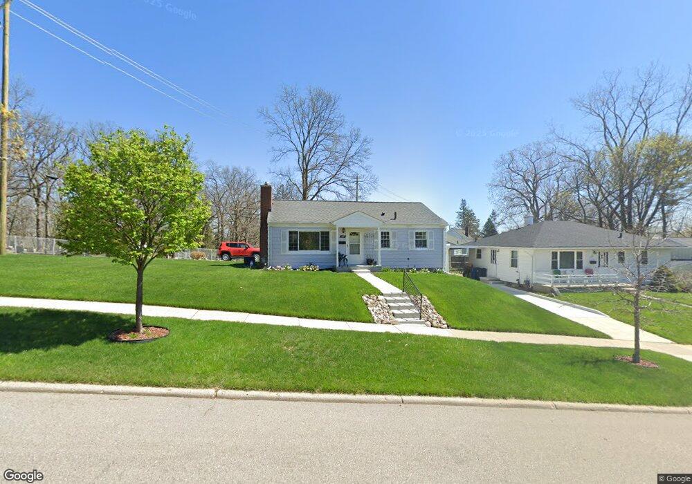
1030 Daniel St Ann Arbor, MI 48103
Water Hill NeighborhoodEstimated Value: $360,269 - $417,000
3
Beds
1
Bath
866
Sq Ft
$452/Sq Ft
Est. Value
About This Home
This home is located at 1030 Daniel St, Ann Arbor, MI 48103 and is currently estimated at $391,317, approximately $451 per square foot. 1030 Daniel St is a home located in Washtenaw County with nearby schools including Wines Elementary School, Forsythe Middle School, and Skyline High School.
Ownership History
Date
Name
Owned For
Owner Type
Purchase Details
Closed on
Aug 9, 2022
Sold by
Burris Felix F and Burris Mae F
Bought by
Burris Felix and Burris Felix
Current Estimated Value
Home Financials for this Owner
Home Financials are based on the most recent Mortgage that was taken out on this home.
Original Mortgage
$472,500
Outstanding Balance
$471,079
Interest Rate
5.51%
Mortgage Type
FHA
Estimated Equity
-$79,762
Purchase Details
Closed on
Oct 11, 2018
Sold by
Burris Felix and Burris Mae F
Bought by
Burris Felix and Burris Mae F
Create a Home Valuation Report for This Property
The Home Valuation Report is an in-depth analysis detailing your home's value as well as a comparison with similar homes in the area
Home Values in the Area
Average Home Value in this Area
Purchase History
| Date | Buyer | Sale Price | Title Company |
|---|---|---|---|
| Burris Felix | -- | -- | |
| Burris Felix | -- | None Available |
Source: Public Records
Mortgage History
| Date | Status | Borrower | Loan Amount |
|---|---|---|---|
| Open | Burris Felix | $472,500 | |
| Closed | Burris Felix | $472,500 |
Source: Public Records
Tax History Compared to Growth
Tax History
| Year | Tax Paid | Tax Assessment Tax Assessment Total Assessment is a certain percentage of the fair market value that is determined by local assessors to be the total taxable value of land and additions on the property. | Land | Improvement |
|---|---|---|---|---|
| 2025 | $4,630 | $167,900 | $0 | $0 |
| 2024 | $4,312 | $142,700 | $0 | $0 |
| 2023 | $3,976 | $127,700 | $0 | $0 |
| 2022 | $4,332 | $132,600 | $0 | $0 |
| 2021 | $4,230 | $134,700 | $0 | $0 |
| 2020 | $4,145 | $128,500 | $0 | $0 |
| 2019 | $3,944 | $134,200 | $134,200 | $0 |
| 2018 | $3,889 | $128,700 | $0 | $0 |
| 2017 | $3,783 | $116,600 | $0 | $0 |
| 2016 | $3,222 | $75,650 | $0 | $0 |
| 2015 | $3,476 | $75,424 | $0 | $0 |
| 2014 | $3,476 | $73,068 | $0 | $0 |
| 2013 | -- | $73,068 | $0 | $0 |
Source: Public Records
Map
Nearby Homes
- 209 Sunset Rd
- 207 Sunset Rd
- 601 Cressfield Ln
- 508 W Summit St
- 1320 Orkney Dr
- 118 W Summit St
- 445 Hiscock St
- 818 Gott St
- 117 E Summit St
- 916 Brooks St
- 1132 Longshore Dr Unit 2
- 651 N 5th Ave
- 639 N 4th Ave
- 218 W Kingsley St Unit 209
- 408 Longshore Dr Unit A
- 408 Longshore Dr Unit C
- 1128 Longshore Dr Unit 1
- 1128 Longshore Dr Unit 2
- 1136 Longshore Dr Unit 1
- 611 N 4th Ave
- 1026 Daniel St
- 289 Sunset Rd
- 1022 Daniel St
- 283 Sunset Rd
- 1016 Daniel St
- 277 Sunset Rd
- 271 Sunset Rd
- 281 Brookridge Rd
- 281 Brookridge Ct
- 281 Brookridge Ct Unit 1
- 265 Sunset Rd
- 271 Brookridge Ct
- 912 Daniel St
- 261 Brookridge Ct
- 410 Sunset Rd
- 261 Sunset Rd
- 255 Sunset Rd
- 0 Brookridge Ct
- 906 Daniel St
- 257 Brookridge Ct